|
|
| Wexford County Airport |
| IATA: CAD – ICAO: KCAD – FAA LID: CAD |
| Summary |
| Airport type |
Public |
| Operator |
Wexford County Airport Authority |
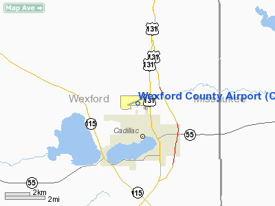
| Location |
Cadillac, Michigan |
| Elevation AMSL |
1,307 ft / 398.4 m |
| Coordinates |
44°16′31.12″N 85°25′08.13″W / 44.2753111°N 85.418925°W / 44.2753111; -85.418925Coordinates: 44°16′31.12″N 85°25′08.13″W / 44.2753111°N 85.418925°W / 44.2753111; -85.418925 |
| Runways |
| Direction |
Length |
Surface |
| ft |
m |
| 7/25 |
5,000 |
1,524 |
Asphalt |
| 18/36 |
2,005 |
611 |
Turf |
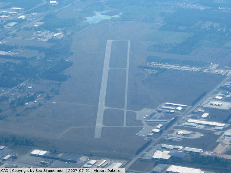
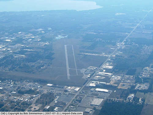
Wexford County Airport (IATA: CAD, ICAO: KCAD, FAA LID: CAD) is a general aviation airport located 2 miles (3 km) north of the city of Cadillac in Wexford County, Michigan, USA.
Facilities
Wexford County Airport covers 441 acres (1.78 km) and has two runways:
- Runway 7/25: 5,000 x 100 ft (1,524 x 30 m), Surface: Asphalt
- Runway 18/36: 2,005 x 150 ft (611 x 46 m), Surface: Turf
The above content comes from Wikipedia and is published under free licenses – click here to read more.
|
 |
(Click on the photo to enlarge) |
|
 |
(Click on the photo to enlarge) |
Location & QuickFacts
| FAA Information Effective: | 2008-09-25 |
| Airport Identifier: | CAD |
| Airport Status: | Operational |
| Longitude/Latitude: | 085-25-08.1370W/44-16-31.1280N
-85.418927/44.275313 (Estimated) |
| Elevation: | 1307 ft / 398.37 m (Estimated) |
| Land: | 441 acres |
| From nearest city: | 2 nautical miles N of Cadillac, MI |
| Location: | Wexford County, MI |
| Magnetic Variation: | 04W (1985) |
Owner & Manager
| Ownership: | Publicly owned |
| Owner: | Wexford/co Arpt Auth |
| Address: | 8040 East 34th Road
Cadillac, MI 49601 |
| Phone number: | 231-779-9525 |
| Manager: | Dana L. Mcgregor |
| Address: | 8040 E. 34th Rd.
Cadillac, MI 49601 |
| Phone number: | 231-779-9525 |
Airport Operations and Facilities
| Airport Use: | Open to public |
| Wind indicator: | Yes |
| Segmented Circle: | Yes |
| Control Tower: | No |
| Lighting Schedule: | DUSK-DAWN
ACTVT MIRL RY 07/25; MALSR RY 07, REIL RYS 07 & 25; VASI RY 07 & PAPI RY 25 - CTAF. |
| Beacon Color: | Clear-Green (lighted land airport) |
| Landing fee charge: | Yes
LDG FEE FOR COML OPNS WAIVED WITH MINIMUM FUEL PURCHASE. |
| Sectional chart: | Green Bay |
| Region: | AGL - Great Lakes |
| Boundary ARTCC: | ZMP - Minneapolis |
| Tie-in FSS: | LAN - Lansing |
| FSS on Airport: | No |
| FSS Toll Free: | 1-800-WX-BRIEF |
| NOTAMs Facility: | CAD (NOTAM-d service avaliable) |
| Federal Agreements: | NGY |
Airport Communications
| CTAF: | 122.800 |
| Unicom: | 122.800 |
Airport Services
| Fuel available: | 100LLA
24 HR SELF SVC. |
| Airframe Repair: | MAJOR |
| Power Plant Repair: | MAJOR |
Runway Information
Runway 07/25
| Dimension: | 5000 x 100 ft / 1524.0 x 30.5 m |
| Surface: | ASPH, Good Condition |
| Weight Limit: | Single wheel: 30000 lbs.
Dual wheel: 45000 lbs. |
| Edge Lights: | Medium |
| |
Runway 07 |
Runway 25 |
| Longitude: | 085-25-51.0480W | 085-24-48.0900W |
| Latitude: | 44-16-22.3710N | 44-16-42.1670N |
| Elevation: | 1307.00 ft | 1298.00 ft |
| Alignment: | 66 | 127 |
| ILS Type: | ILS/DME
| |
| Traffic Pattern: | Left | Left |
| Markings: | Precision instrument, Good Condition | Non-precision instrument, Good Condition |
| Crossing Height: | 41.00 ft | 44.00 ft |
| VASI: | 2-box on left side | 4-light PAPI on left side |
| Visual Glide Angle: | 3.00° | 3.00° |
| Approach lights: | MALSR | |
| Runway End Identifier: | Yes | Yes |
| Centerline Lights: | No | No |
| Touchdown Lights: | No | No |
| Obstruction: | , 50:1 slope to clear | 23 ft rr, 870.0 ft from runway, 610 ft left of centerline, 29:1 slope to clear |
|
Runway 18/36
| Dimension: | 2005 x 150 ft / 611.1 x 45.7 m |
| Surface: | TURF, Good Condition |
| |
Runway 18 |
Runway 36 |
| Longitude: | 085-24-39.7160W | 085-24-39.4390W |
| Latitude: | 44-16-38.5770N | 44-16-18.7790N |
| Elevation: | 1295.00 ft | 1295.00 ft |
| Alignment: | 127 | 127 |
| Traffic Pattern: | Left | Left |
| Markings: | None,
18/36 MARKED WITH 18 INCH YELLOW CONES. | None, |
| Runway End Identifier: | No | No |
| Centerline Lights: | No | No |
| Touchdown Lights: | No | No |
| Obstruction: | 40 ft trees, 1360.0 ft from runway, 34:1 slope to clear | 102 ft stack, 3650.0 ft from runway, 55 ft right of centerline, 35:1 slope to clear |
|
Radio Navigation Aids
| ID |
Type |
Name |
Ch |
Freq |
Var |
Dist |
| CAD | NDB | Cadillac | | 269.00 | 04W | 0.2 nm |
| TV | NDB | Gwenn | | 365.00 | 05W | 27.6 nm |
| GYG | NDB | Grayling | | 359.00 | 06W | 38.1 nm |
| CXK | NDB | Clam Lake | | 251.00 | 05W | 38.3 nm |
| GDW | NDB | Wiggins | | 209.00 | 04W | 44.7 nm |
| LDM | NDB | Ludington | | 341.00 | 03W | 46.7 nm |
| CGG | VOR | Grayling | | 109.80 | 06W | 38.4 nm |
| HTL | VOR/DME | Houghton Lake | 053X | 111.60 | 05W | 32.8 nm |
| MBL | VOR/DME | Manistee | 051X | 111.40 | 05W | 35.9 nm |
| HIC | VOR/DME | White Cloud | 123X | 117.60 | 01W | 44.0 nm |
| MOP | VOR/DME | Mount Pleasant | 043X | 110.60 | 05W | 49.1 nm |
| TVC | VORTAC | Traverse City | 093X | 114.60 | 02W | 24.3 nm |
Remarks
- GCO AVBL ON FREQ 121.725 THRU MINNEAPOLIS ARTCC CD & FLT SVCS.
- GLIDER ACTIVITY ON & INVOF ARPT APR-NOV.
- DEER ON & INVOF ARPT.
Images and information placed above are from
http://www.airport-data.com/airport/CAD/
We thank them for the data!
| General Info
|
| Country |
United States
|
| State |
MICHIGAN
|
| FAA ID |
CAD
|
| Latitude |
44-16-31.128N
|
| Longitude |
085-25-08.137W
|
| Elevation |
1307 feet
|
| Near City |
CADILLAC
|
We don't guarantee the information is fresh and accurate. The data may
be wrong or outdated.
For more up-to-date information please refer to other sources.
|
|