 |
|
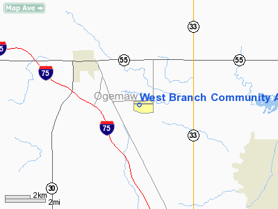
West Branch Community Airport |
Location & QuickFacts
| FAA Information Effective: | 2008-09-25 |
| Airport Identifier: | Y31 |
| Airport Status: | Operational |
| Longitude/Latitude: | 084-10-47.2970W/44-14-41.3700N
-84.179805/44.244825 (Estimated) |
| Elevation: | 882 ft / 268.83 m (Surveyed) |
| Land: | 520 acres |
| From nearest city: | 3 nautical miles SE of West Branch, MI |
| Location: | Ogemaw County, MI |
| Magnetic Variation: | 06W (1985) |
Owner & Manager
| Ownership: | Publicly owned |
| Owner: | Co Ogemaw City W Branch |
| Address: | P.o. Box 183
West Branch, MI 48661 |
| Phone number: | 989-345-1453 |
| Manager: | Lane Taber |
| Address: | 1519 Airport Rd., P.o. Box 183
West Branch, MI 48661 |
| Phone number: | 989-345-1453 |
Airport Operations and Facilities
| Airport Use: | Open to public |
| Wind indicator: | Yes |
| Segmented Circle: | Yes |
| Control Tower: | No |
| Lighting Schedule: | DUSK-DAWN
ACTVT MIRL RY 09/27; PAPI & REIL RYS 09 & 27 - CTAF. |
| Beacon Color: | Clear-Green (lighted land airport) |
| Landing fee charge: | No |
| Sectional chart: | Lake Huron |
| Region: | AGL - Great Lakes |
| Boundary ARTCC: | ZMP - Minneapolis |
| Tie-in FSS: | LAN - Lansing |
| FSS on Airport: | No |
| FSS Toll Free: | 1-800-WX-BRIEF |
| NOTAMs Facility: | LAN (NOTAM-d service avaliable) |
| Federal Agreements: | NGY |
Airport Communications
| CTAF: | 122.800 |
| Unicom: | 122.800 |
Airport Services
| Fuel available: | 100LLA |
| Airframe Repair: | MAJOR |
| Power Plant Repair: | MAJOR |
| Bottled Oxygen: | NONE |
| Bulk Oxygen: | NONE |
Runway Information
Runway 09/27
| Dimension: | 5000 x 100 ft / 1524.0 x 30.5 m |
| Surface: | ASPH, Fair Condition |
| Weight Limit: | Single wheel: 26000 lbs. |
| Edge Lights: | Medium |
| |
Runway 09 |
Runway 27 |
| Longitude: | 084-11-21.6510W | 084-10-12.9840W |
| Latitude: | 44-14-40.8370N | 44-14-41.8140N |
| Elevation: | 881.00 ft | 860.00 ft |
| Alignment: | 89 | 127 |
| Traffic Pattern: | Left | Left |
| Markings: | Non-precision instrument, Good Condition | Non-precision instrument, Fair Condition |
| Crossing Height: | 41.00 ft | 41.00 ft |
| VASI: | 4-light PAPI on left side | 4-light PAPI on left side |
| Visual Glide Angle: | 3.00° | 3.00° |
| Runway End Identifier: | Yes | Yes |
| Obstruction: | 44 ft trees, 863.0 ft from runway, 30 ft right of centerline, 15:1 slope to clear | 44 ft trees, 1430.0 ft from runway, 27:1 slope to clear |
|
Radio Navigation Aids
| ID |
Type |
Name |
Ch |
Freq |
Var |
Dist |
| BHW | NDB | Hardwood | | 236.00 | 06W | 4.1 nm |
| GDW | NDB | Wiggins | | 209.00 | 04W | 20.9 nm |
| GYG | NDB | Grayling | | 359.00 | 06W | 41.2 nm |
| CGG | VOR | Grayling | | 109.80 | 06W | 35.3 nm |
| BXZ | VOR/DME | West Branch | 079X | 113.20 | 06W | 0.2 nm |
| HTL | VOR/DME | Houghton Lake | 053X | 111.60 | 05W | 22.0 nm |
| ASP | VOR/DME | Au Sable | 108X | 116.10 | 07W | 35.9 nm |
| MBS | VOR/DME | Saginaw | 076X | 112.90 | 03W | 43.1 nm |
| MOP | VOR/DME | Mount Pleasant | 043X | 110.60 | 05W | 44.5 nm |
Remarks
Images and information placed above are from
http://www.airport-data.com/airport/Y31/
We thank them for the data!
| General Info
|
| Country |
United States
|
| State |
MICHIGAN
|
| FAA ID |
Y31
|
| Latitude |
44-14-41.370N
|
| Longitude |
084-10-47.297W
|
| Elevation |
882 feet
|
| Near City |
WEST BRANCH
|
We don't guarantee the information is fresh and accurate. The data may
be wrong or outdated.
For more up-to-date information please refer to other sources.
|
|


