 |
|
| Wend Valley Airport |
| IATA: 49G – ICAO: K49G |
| Summary |
| Airport type |
Public |
| Operator |
Roger Wend |
| Location |
Charlotte, Michigan |
| Elevation AMSL |
891 ft / 272 m |
| Coordinates |
42°34′45.131″N 84°54′29.965″W / 42.57920306°N 84.90832361°W / 42.57920306; -84.90832361Coordinates: 42°34′45.131″N 84°54′29.965″W / 42.57920306°N 84.90832361°W / 42.57920306; -84.90832361 |
| Runways |
| Direction |
Length |
Surface |
| ft |
m |
| 18/36 |
1,800 |
549 |
Turf |
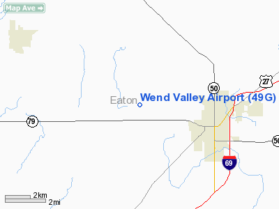
Wend Valley Airport (IATA: 49G, ICAO: K49G) is a general aviation airport located northwest of Charlotte in Eaton County, Michigan, USA. Facilities
Wend Valley Airport has 1 runway. The airport is closed from December through March, and also when snow-covered.
Runways
- Runway 18/36: 1,800 x 100 ft. (549 x 30 m), Surface: Turf
Transit
- The airport is accessible by road from Valley Hwy, and is located approximately 1 mile north of M-79.
The above content comes from Wikipedia and is published under free licenses – click here to read more.
Location & QuickFacts
| FAA Information Effective: | 2008-09-25 |
| Airport Identifier: | 49G |
| Airport Status: | Operational |
| Longitude/Latitude: | 084-54-29.9650W/42-34-45.1310N
-84.908324/42.579203 (Estimated) |
| Elevation: | 859 ft / 261.82 m (Surveyed) |
| Land: | 35 acres |
| From nearest city: | 3 nautical miles NW of Charlotte, MI |
| Location: | Eaton County, MI |
| Magnetic Variation: | 04W (1985) |
Owner & Manager
| Ownership: | Privately owned |
| Owner: | Roger Wend |
| Address: | 3711 Valley Hwy
Charlotte, MI 48813 |
| Phone number: | 517-543-6690 |
| Manager: | Roger Wend |
| Address: | 3711 Valley Hwy
Charlotte, MI 48813 |
| Phone number: | 517-543-6690 |
Airport Operations and Facilities
| Airport Use: | Open to public |
| Wind indicator: | Yes |
| Segmented Circle: | No |
| Control Tower: | No |
| Landing fee charge: | No |
| Sectional chart: | Detroit |
| Region: | AGL - Great Lakes |
| Boundary ARTCC: | ZOB - Cleveland |
| Tie-in FSS: | LAN - Lansing |
| FSS on Airport: | No |
| FSS Toll Free: | 1-800-WX-BRIEF |
| NOTAMs Facility: | LAN (NOTAM-d service avaliable) |
Airport Communications
Airport Services
Runway Information
Runway 18/36
| Dimension: | 1800 x 100 ft / 548.6 x 30.5 m |
| Surface: | TURF, Good Condition |
| |
Runway 18 |
Runway 36 |
| Longitude: | 084-54-29.9600W | 084-54-29.9600W |
| Latitude: | 42-34-50.0700N | 42-34-32.2800N |
| Elevation: | 859.00 ft | 859.00 ft |
| Traffic Pattern: | Left | Left |
| Runway End Identifier: | No | No |
| Touchdown Lights: | No | No |
| Obstruction: | 28 ft bldg, 225.0 ft from runway, 145 ft right of centerline, 8:1 slope to clear | 4 ft fence, 30.0 ft from runway, 70 ft right of centerline, 7:1 slope to clear |
|
Radio Navigation Aids
| ID |
Type |
Name |
Ch |
Freq |
Var |
Dist |
| BT | NDB | Batol | | 272.00 | 04W | 17.9 nm |
| OZW | NDB | Howell | | 243.00 | 05W | 40.9 nm |
| AMN | NDB | Alma | | 329.00 | 05W | 45.1 nm |
| HAI | NDB | Three Rivers | | 407.00 | 02W | 48.1 nm |
| JXN | VOR/DME | Jackson | 033X | 109.60 | 05W | 27.7 nm |
| GRR | VOR/DME | Grand Rapids | 106Y | 115.95 | 04W | 28.9 nm |
| LFD | VOR/DME | Litchfield | 049X | 111.20 | 05W | 31.7 nm |
| AZO | VOR/DME | Kalamazoo | 027X | 109.00 | 01W | 35.2 nm |
| LAN | VORTAC | Lansing | 045X | 110.80 | 05W | 12.5 nm |
| BTL | VORTAC | Battle Creek | 031X | 109.40 | 02W | 22.2 nm |
Remarks
- NO SNOW REMOVAL ON RY 18/36.
- +30 FT P-LINE N END RWY.
- ULTRALIGHT ACTIVITY ON AND INVOF ARPT.
- ARPT CLSD DEC-MAR AND WHEN SNOW COVERED.
Images and information placed above are from
http://www.airport-data.com/airport/49G/
We thank them for the data!
| General Info
|
| Country |
United States
|
| State |
MICHIGAN
|
| FAA ID |
49G
|
| Latitude |
42-34-45.131N
|
| Longitude |
084-54-29.965W
|
| Elevation |
859 feet
|
| Near City |
CHARLOTTE
|
We don't guarantee the information is fresh and accurate. The data may
be wrong or outdated.
For more up-to-date information please refer to other sources.
|
|


