 |
|
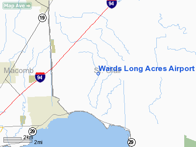
Location & QuickFacts
| FAA Information Effective: | 2008-09-25 |
| Airport Identifier: | MI15 |
| Airport Status: | Operational |
| Longitude/Latitude: | 082-39-54.6990W/42-43-45.1150N
-82.665194/42.729199 (Estimated) |
| Elevation: | 618 ft / 188.37 m (Estimated) |
| Land: | 0 acres |
| From nearest city: | 3 nautical miles N of Fair Haven, MI |
| Location: | St Clair County, MI |
| Magnetic Variation: | 06W (1985) |
Owner & Manager
| Ownership: | Privately owned |
| Owner: | Robert J. Ward |
| Address: | 5743 Meldrum Rd
Anchorville, MI 48004 |
| Phone number: | 313-725-7132 |
| Manager: | Robert J. Ward |
| Address: | 5743 Meldrum Rd
Anchorville, MI 48004 |
| Phone number: | 313-725-7132 |
Airport Operations and Facilities
| Airport Use: | Private |
| Wind indicator: | Yes |
| Segmented Circle: | No |
| Control Tower: | No |
| Landing fee charge: | No |
| Sectional chart: | Detroit |
| Region: | AGL - Great Lakes |
| Boundary ARTCC: | ZOB - Cleveland |
| Tie-in FSS: | LAN - Lansing |
| FSS on Airport: | No |
| FSS Toll Free: | 1-800-WX-BRIEF |
Airport Services
| Airframe Repair: | NONE |
| Power Plant Repair: | NONE |
Runway Information
Runway 09/27
| Dimension: | 1700 x 164 ft / 518.2 x 50.0 m |
| Surface: | TURF, |
| |
Runway 09 |
Runway 27 |
| Traffic Pattern: | Left | Right |
|
Radio Navigation Aids
| ID |
Type |
Name |
Ch |
Freq |
Var |
Dist |
| ZR | NDB | Sarnia | | 404.00 | 06W | 22.9 nm |
| VQ | NDB | Cargl | | 230.00 | 05W | 25.8 nm |
| QG | NDB | Windsor | | 353.00 | 06W | 26.6 nm |
| G | NDB | Golf | | 398.00 | 05W | 33.7 nm |
| 4L | NDB | Chatham | | 236.00 | 06W | 36.1 nm |
| RYS | NDB | Grosse Ile | | 419.00 | 06W | 43.5 nm |
| MTC | TACAN | Selfridge | 064X | | 06W | 10.2 nm |
| YQG | VOR/DME | Windsor | 085X | 113.80 | 06W | 29.7 nm |
| DXO | VOR/DME | Detroit | 081X | 113.40 | 06W | 43.9 nm |
| ECK | VORTAC | Peck | 087X | 114.00 | 07W | 31.7 nm |
| PSI | VORTAC | Pontiac | 047X | 111.00 | 03W | 38.4 nm |
| SVM | VORTAC | Salem | 090X | 114.30 | 03W | 45.4 nm |
| FNT | VORTAC | Flint | 116X | 116.90 | 06W | 49.8 nm |
| DET | VOT | Detroit City | | 111.60 | | 24.9 nm |
| DTW | VOT | Detroit Met Wayne | | 109.80 | | 43.2 nm |
| YIP | VOT | Willow Run | | 112.00 | | 48.3 nm |
Remarks
- PREDICATED ON ESTABLISHMENT OF COMPATIBLE TFC PATS WITH ADJ ARPTS.
Images and information placed above are from
http://www.airport-data.com/airport/MI15/
We thank them for the data!
| General Info
|
| Country |
United States
|
| State |
MICHIGAN
|
| FAA ID |
MI15
|
| Latitude |
42-43-45.115N
|
| Longitude |
082-39-54.699W
|
| Elevation |
618 feet
|
| Near City |
FAIR HAVEN
|
We don't guarantee the information is fresh and accurate. The data may
be wrong or outdated.
For more up-to-date information please refer to other sources.
|
|


