 |
|
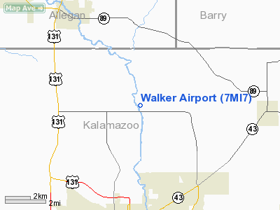
Location & QuickFacts
| FAA Information Effective: | 2008-09-25 |
| Airport Identifier: | 7MI7 |
| Airport Status: | Operational |
| Longitude/Latitude: | 085-34-39.0350W/42-22-50.1370N
-85.577510/42.380594 (Estimated) |
| Elevation: | 750 ft / 228.60 m (Estimated) |
| Land: | 60 acres |
| From nearest city: | 1 nautical miles W of Cooper, MI |
| Location: | Kalamazoo County, MI |
| Magnetic Variation: | 03W (1985) |
Owner & Manager
| Ownership: | Privately owned |
| Owner: | William S. Walker |
| Address: | 1229 East D Ave.
Kalamazoo, MI 49004 |
| Phone number: | 616-382-4522 |
| Manager: | William S. Walker |
| Address: | 1229 East D Ave.
Kalamazoo, MI 49004 |
| Phone number: | 616-382-4522 |
Airport Operations and Facilities
| Airport Use: | Private
PERSONAL USE. |
| Wind indicator: | Yes |
| Segmented Circle: | No |
| Control Tower: | No |
| Lighting Schedule: | DUSK-DAWN
MULTICOM 122.9. |
| Beacon Color: | Clear-Green (lighted land airport) |
| Sectional chart: | Detroit |
| Region: | AGL - Great Lakes |
| Boundary ARTCC: | ZAU - Chicago |
| Tie-in FSS: | LAN - Lansing |
| FSS on Airport: | No |
| FSS Toll Free: | 1-800-WX-BRIEF |
Runway Information
Runway 18/36
| Dimension: | 2000 x 100 ft / 609.6 x 30.5 m |
| Surface: | TURF, |
| Edge Lights: | High |
| |
Runway 18 |
Runway 36 |
| Traffic Pattern: | Right | Left |
| Displaced threshold: | 200.00 ft | 300.00 ft |
| Obstruction: | | 50 ft trees, 600.0 ft from runway |
|
Radio Navigation Aids
| ID |
Type |
Name |
Ch |
Freq |
Var |
Dist |
| BT | NDB | Batol | | 272.00 | 04W | 17.5 nm |
| HAI | NDB | Three Rivers | | 407.00 | 02W | 25.4 nm |
| IRS | NDB | Sturgis | | 382.00 | 04W | 34.7 nm |
| HLM | NDB | Holland | | 233.00 | 03W | 35.8 nm |
| ANQ | NDB | Angola | | 347.00 | 05W | 49.6 nm |
| AZO | VOR/DME | Kalamazoo | 027X | 109.00 | 01W | 8.7 nm |
| PMM | VOR/DME | Pullman | 058X | 112.10 | 00E | 24.0 nm |
| GRR | VOR/DME | Grand Rapids | 106Y | 115.95 | 04W | 24.7 nm |
| ELX | VOR/DME | Keeler | 113X | 116.60 | 00E | 28.1 nm |
| LFD | VOR/DME | Litchfield | 049X | 111.20 | 05W | 40.9 nm |
| BTL | VORTAC | Battle Creek | 031X | 109.40 | 02W | 15.1 nm |
| LAN | VORTAC | Lansing | 045X | 110.80 | 05W | 43.9 nm |
| GIJ | VORTAC | Gipper | 101X | 115.40 | 00E | 49.5 nm |
Images and information placed above are from
http://www.airport-data.com/airport/7MI7/
We thank them for the data!
| General Info
|
| Country |
United States
|
| State |
MICHIGAN
|
| FAA ID |
7MI7
|
| Latitude |
42-22-50.137N
|
| Longitude |
085-34-39.035W
|
| Elevation |
750 feet
|
| Near City |
COOPER
|
We don't guarantee the information is fresh and accurate. The data may
be wrong or outdated.
For more up-to-date information please refer to other sources.
|
|


