 |
|
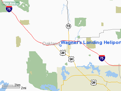
Wagner's Landing Heliport |
Location & QuickFacts
| FAA Information Effective: | 2008-09-25 |
| Airport Identifier: | 11MI |
| Airport Status: | Operational |
| Longitude/Latitude: | 083-26-14.7910W/42-44-18.1050N
-83.437442/42.738363 (Estimated) |
| Elevation: | 975 ft / 297.18 m (Estimated) |
| Land: | 0 acres |
| From nearest city: | 1 nautical miles W of Clarkston, MI |
| Location: | Oakland County, MI |
| Magnetic Variation: | 05W (1985) |
Owner & Manager
| Ownership: | Privately owned |
| Owner: | Ronald G. Wagner |
| Address: | 7500 Deer Park Trail
48346 |
| Phone number: | 313-625-9393 |
| Manager: | Ronald G. Wagner |
| Address: | 7500 Deer Park Trail
48346 |
| Phone number: | 313-625-9393 |
Airport Operations and Facilities
| Airport Use: | Private |
| Wind indicator: | Yes |
| Segmented Circle: | No |
| Control Tower: | No |
| Sectional chart: | Detroit |
| Region: | AGL - Great Lakes |
| Boundary ARTCC: | ZOB - Cleveland |
| Tie-in FSS: | LAN - Lansing |
| FSS Toll Free: | 1-800-WX-BRIEF |
Runway Information
Helipad H1
| Dimension: | 50 x 50 ft / 15.2 x 15.2 m |
| Surface: | TURF, |
| |
Runway H1 |
Runway |
| Traffic Pattern: | Left | Left |
| Markings: | Basic, | , |
|
Radio Navigation Aids
| ID |
Type |
Name |
Ch |
Freq |
Var |
Dist |
| OZW | NDB | Howell | | 243.00 | 05W | 25.1 nm |
| VQ | NDB | Cargl | | 230.00 | 05W | 31.4 nm |
| G | NDB | Golf | | 398.00 | 05W | 34.4 nm |
| QG | NDB | Windsor | | 353.00 | 06W | 35.9 nm |
| RYS | NDB | Grosse Ile | | 419.00 | 06W | 40.3 nm |
| HYX | NDB | Browne | | 385.00 | 06W | 45.6 nm |
| TCU | NDB | Tecumseh | | 239.00 | 04W | 46.6 nm |
| MTC | TACAN | Selfridge | 064X | | 06W | 27.8 nm |
| DXO | VOR/DME | Detroit | 081X | 113.40 | 06W | 31.7 nm |
| YQG | VOR/DME | Windsor | 085X | 113.80 | 06W | 39.9 nm |
| PSI | VORTAC | Pontiac | 047X | 111.00 | 03W | 4.8 nm |
| FNT | VORTAC | Flint | 116X | 116.90 | 06W | 19.4 nm |
| SVM | VORTAC | Salem | 090X | 114.30 | 03W | 21.0 nm |
| CRL | VORTAC | Carleton | 104X | 115.70 | 03W | 41.5 nm |
| ECK | VORTAC | Peck | 087X | 114.00 | 07W | 44.4 nm |
| DET | VOT | Detroit City | | 111.60 | | 27.4 nm |
| YIP | VOT | Willow Run | | 112.00 | | 30.5 nm |
| DTW | VOT | Detroit Met Wayne | | 109.80 | | 30.9 nm |
Remarks
- PRVDD OPNS ARE CONDUCTED FM 020 TO 100 DEGS & FM 200 TO 280 DEGS; AREA IS MKD & WIND INDICATOR IS MAINTAINED.
Images and information placed above are from
http://www.airport-data.com/airport/11MI/
We thank them for the data!
| General Info
|
| Country |
United States
|
| State |
MICHIGAN
|
| FAA ID |
11MI
|
| Latitude |
42-44-18.105N
|
| Longitude |
083-26-14.791W
|
| Elevation |
970 feet
|
| Near City |
CLARKSTON
|
We don't guarantee the information is fresh and accurate. The data may
be wrong or outdated.
For more up-to-date information please refer to other sources.
|
|


