 |
|
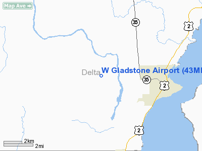
Location & QuickFacts
| FAA Information Effective: | 2008-09-25 |
| Airport Identifier: | 43MI |
| Airport Status: | Operational |
| Longitude/Latitude: | 087-07-00.4940W/45-51-32.8720N
-87.116804/45.859131 (Estimated) |
| Elevation: | 720 ft / 219.46 m (Estimated) |
| Land: | 102 acres |
| From nearest city: | 3 nautical miles W of Gladstone, MI |
| Location: | Delta County, MI |
| Magnetic Variation: | 03W (1985) |
Owner & Manager
| Ownership: | Privately owned |
| Owner: | Jon G. Thorin |
| Address: | 8703 M.5 Road
Gladstone, MI 49837 |
| Phone number: | 906-786-6204 |
| Manager: | Jon G. Thorin |
| Address: | 8703 M.5 Road
Gladstone, MI 49837 |
| Phone number: | 906-786-6204 |
Airport Operations and Facilities
| Airport Use: | Private |
| Wind indicator: | Yes |
| Segmented Circle: | No |
| Control Tower: | No |
| Landing fee charge: | No |
| Sectional chart: | Green Bay |
| Region: | AGL - Great Lakes |
| Boundary ARTCC: | ZMP - Minneapolis |
| Tie-in FSS: | GRB - Green Bay |
| FSS on Airport: | No |
| FSS Toll Free: | 1-800-WX-BRIEF |
Airport Communications
Airport Services
| Fuel available: | 100LL |
| Airframe Repair: | MINOR |
| Power Plant Repair: | MINOR |
| Bottled Oxygen: | NONE |
| Bulk Oxygen: | NONE |
Runway Information
Runway 18/36
| Dimension: | 3000 x 68 ft / 914.4 x 20.7 m
HAS DRAINAGE CULVERT WITH 3 FT DROP OFF MID FIELD. |
| Surface: | TURF, Fair Condition
SOFT WHEN WET, SOME BARE SPOTS. |
| |
Runway 18 |
Runway 36 |
| Longitude: | 087-07-00.4900W | 087-07-00.4900W |
| Latitude: | 45-50-46.9600N | 45-51-17.5600N |
| Elevation: | 720.00 ft | 720.00 ft |
| Traffic Pattern: | Left | Left |
| Displaced threshold: | 0.00 ft | 397.00 ft |
| Runway End Identifier: | No | No |
| Centerline Lights: | No | No |
| Touchdown Lights: | No | No |
| Obstruction: | 20 ft trees, 70 ft right of centerline
RY 18 APCH RATIO 20:1 BASED ON STRAIGHT OUT OVER 15 FT TREES 300 FT DSTC. | 20 ft trees, 0.0 ft from runway, 80 ft right of centerline
APCH RATIO 26:1 AT DSPLCD THLD BASED ON STRAIGHT OUT. |
|
Radio Navigation Aids
| ID |
Type |
Name |
Ch |
Freq |
Var |
Dist |
| ESC | VOR/DME | Escanaba | 045X | 110.80 | 00E | 8.3 nm |
| SAW | VOR/DME | Sawyer | 118X | 117.10 | 04W | 32.2 nm |
| ISQ | VOR/DME | Schoolcraft County | 041X | 110.40 | 05W | 40.1 nm |
| IMT | VOR/DME | Iron Mountain | 049X | 111.20 | 02W | 41.8 nm |
| MQT | VOR/DME | Marquette/dcmsnd | 114X | 116.70 | 02W | 44.7 nm |
| MNM | VOR/DME | Menominee | 033X | 109.60 | 00E | 46.5 nm |
Remarks
- TREES & BRUSH IN PRIMARY SFC BOTH SIDES.
- DEER ON & INVOF ARPT.
Images and information placed above are from
http://www.airport-data.com/airport/43MI/
We thank them for the data!
We don't guarantee the information is fresh and accurate. The data may
be wrong or outdated.
For more up-to-date information please refer to other sources.
|
|


