 |
|
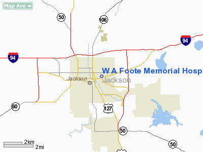
W A Foote Memorial Hospital Heliport |
Location & QuickFacts
| FAA Information Effective: | 2008-09-25 |
| Airport Identifier: | 06MI |
| Airport Status: | Operational |
| Longitude/Latitude: | 084-23-29.0000W/42-15-04.0000N
-84.391389/42.251111 (Estimated) |
| Elevation: | 978 ft / 298.09 m (Estimated) |
| Land: | 0 acres |
| From nearest city: | 0 nautical miles N of Jackson, MI |
| Location: | Jackson County, MI |
| Magnetic Variation: | 04W (1980) |
Owner & Manager
| Ownership: | Privately owned |
| Owner: | W.a. Foote Memorial Hospital |
| Address: | 205 N East Avenue
Jackson, MI 49201 |
| Phone number: | 517-788-4800 |
| Manager: | George J. Gancsos Jr |
| Address: | 205 N East Avenue
Jackson, MI 49201 |
| Phone number: | 517-780-9804 |
Airport Operations and Facilities
| Airport Use: | Private
MEDICAL USE. |
| Wind indicator: | Yes |
| Segmented Circle: | No |
| Control Tower: | No |
| Sectional chart: | Detroit |
| Region: | AGL - Great Lakes |
| Boundary ARTCC: | ZOB - Cleveland |
| Tie-in FSS: | LAN - Lansing |
| FSS Toll Free: | 1-800-WX-BRIEF |
Runway Information
Helipad H1
| Dimension: | 45 x 45 ft / 13.7 x 13.7 m |
| Surface: | CONC, |
| |
Runway H1 |
Runway |
| Traffic Pattern: | Left | Left |
|
Helipad H2
| Dimension: | 45 x 45 ft / 13.7 x 13.7 m |
| Surface: | ASPH, |
| |
Runway H2 |
Runway |
| Traffic Pattern: | Left | Left |
|
Radio Navigation Aids
| ID |
Type |
Name |
Ch |
Freq |
Var |
Dist |
| TCU | NDB | Tecumseh | | 239.00 | 04W | 26.2 nm |
| ADG | NDB | Adrian | | 278.00 | 06W | 26.9 nm |
| OZW | NDB | Howell | | 243.00 | 05W | 29.2 nm |
| BT | NDB | Batol | | 272.00 | 04W | 35.9 nm |
| USE | NDB | Fulton | | 375.00 | 05W | 40.3 nm |
| BYN | NDB | Bryan | | 260.00 | 04W | 46.5 nm |
| ANQ | NDB | Angola | | 347.00 | 05W | 48.1 nm |
| TOL | TACAN | Toledo | 072X | | 05W | 47.6 nm |
| JXN | VOR/DME | Jackson | 033X | 109.60 | 05W | 3.0 nm |
| LFD | VOR/DME | Litchfield | 049X | 111.20 | 05W | 20.1 nm |
| DXO | VOR/DME | Detroit | 081X | 113.40 | 06W | 45.7 nm |
| LAN | VORTAC | Lansing | 045X | 110.80 | 05W | 31.1 nm |
| SVM | VORTAC | Salem | 090X | 114.30 | 03W | 36.7 nm |
| BTL | VORTAC | Battle Creek | 031X | 109.40 | 02W | 38.4 nm |
| CRL | VORTAC | Carleton | 104X | 115.70 | 03W | 43.4 nm |
| PSI | VORTAC | Pontiac | 047X | 111.00 | 03W | 46.7 nm |
| YIP | VOT | Willow Run | | 112.00 | | 38.7 nm |
| DTW | VOT | Detroit Met Wayne | | 109.80 | | 45.7 nm |
Remarks
- PRVDD APCH/DEPT OPNS CONDUCTED TO/FM 180 DEG & 360 DEG; AREA MKD; WIND INDICATOR MNTD.
Images and information placed above are from
http://www.airport-data.com/airport/06MI/
We thank them for the data!
| General Info
|
| Country |
United States
|
| State |
MICHIGAN
|
| FAA ID |
06MI
|
| Latitude |
42-15-05.127N
|
| Longitude |
084-23-32.846W
|
| Elevation |
965 feet
|
| Near City |
JACKSON
|
We don't guarantee the information is fresh and accurate. The data may
be wrong or outdated.
For more up-to-date information please refer to other sources.
|
|


