 |
|
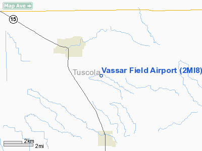
Location & QuickFacts
| FAA Information Effective: | 2008-09-25 |
| Airport Identifier: | 2MI8 |
| Airport Status: | Operational |
| Longitude/Latitude: | 083-32-06.8420W/43-20-36.0840N
-83.535234/43.343357 (Estimated) |
| Elevation: | 675 ft / 205.74 m (Estimated) |
| Land: | 40 acres |
| From nearest city: | 3 nautical miles SE of Vassar, MI |
| Location: | Tuscola County, MI |
| Magnetic Variation: | 05W (1985) |
Owner & Manager
| Ownership: | Privately owned |
| Owner: | Eugene T Tanke Ii |
| Address: | 6215 Hess
Vassar, MI 48768 |
| Phone number: | 989-823-3426 |
| Manager: | Eugene T. Tanke Ii |
| Address: | 6215 Hess
Vassar, MI 48768 |
| Phone number: | 989-823-3426 |
Airport Operations and Facilities
| Airport Use: | Private |
| Wind indicator: | Yes |
| Segmented Circle: | No |
| Control Tower: | No |
| Sectional chart: | Detroit |
| Region: | AGL - Great Lakes |
| Boundary ARTCC: | ZOB - Cleveland |
| Tie-in FSS: | LAN - Lansing |
| FSS Toll Free: | 1-800-WX-BRIEF |
Runway Information
Runway 10/28
| Dimension: | 2300 x 50 ft / 701.0 x 15.2 m |
| Surface: | TURF, Fair Condition |
| |
Runway 10 |
Runway 28 |
| Traffic Pattern: | Left | Left |
| Displaced threshold: | 670.00 ft | 740.00 ft |
| Obstruction: | 55 ft trees, 450.0 ft from runway, 40 ft left of centerline, 8:1 slope to clear
APCH RATIO 0:1 60 FT TREES 70 FT L/R. | 25 ft trees
RY 27 APCH RATIO 0:1 60 FT TREES 70 FT L/R. |
|
Radio Navigation Aids
| ID |
Type |
Name |
Ch |
Freq |
Var |
Dist |
| HYX | NDB | Browne | | 385.00 | 06W | 15.1 nm |
| OZW | NDB | Howell | | 243.00 | 05W | 47.1 nm |
| MBS | VOR/DME | Saginaw | 076X | 112.90 | 03W | 26.2 nm |
| BAX | VOR/DME | Bad Axe | 019X | 108.20 | 05W | 35.8 nm |
| FNT | VORTAC | Flint | 116X | 116.90 | 06W | 24.5 nm |
| ECK | VORTAC | Peck | 087X | 114.00 | 07W | 36.1 nm |
| PSI | VORTAC | Pontiac | 047X | 111.00 | 03W | 38.6 nm |
Remarks
- 60 FT TREES PARALLEL ENTIRE RY70 FT R & L OF RY CNTRLN.
- DEER ON AND INVOF RY.
- NO TOUCH AND GO LANDINGS.
- RY 09/27 SOFT IN SPRING.
- SAFE OPNS CANNOT BE ASSURED DUE TO MAN-MADE OR NATURAL OBJECTS THAT EXIST.
Images and information placed above are from
http://www.airport-data.com/airport/2MI8/
We thank them for the data!
| General Info
|
| Country |
United States
|
| State |
MICHIGAN
|
| FAA ID |
2MI8
|
| Latitude |
43-20-36.084N
|
| Longitude |
083-32-06.842W
|
| Elevation |
675 feet
|
| Near City |
VASSAR
|
We don't guarantee the information is fresh and accurate. The data may
be wrong or outdated.
For more up-to-date information please refer to other sources.
|
|


