 |
|
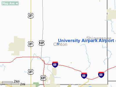
University Airpark Airport |
| University Airpark |
| IATA: 41G – ICAO: K41G – FAA LID: 41G |
| Summary |
| Airport type |
Public |
| Operator |
Robert Alleva |
| Serves |
Bath, Michigan |
| Location |
Bath Township, Michigan |
| Elevation AMSL |
856 ft / 261 m |
| Coordinates |
42°50′25.120″N 84°28′44.922″W / 42.8403111°N 84.479145°W / 42.8403111; -84.479145Coordinates: 42°50′25.120″N 84°28′44.922″W / 42.8403111°N 84.479145°W / 42.8403111; -84.479145 |
| Runways |
| Direction |
Length |
Surface |
| ft |
m |
| 8/26 |
1,988 |
606 |
Turf |
| Statistics (2005) |
| Aircraft operations |
639 |
| Based aircraft |
8 |
University Airpark (IATA: 41G, ICAO: K41G, FAA LID: 41G) is a general aviation airport located west northwest of Bath, Michigan in Clinton County, Michigan, USA. Nearby Lansing Capital Region International Airport is located 6 miles (10 km) southwest. Facilities
University Airpark has 1 runway. It is attended intermittently.
Runways
- Runway 8/26: 1,988 x 100 ft. (606 x 30 m), Surface: Turf
Transit
- The airport is accessible by road from Howe Rd, and is located near the corner of Howe Rd and Chandler Rd.
The above content comes from Wikipedia and is published under free licenses – click here to read more.
Location & QuickFacts
| FAA Information Effective: | 2008-09-25 |
| Airport Identifier: | 41G |
| Airport Status: | Operational |
| Longitude/Latitude: | 084-28-44.9220W/42-50-25.1200N
-84.479145/42.840311 (Estimated) |
| Elevation: | 856 ft / 260.91 m (Surveyed) |
| Land: | 20 acres |
| From nearest city: | 2 nautical miles NW of Bath, MI |
| Location: | Clinton County, MI |
| Magnetic Variation: | 05W (1985) |
Owner & Manager
| Ownership: | Privately owned |
| Owner: | Robert Alleva |
| Address: | 4232 Howe Rd
Bath, MI 48808 |
| Phone number: | 517-641-7788 |
| Manager: | Robert Alleva |
| Address: | 4232 Howe Rd
Bath, MI 48808 |
| Phone number: | 517-641-7788 |
Airport Operations and Facilities
| Airport Use: | Open to public |
| Wind indicator: | Yes |
| Segmented Circle: | No |
| Control Tower: | No |
| Lighting Schedule: | RDO-CTL
ACTVT LIRL RY 08/26 & ROTG BCN - 122.85. |
| Beacon Color: | Clear (unlighted land airport)
NSTD FLASHING STROBE AND ALTNG WHITE/RED BCN. |
| Landing fee charge: | No |
| Sectional chart: | Detroit |
| Region: | AGL - Great Lakes |
| Boundary ARTCC: | ZOB - Cleveland |
| Tie-in FSS: | LAN - Lansing |
| FSS on Airport: | No |
| FSS Toll Free: | 1-800-WX-BRIEF |
| NOTAMs Facility: | LAN (NOTAM-d service avaliable) |
Airport Communications
Airport Services
| Airframe Repair: | MINOR |
| Power Plant Repair: | MINOR |
| Bottled Oxygen: | NONE |
| Bulk Oxygen: | NONE |
Runway Information
Runway 08/26
| Dimension: | 1988 x 100 ft / 605.9 x 30.5 m |
| Surface: | TURF, Good Condition |
| Edge Lights: | Low |
| |
Runway 08 |
Runway 26 |
| Longitude: | 084-28-59.4900W | 084-28-30.3100W |
| Latitude: | 42-50-23.9400N | 42-50-26.0900N |
| Elevation: | 856.00 ft | 856.00 ft |
| Traffic Pattern: | Left | Left |
| Runway End Identifier: | No | No |
| Centerline Lights: | No | No |
| Touchdown Lights: | No | No |
| Obstruction: | 35 ft bldg, 69.0 ft from runway, 140 ft right of centerline, 2:1 slope to clear | 60 ft tree, 15.0 ft from runway, 120 ft right of centerline |
|
Radio Navigation Aids
| ID |
Type |
Name |
Ch |
Freq |
Var |
Dist |
| OZW | NDB | Howell | | 243.00 | 05W | 25.0 nm |
| AMN | NDB | Alma | | 329.00 | 05W | 32.0 nm |
| BT | NDB | Batol | | 272.00 | 04W | 42.4 nm |
| HYX | NDB | Browne | | 385.00 | 06W | 44.8 nm |
| JXN | VOR/DME | Jackson | 033X | 109.60 | 05W | 34.9 nm |
| GRR | VOR/DME | Grand Rapids | 106Y | 115.95 | 04W | 45.0 nm |
| MBS | VOR/DME | Saginaw | 076X | 112.90 | 03W | 45.1 nm |
| MOP | VOR/DME | Mount Pleasant | 043X | 110.60 | 05W | 48.4 nm |
| LFD | VOR/DME | Litchfield | 049X | 111.20 | 05W | 48.4 nm |
| LAN | VORTAC | Lansing | 045X | 110.80 | 05W | 12.1 nm |
| FNT | VORTAC | Flint | 116X | 116.90 | 06W | 33.1 nm |
| PSI | VORTAC | Pontiac | 047X | 111.00 | 03W | 42.6 nm |
| BTL | VORTAC | Battle Creek | 031X | 109.40 | 02W | 46.8 nm |
| SVM | VORTAC | Salem | 090X | 114.30 | 03W | 47.0 nm |
Remarks
- TREES IN PRIM SFC.
- RY 08 15 FT RD 313 FT FM RY END 20:1; +25 FT POWERLINE 642 FT FM END; 0B; APCH RATIO 25:1.
Images and information placed above are from
http://www.airport-data.com/airport/41G/
We thank them for the data!
| General Info
|
| Country |
United States
|
| State |
MICHIGAN
|
| FAA ID |
41G
|
| Latitude |
42-50-25.120N
|
| Longitude |
084-28-44.922W
|
| Elevation |
856 feet
|
| Near City |
BATH
|
We don't guarantee the information is fresh and accurate. The data may
be wrong or outdated.
For more up-to-date information please refer to other sources.
|
|


