 |
|
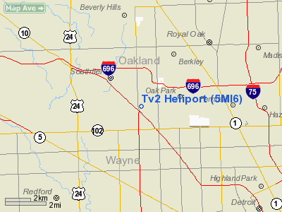
Location & QuickFacts
| FAA Information Effective: | 2008-09-25 |
| Airport Identifier: | 5MI6 |
| Airport Status: | Operational |
| Longitude/Latitude: | 083-13-02.0000W/42-27-38.1280N
-83.217222/42.460591 (Estimated) |
| Elevation: | 650 ft / 198.12 m (Surveyed) |
| Land: | 40 acres |
| From nearest city: | 0 nautical miles N of Southfield, MI |
| Location: | Oakland County, MI |
| Magnetic Variation: | 06W (1985) |
Owner & Manager
| Ownership: | Privately owned |
| Owner: | Wjbk-tv2 |
| Address: | 16550 W. Nine Mile Road
Southfield, MI 48075 |
| Phone number: | 313-557-2000 |
| Manager: | Steve Antoniotti |
| Address: | Wjbk-tv Box 2000
Southfield, MI 48037-2000 |
| Phone number: | 313-557-2000 |
Airport Operations and Facilities
| Airport Use: | Private |
| Wind indicator: | Yes |
| Segmented Circle: | No |
| Control Tower: | No |
| Landing fee charge: | No |
| Sectional chart: | Detroit |
| Region: | AGL - Great Lakes |
| Boundary ARTCC: | ZOB - Cleveland |
| Tie-in FSS: | LAN - Lansing |
| FSS on Airport: | No |
| FSS Toll Free: | 1-800-WX-BRIEF |
Runway Information
Helipad H1
| Dimension: | 60 x 20 ft / 18.3 x 6.1 m |
| Surface: | CONC, |
| |
Runway H1 |
Runway |
| Traffic Pattern: | Left | Left |
|
Radio Navigation Aids
| ID |
Type |
Name |
Ch |
Freq |
Var |
Dist |
| VQ | NDB | Cargl | | 230.00 | 05W | 13.2 nm |
| G | NDB | Golf | | 398.00 | 05W | 15.0 nm |
| QG | NDB | Windsor | | 353.00 | 06W | 17.8 nm |
| RYS | NDB | Grosse Ile | | 419.00 | 06W | 21.8 nm |
| OZW | NDB | Howell | | 243.00 | 05W | 35.7 nm |
| TCU | NDB | Tecumseh | | 239.00 | 04W | 39.0 nm |
| PT | NDB | Pelee Island | | 283.00 | 05W | 47.7 nm |
| MTC | TACAN | Selfridge | 064X | | 06W | 19.4 nm |
| DXO | VOR/DME | Detroit | 081X | 113.40 | 06W | 16.3 nm |
| YQG | VOR/DME | Windsor | 085X | 113.80 | 06W | 21.4 nm |
| SVM | VORTAC | Salem | 090X | 114.30 | 03W | 17.0 nm |
| PSI | VORTAC | Pontiac | 047X | 111.00 | 03W | 20.1 nm |
| CRL | VORTAC | Carleton | 104X | 115.70 | 03W | 27.0 nm |
| FNT | VORTAC | Flint | 116X | 116.90 | 06W | 38.4 nm |
| DET | VOT | Detroit City | | 111.60 | | 9.5 nm |
| DTW | VOT | Detroit Met Wayne | | 109.80 | | 15.5 nm |
| YIP | VOT | Willow Run | | 112.00 | | 19.2 nm |
Remarks
- (E111-2) NON-OBSTRUCTING WIND INDICATOR IS MAINTAINED ADJACENT TO TAKEOFF/LANDING AREA; EXISTING ORANGE OBSTRUCTION MARKED BALLS ON THE.
- (E111-3) ANTENNA TWR GUY WIRES ARE NOT REMOVED AND ARE APPROPRIATELY MAINTAINED; OWNER/OPERATOR CONDUCT A COMPLETE OPERATION BRIEFING.
- (E111-4) FOR ALL PILOTS REGARDING ARRIVAL/DEPARTURE ROUTE OPERATIONS AND TWR GUY WIRE LOCATIONS PRIOR TO ANY PILOT'S AUTHORIZATION.
- PRVDD ALL APCH/DPTR ROUTE HELCOPTER OPNS ARE CONDUCTED IN AN AREA FROM 260 DEGS CLKWS TO 345 DEGS OR ON ABEARING OF 225 DEGS. FROM THE TOUCHDOWN PAD USING THE TOUCHDOWN PAD AS THE CENTER OF A COMPASS ROSE; TAKEOFF/LANDING AREA IS APPROPRIATELY MARKED. FOR FIRST-TIME USE OF THE HELIPORT.
Images and information placed above are from
http://www.airport-data.com/airport/5MI6/
We thank them for the data!
| General Info
|
| Country |
United States
|
| State |
MICHIGAN
|
| FAA ID |
5MI6
|
| Latitude |
42-27-38.128N
|
| Longitude |
083-12-48.741W
|
| Elevation |
677 feet
|
| Near City |
SOUTHFIELD
|
We don't guarantee the information is fresh and accurate. The data may
be wrong or outdated.
For more up-to-date information please refer to other sources.
|
|


