|
|
|
 |
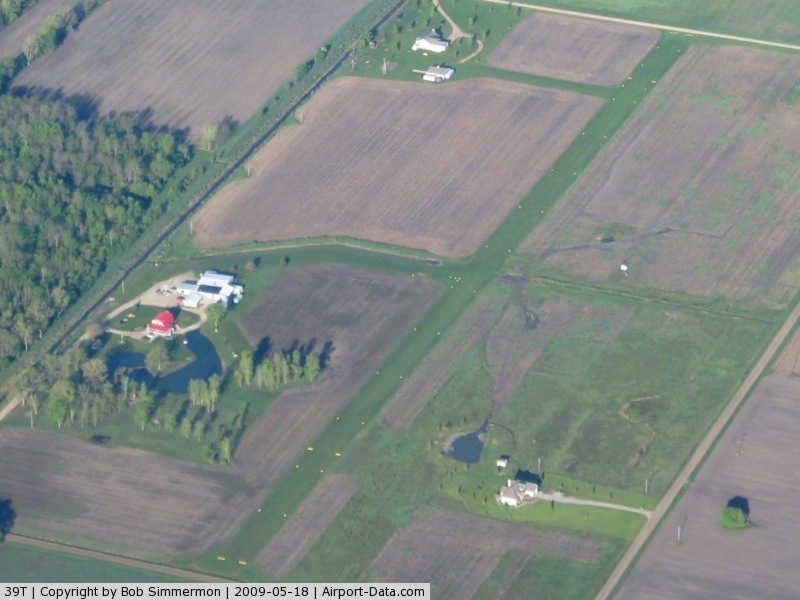
(Click on the photo to enlarge) |
Location & QuickFacts
| FAA Information Effective: | 2008-09-25 |
| Airport Identifier: | 39T |
| Airport Status: | Operational |
| Longitude/Latitude: | 084-29-20.9460W/43-03-53.1100N
-84.489152/43.064753 (Estimated) |
| Elevation: | 717 ft / 218.54 m (Surveyed) |
| Land: | 10 acres |
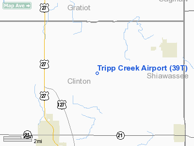
| From nearest city: | 6 nautical miles NE of St Johns, MI |
| Location: | Clinton County, MI |
| Magnetic Variation: | 05W (1985) |
Owner & Manager
| Ownership: | Privately owned |
| Owner: | Robert G. Parker |
| Address: | 5153 N. Chandler Rd
Elsie, MI 48831 |
| Phone number: | 989-862-4413 |
| Manager: | Robert G. Parker |
| Address: | 5153 N. Chandler Rd
Elsie, MI 48831 |
| Phone number: | 989-862-4413 |
Airport Operations and Facilities
| Airport Use: | Open to public |
| Wind indicator: | Yes |
| Segmented Circle: | No |
| Control Tower: | No |
| Landing fee charge: | No |
| Sectional chart: | Detroit |
| Region: | AGL - Great Lakes |
| Boundary ARTCC: | ZOB - Cleveland |
| Tie-in FSS: | LAN - Lansing |
| FSS on Airport: | No |
| FSS Toll Free: | 1-800-WX-BRIEF |
| NOTAMs Facility: | LAN (NOTAM-d service avaliable) |
Airport Communications
Airport Services
| Airframe Repair: | MINOR |
| Power Plant Repair: | MINOR |
Runway Information
Runway 09/27
| Dimension: | 2509 x 50 ft / 764.7 x 15.2 m |
| Surface: | TURF, Good Condition |
| |
Runway 09 |
Runway 27 |
| Traffic Pattern: | Left | Left |
| Displaced threshold: | 280.00 ft | 425.00 ft |
| Obstruction: | 15 ft road, 20.0 ft from runway
APCH RATIO 20:1 AT DSPLCD THR. | 18 ft road, 87.0 ft from runway, 4:1 slope to clear
APCH RATIO 20:1 AT DSPLCD THR OVER +35 FT PLINE (POLES AND LINES MARKED): 279 FT DSCT FM RWY END. |
|
Radio Navigation Aids
| ID |
Type |
Name |
Ch |
Freq |
Var |
Dist |
| AMN | NDB | Alma | | 329.00 | 05W | 20.2 nm |
| OZW | NDB | Howell | | 243.00 | 05W | 34.0 nm |
| HYX | NDB | Browne | | 385.00 | 06W | 35.3 nm |
| MBS | VOR/DME | Saginaw | 076X | 112.90 | 03W | 33.3 nm |
| MOP | VOR/DME | Mount Pleasant | 043X | 110.60 | 05W | 35.3 nm |
| GRR | VOR/DME | Grand Rapids | 106Y | 115.95 | 04W | 47.4 nm |
| JXN | VOR/DME | Jackson | 033X | 109.60 | 05W | 48.4 nm |
| LAN | VORTAC | Lansing | 045X | 110.80 | 05W | 22.8 nm |
| FNT | VORTAC | Flint | 116X | 116.90 | 06W | 33.1 nm |
| PSI | VORTAC | Pontiac | 047X | 111.00 | 03W | 47.5 nm |
Remarks
- SNOW REMOVAL IREG - CONFIRM ARPT COND WITH ARPT MGR - CALL 989-862-4413.
- DEER ON & INVOF ARPT.
- FOR MINOR A&P REPAIRS, CALL 989-862-4413,
- PRVDD RWY THRS ARE DSPLCD TO PROVIDE 20:1 OBSTN CLEARANCE OVER GILSON & CHANDLER RDS.
Images and information placed above are from
http://www.airport-data.com/airport/39T/
We thank them for the data!
| General Info
|
| Country |
United States
|
| State |
MICHIGAN
|
| FAA ID |
39T
|
| Latitude |
43-03-53.110N
|
| Longitude |
084-29-20.946W
|
| Elevation |
717 feet
|
| Near City |
ST JOHNS
|
We don't guarantee the information is fresh and accurate. The data may
be wrong or outdated.
For more up-to-date information please refer to other sources.
|
|