 |
|
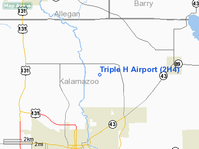
Location & QuickFacts
| FAA Information Effective: | 2008-09-25 |
| Airport Identifier: | 2H4 |
| Airport Status: | Operational |
| Longitude/Latitude: | 085-33-21.0300W/42-21-55.1390N
-85.555842/42.365316 (Estimated) |
| Elevation: | 785 ft / 239.27 m (Estimated) |
| Land: | 60 acres |
| From nearest city: | 3 nautical miles N of Parchment, MI |
| Location: | Kalamazoo County, MI |
| Magnetic Variation: | 03W (1985) |
Owner & Manager
| Ownership: | Privately owned |
| Owner: | Henry H. Hoffa |
| Address: | 7459 N Riverview Dr
Kalamazoo, MI 49004 |
| Phone number: | 269-381-8983 |
| Manager: | Henry H. Hoffa |
| Address: | 7459 N Riverview Dr
Kalamazoo, MI 49004 |
| Phone number: | 269-381-8983 |
Airport Operations and Facilities
| Airport Use: | Open to public |
| Wind indicator: | Yes |
| Segmented Circle: | Yes |
| Control Tower: | No |
| Lighting Schedule: | (NONE) |
| Sectional chart: | Chicago |
| Region: | AGL - Great Lakes |
| Boundary ARTCC: | ZAU - Chicago |
| Tie-in FSS: | LAN - Lansing |
| FSS Toll Free: | 1-800-WX-BRIEF |
| NOTAMs Facility: | LAN (NOTAM-d service avaliable) |
Airport Communications
Airport Services
Runway Information
Runway 01/19
| Dimension: | 2400 x 100 ft / 731.5 x 30.5 m |
| Surface: | TURF, Good Condition |
| |
Runway 01 |
Runway 19 |
| Longitude: | 085-33-20.0000W | 085-33-14.4500W |
| Latitude: | 42-21-43.0000N | 42-22-06.3500N |
| Elevation: | 785.00 ft | 785.00 ft |
| Traffic Pattern: | Right | Left |
| Displaced threshold: | 400.00 ft | 968.00 ft |
| Obstruction: | 53 ft tree, 57.0 ft from runway, 97 ft left of centerline, 1:1 slope to clear
RWY 01 APCH RATIO 8:1 TO DSPLD THRESHOLD. | 94 ft trees, 312.0 ft from runway, 125 ft right of centerline, 3:1 slope to clear
RWY 19 APCH RATIO 13:1 AT DSPLCD THLD. |
|
Runway 09/27
| Dimension: | 2600 x 100 ft / 792.5 x 30.5 m |
| Surface: | TURF, Good Condition |
| |
Runway 09 |
Runway 27 |
| Longitude: | 085-33-45.1300W | 085-33-10.5000W |
| Latitude: | 42-21-56.9900N | 42-21-57.0000N |
| Elevation: | 785.00 ft | 785.00 ft |
| Traffic Pattern: | Right | Left |
| Displaced threshold: | 0.00 ft | 1200.00 ft |
| Obstruction: | 67 ft trees, 28.0 ft from runway, 100 ft right of centerline | 31 ft pline, 30.0 ft from runway
RWY 27 APCH RATIO 0:1; +60 FT TREE 5 FT FM DSPLCD THLD, 60 FT L. |
|
Radio Navigation Aids
| ID |
Type |
Name |
Ch |
Freq |
Var |
Dist |
| BT | NDB | Batol | | 272.00 | 04W | 16.5 nm |
| HAI | NDB | Three Rivers | | 407.00 | 02W | 24.5 nm |
| IRS | NDB | Sturgis | | 382.00 | 04W | 33.6 nm |
| HLM | NDB | Holland | | 233.00 | 03W | 37.2 nm |
| ANQ | NDB | Angola | | 347.00 | 05W | 48.4 nm |
| AZO | VOR/DME | Kalamazoo | 027X | 109.00 | 01W | 7.7 nm |
| PMM | VOR/DME | Pullman | 058X | 112.10 | 00E | 25.1 nm |
| GRR | VOR/DME | Grand Rapids | 106Y | 115.95 | 04W | 25.5 nm |
| ELX | VOR/DME | Keeler | 113X | 116.60 | 00E | 28.5 nm |
| LFD | VOR/DME | Litchfield | 049X | 111.20 | 05W | 39.6 nm |
| JXN | VOR/DME | Jackson | 033X | 109.60 | 05W | 49.2 nm |
| BTL | VORTAC | Battle Creek | 031X | 109.40 | 02W | 13.9 nm |
| LAN | VORTAC | Lansing | 045X | 110.80 | 05W | 43.5 nm |
| GIJ | VORTAC | Gipper | 101X | 115.40 | 00E | 49.4 nm |
Remarks
- DEER INVOF ARPT.
- PRVDD APPROPRIATE OBSTACLE FREE ZONE ESTABLISHED; 20:1 THLD SITING REQUIREMENTS ESTABLISHED.
Images and information placed above are from
http://www.airport-data.com/airport/2H4/
We thank them for the data!
| General Info
|
| Country |
United States
|
| State |
MICHIGAN
|
| FAA ID |
2H4
|
| Latitude |
42-21-55.139N
|
| Longitude |
085-33-21.030W
|
| Elevation |
785 feet
|
| Near City |
PARCHMENT
|
We don't guarantee the information is fresh and accurate. The data may
be wrong or outdated.
For more up-to-date information please refer to other sources.
|
|


