 |
|
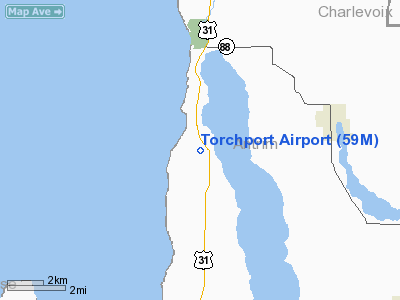
Location & QuickFacts
| FAA Information Effective: | 2008-09-25 |
| Airport Identifier: | 59M |
| Airport Status: | Operational |
| Longitude/Latitude: | 085-21-21.2590W/45-03-21.0100N
-85.355905/45.055836 (Estimated) |
| Elevation: | 640 ft / 195.07 m (Estimated) |
| Land: | 230 acres |
| From nearest city: | 3 nautical miles S of Eastport, MI |
| Location: | Antrim County, MI |
| Magnetic Variation: | 04W (1985) |
Owner & Manager
| Ownership: | Privately owned |
| Owner: | Duane Jorgensen
ARPT PHYSICAL ADDRESS :1309 U.S. 31. EASTPORT, MI., 49627. |
| Address: | P.o. Box 217
Elk Rapids, MI 49629 |
| Phone number: | 231-620-4859 |
| Manager: | Duane Jorgensen |
| Address: | P.o. Box 217
Elk Rapids, MI 49629 |
| Phone number: | 231-620-4859
ASST MGR 231-632-2412; MGR E-MAIL: MJORGENSEN @TORCHPORT.COM |
Airport Operations and Facilities
| Airport Use: | Open to public |
| Wind indicator: | Yes |
| Segmented Circle: | Yes |
| Control Tower: | No |
| Sectional chart: | Green Bay |
| Region: | AGL - Great Lakes |
| Boundary ARTCC: | ZMP - Minneapolis |
| Tie-in FSS: | LAN - Lansing |
| FSS on Airport: | No |
| FSS Toll Free: | 1-800-WX-BRIEF |
| NOTAMs Facility: | LAN (NOTAM-d service avaliable) |
Airport Communications
Airport Services
Runway Information
Runway 04/22
| Dimension: | 2600 x 100 ft / 792.5 x 30.5 m |
| Surface: | TURF, Fair Condition |
| |
Runway 04 |
Runway 22 |
| Traffic Pattern: | Left | Left |
| Displaced threshold: | 0.00 ft | 600.00 ft |
| Obstruction: | 55 ft tree, 330.0 ft from runway, 147 ft right of centerline, 6:1 slope to clear
APCH RATIO 20:1 BASED ON STRAIGHT OUT OVER +36 FT TREES 720 FT DSTC 50 FT L. | 14 ft road, 15.0 ft from runway, 125 ft right of centerline, 1:1 slope to clear
APCH RATIO 20:1 AT DSPLCD THLD OVR 74 FT TREES, 1480 FT DSTC. |
|
Runway 09/27
| Dimension: | 3300 x 100 ft / 1005.8 x 30.5 m |
| Surface: | TURF, Fair Condition |
| |
Runway 09 |
Runway 27 |
| Traffic Pattern: | Left | Left |
| Displaced threshold: | 0.00 ft | 1200.00 ft |
| Obstruction: | 80 ft trees, 310.0 ft from runway, 140 ft left of centerline, 3:1 slope to clear
APCH RATIO 25:1 BASED ON STRAIGHT OUT. | 70 ft trees, 125.0 ft from runway, 125 ft right of centerline, 1:1 slope to clear
APCH RATIO 20:1 AT DSPLCD THLD +90 FT TREES; 1800 FT FM DSPLCD THLD. |
|
Radio Navigation Aids
| ID |
Type |
Name |
Ch |
Freq |
Var |
Dist |
| CXK | NDB | Clam Lake | | 251.00 | 05W | 10.6 nm |
| CVX | NDB | Charlevoix | | 392.00 | 05W | 15.2 nm |
| TV | NDB | Gwenn | | 365.00 | 05W | 19.6 nm |
| BFA | NDB | Boyne Falls | | 263.00 | 06W | 19.6 nm |
| GYG | NDB | Grayling | | 359.00 | 06W | 29.0 nm |
| SJX | NDB | St James | | 382.00 | 05W | 39.3 nm |
| CAD | NDB | Cadillac | | 269.00 | 04W | 47.0 nm |
| CGG | VOR | Grayling | | 109.80 | 06W | 34.9 nm |
| GLR | VOR/DME | Gaylord | 029X | 109.20 | 06W | 27.8 nm |
| TVC | VORTAC | Traverse City | 093X | 114.60 | 02W | 24.7 nm |
| PLN | VORTAC | Pellston | 055X | 111.80 | 06W | 45.3 nm |
Remarks
- NO SNOW REMOVAL; 110 V OUTLETS FOR SKI EQUIPPED ACFT.
- ARPT PHYSICAL ADDRESS 1309 U.S. 31. EASTPORT, MI., 49627.
- OBST IN RY APCH SLOPE SFC REMOVED/LOWERED; OR RY THR DSPLCD AND MKD TO PRVD MINIMUM 20:1 APCH SFC CLNC OVER OBST; AREA 125 FT EITHER SIDE OF RY C/L CLEAR OF ANY OBST; PRVDD ALL ASPECTS OF 89-AGL-671-NRA COMPLIED WITH; APPROVED FOR RY 09/27 ONLY.
Images and information placed above are from
http://www.airport-data.com/airport/59M/
We thank them for the data!
| General Info
|
| Country |
United States
|
| State |
MICHIGAN
|
| FAA ID |
59M
|
| Latitude |
45-03-21.010N
|
| Longitude |
085-21-21.259W
|
| Elevation |
640 feet
|
| Near City |
EASTPORT
|
We don't guarantee the information is fresh and accurate. The data may
be wrong or outdated.
For more up-to-date information please refer to other sources.
|
|


