 |
|
Location & QuickFacts
| FAA Information Effective: | 2008-09-25 |
| Airport Identifier: | 6MI5 |
| Airport Status: | Operational |
| Longitude/Latitude: | 083-43-40.7860W/42-17-02.1360N
-83.727996/42.283927 (Estimated) |
| Elevation: | 892 ft / 271.88 m (Surveyed) |
| Land: | 0 acres |
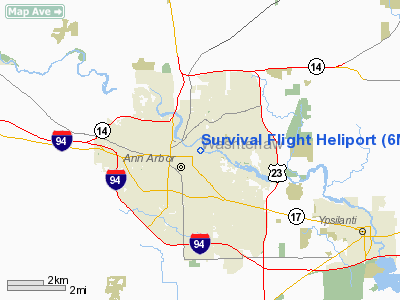
| From nearest city: | 0 nautical miles N of Ann Arbor, MI |
| Location: | Washtenaw County, MI |
| Magnetic Variation: | 05W (1985) |
Owner & Manager
| Ownership: | Privately owned |
| Owner: | University Of Mi Medical Ctr |
| Address: | 1500 East Ann Street
Ann Arbor, MI 48109-0014 |
| Phone number: | 313-936-6035 |
| Manager: | E. Marszalek-gaucher |
| Address: | 1405 East Ann Street
Ann Arbor, MI 48109 |
| Phone number: | 313-936-5500 |
Airport Operations and Facilities
| Airport Use: | Private |
| Wind indicator: | Yes |
| Segmented Circle: | No |
| Control Tower: | No |
| Lighting Schedule: | DUSK-DAWN
HELIPAD LGTS ON 24 HOURS. |
| Beacon Color: | Clear-Green-Yellow (heliport) |
| Sectional chart: | Detroit |
| Region: | AGL - Great Lakes |
| Boundary ARTCC: | ZOB - Cleveland |
| Tie-in FSS: | LAN - Lansing |
| FSS on Airport: | No |
| FSS Toll Free: | 1-800-WX-BRIEF |
Airport Communications
Runway Information
Helipad H1
| Dimension: | 90 x 90 ft / 27.4 x 27.4 m |
| Surface: | CONC, |
| Edge Lights: | Medium |
| |
Runway H1 |
Runway |
| Traffic Pattern: | Left | Left |
|
Radio Navigation Aids
| ID |
Type |
Name |
Ch |
Freq |
Var |
Dist |
| TCU | NDB | Tecumseh | | 239.00 | 04W | 16.4 nm |
| OZW | NDB | Howell | | 243.00 | 05W | 24.0 nm |
| RYS | NDB | Grosse Ile | | 419.00 | 06W | 27.9 nm |
| ADG | NDB | Adrian | | 278.00 | 06W | 29.4 nm |
| G | NDB | Golf | | 398.00 | 05W | 30.4 nm |
| VQ | NDB | Cargl | | 230.00 | 05W | 34.7 nm |
| QG | NDB | Windsor | | 353.00 | 06W | 38.3 nm |
| USE | NDB | Fulton | | 375.00 | 05W | 44.4 nm |
| TOL | TACAN | Toledo | 072X | | 05W | 41.6 nm |
| MTC | TACAN | Selfridge | 064X | | 06W | 44.4 nm |
| DXO | VOR/DME | Detroit | 081X | 113.40 | 06W | 16.6 nm |
| JXN | VOR/DME | Jackson | 033X | 109.60 | 05W | 32.5 nm |
| YQG | VOR/DME | Windsor | 085X | 113.80 | 06W | 40.1 nm |
| LFD | VOR/DME | Litchfield | 049X | 111.20 | 05W | 48.1 nm |
| SVM | VORTAC | Salem | 090X | 114.30 | 03W | 9.6 nm |
| CRL | VORTAC | Carleton | 104X | 115.70 | 03W | 18.6 nm |
| PSI | VORTAC | Pontiac | 047X | 111.00 | 03W | 26.5 nm |
| FNT | VORTAC | Flint | 116X | 116.90 | 06W | 41.1 nm |
| YIP | VOT | Willow Run | | 112.00 | | 9.6 nm |
| DTW | VOT | Detroit Met Wayne | | 109.80 | | 16.5 nm |
| DET | VOT | Detroit City | | 111.60 | | 32.4 nm |
Remarks
- (E111-1) APPROPRIATELY MARKED NON-OBSTNG WIND INDICATOR IS MAINT; NO NIGHT OPNS UNLESS HELIPAD & WIND INCICATOR ARE LGTD; ANTENNAS AT NORTH END OF BLDG ARE REMOVED OR LGTD; OBSTN LGTS ARE INSTALLED ON THE HIGHEST POINT ON THE ROOF & THE FOUR CONERS.
- ALL APCH/DEP ROUTE HELI OPNS ARE CONDUCTED IN AN AREA FROM 330 DEG CLOCKWISE TO 135 DEGS USING TOUCHDOWN PAD AS THE CNTR OF A COMPASS ROSE; TKOF & LNDG AREA IS.
Images and information placed above are from
http://www.airport-data.com/airport/6MI5/
We thank them for the data!
| General Info
|
| Country |
United States
|
| State |
MICHIGAN
|
| FAA ID |
6MI5
|
| Latitude |
42-17-02.136N
|
| Longitude |
083-43-40.786W
|
| Elevation |
892 feet
|
| Near City |
ANN ARBOR
|
We don't guarantee the information is fresh and accurate. The data may
be wrong or outdated.
For more up-to-date information please refer to other sources.
|
|


