 |
|
Location & QuickFacts
| FAA Information Effective: | 2008-09-25 |
| Airport Identifier: | 0MI0 |
| Airport Status: | Operational |
| Longitude/Latitude: | 085-39-57.1100W/42-58-12.0950N
-85.665864/42.970026 (Estimated) |
| Elevation: | 657 ft / 200.25 m (Estimated) |
| Land: | 0 acres |
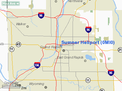
| From nearest city: | 0 nautical miles N of Grand Rapids, MI |
| Location: | Kent County, MI |
| Magnetic Variation: | 04W (1990) |
Owner & Manager
| Ownership: | Privately owned |
| Owner: | Butterworth Hospital |
| Address: | 100 Michigan Ne
Grand Rapids, MI 49503 |
| Phone number: | 616-774-1425 |
| Manager: | Loss Prevention Butterworth H |
| Address: | 100 Michigan Ne
Grand Rapids, MI 49503 |
| Phone number: | 616-774-1425 |
Airport Operations and Facilities
| Airport Use: | Private
MEDICAL USE. |
| Wind indicator: | Yes |
| Segmented Circle: | No |
| Control Tower: | No |
| Lighting Schedule: | PHONE REQ
FOR ROTG BCN AND PERIMETER LGTS CALL 616-774-1425. |
| Beacon Color: | Clear-Green-Yellow (heliport) |
| Sectional chart: | Chicago |
| Region: | AGL - Great Lakes |
| Boundary ARTCC: | ZAU - Chicago |
| Tie-in FSS: | LAN - Lansing |
| FSS Toll Free: | 1-800-WX-BRIEF |
Runway Information
Helipad H1
| Dimension: | 100 x 45 ft / 30.5 x 13.7 m |
| Surface: | CONC, |
| |
Runway H1 |
Runway |
| Traffic Pattern: | Left | Left |
|
Radio Navigation Aids
| ID |
Type |
Name |
Ch |
Freq |
Var |
Dist |
| HLM | NDB | Holland | | 233.00 | 03W | 24.0 nm |
| BT | NDB | Batol | | 272.00 | 04W | 42.3 nm |
| AMN | NDB | Alma | | 329.00 | 05W | 44.1 nm |
| GRR | VOR/DME | Grand Rapids | 106Y | 115.95 | 04W | 13.3 nm |
| PMM | VOR/DME | Pullman | 058X | 112.10 | 00E | 36.0 nm |
| HIC | VOR/DME | White Cloud | 123X | 117.60 | 01W | 36.4 nm |
| AZO | VOR/DME | Kalamazoo | 027X | 109.00 | 01W | 44.3 nm |
| MKG | VORTAC | Muskegon | 099X | 115.20 | 01W | 20.3 nm |
| BTL | VORTAC | Battle Creek | 031X | 109.40 | 02W | 43.7 nm |
| LAN | VORTAC | Lansing | 045X | 110.80 | 05W | 45.3 nm |
Remarks
- PRVDD OPERS ARE FM 200 TO 340 TWRS BE REMOVED OR OBSTRUCTIONS LIGHTED; WIND SOCK BE LIGHTED FOR NIGHT OPERS; SEE OTHER CONDITIONS IN 3/31/93 LETTER.
Images and information placed above are from
http://www.airport-data.com/airport/0MI0/
We thank them for the data!
| General Info
|
| Country |
United States
|
| State |
MICHIGAN
|
| FAA ID |
0MI0
|
| Latitude |
42-58-12.095N
|
| Longitude |
085-39-57.110W
|
| Elevation |
657 feet
|
| Near City |
GRAND RAPIDS
|
We don't guarantee the information is fresh and accurate. The data may
be wrong or outdated.
For more up-to-date information please refer to other sources.
|
|


