 |
|
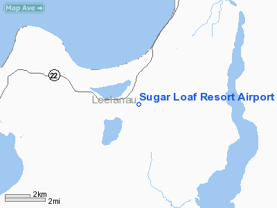
Sugar Loaf Resort Airport |
Location & QuickFacts
| FAA Information Effective: | 2008-09-25 |
| Airport Identifier: | Y04 |
| Airport Status: | Operational |
| Longitude/Latitude: | 085-48-50.3100W/44-54-44.9930N
-85.813975/44.912498 (Estimated) |
| Elevation: | 825 ft / 251.46 m (Surveyed) |
| Land: | 55 acres |
| From nearest city: | 14 nautical miles NW of Traverse City, MI |
| Location: | Leelanau County, MI |
| Magnetic Variation: | 04W (1985) |
Owner & Manager
| Ownership: | Privately owned |
| Owner: | Sugarloaf All Season Resort |
| Address: | 4500 S Sugar Loaf Mt Rd
Cedar, MI 49621 |
| Phone number: | 231-218-0488
WALLY FRYER-OWNER'S CONTACT |
| Manager: | Dane Hyde |
| Address: | 4500 Sugarloaf Mtn. Rd
Cedar, MI 49621 |
| Phone number: | 231-228-5116 |
Airport Operations and Facilities
| Airport Use: | Open to public |
| Wind indicator: | Yes |
| Segmented Circle: | No |
| Control Tower: | No |
| Lighting Schedule: | DUSK-DAWN |
| Sectional chart: | Green Bay |
| Region: | AGL - Great Lakes |
| Boundary ARTCC: | ZMP - Minneapolis |
| Tie-in FSS: | LAN - Lansing |
| FSS on Airport: | No |
| FSS Toll Free: | 1-800-WX-BRIEF |
| NOTAMs Facility: | LAN (NOTAM-d service avaliable) |
Airport Communications
Airport Services
Runway Information
Runway 02/20
| Dimension: | 3519 x 50 ft / 1072.6 x 15.2 m |
| Surface: | ASPH, Poor Condition
EXTENSIVE PAVEMENT CRACKING. |
| |
Runway 02 |
Runway 20 |
| Longitude: | 085-48-59.4600W | 085-48-41.1400W |
| Latitude: | 44-54-28.8800N | 44-55-01.0900N |
| Elevation: | 825.00 ft | 825.00 ft |
| Traffic Pattern: | Left | Left |
| Markings: | Nonstandard, Poor Condition
RWY MARKINGS FADED. | Nonstandard, Poor Condition
RY MARKINGS FADED. |
| Displaced threshold: | 0.00 ft | 572.00 ft |
| Runway End Identifier: | No | No |
| Centerline Lights: | No | No |
| Touchdown Lights: | No | No |
| Obstruction: | 20 ft trees, 201.0 ft from runway, 80 ft right of centerline
20 FT TREES 0-200 FT FM THLD 90 FT L/R. | 59 ft trees, 731.0 ft from runway, 200 ft right of centerline, 9:1 slope to clear
RWY 20 APCH RATIO 23:1 AT DSPLCD THR.
+3 FT ELECTRICAL BOX 90 FT FROM RWY END, 84 FT.L. |
|
Radio Navigation Aids
| ID |
Type |
Name |
Ch |
Freq |
Var |
Dist |
| TV | NDB | Gwenn | | 365.00 | 05W | 19.6 nm |
| CXK | NDB | Clam Lake | | 251.00 | 05W | 24.5 nm |
| CVX | NDB | Charlevoix | | 392.00 | 05W | 32.9 nm |
| BFA | NDB | Boyne Falls | | 263.00 | 06W | 40.9 nm |
| CAD | NDB | Cadillac | | 269.00 | 04W | 42.0 nm |
| GYG | NDB | Grayling | | 359.00 | 06W | 43.1 nm |
| SJX | NDB | St James | | 382.00 | 05W | 48.2 nm |
| CGG | VOR | Grayling | | 109.80 | 06W | 48.3 nm |
| MBL | VOR/DME | Manistee | 051X | 111.40 | 05W | 42.9 nm |
| GLR | VOR/DME | Gaylord | 029X | 109.20 | 06W | 47.6 nm |
| TVC | VORTAC | Traverse City | 093X | 114.60 | 02W | 18.5 nm |
Remarks
- +10 FT HILL ON EACH SIDE OF RY; 10 FT FM PAVEMENT EDGES IN MIDSECTION OF RY
- ORCHARD 90 FT FM RY CNTRLN, EACH SIDE.
- SKI HILL ADJACENT TO RY NW SIDE.
- PEDESTRIANS & GOLF COURSE ADJACENT TO RY N END, PEDESTRIANS & EQUIPMENT CROSSING RWY.
- ADJ SKI FACILITY CLSD.
Images and information placed above are from
http://www.airport-data.com/airport/Y04/
We thank them for the data!
| General Info
|
| Country |
United States
|
| State |
MICHIGAN
|
| FAA ID |
Y04
|
| Latitude |
44-54-44.993N
|
| Longitude |
085-48-50.310W
|
| Elevation |
825 feet
|
| Near City |
TRAVERSE CITY
|
We don't guarantee the information is fresh and accurate. The data may
be wrong or outdated.
For more up-to-date information please refer to other sources.
|
|


