 |
|
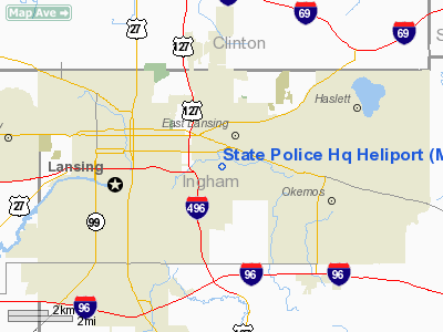
Location & QuickFacts
| FAA Information Effective: | 2008-09-25 |
| Airport Identifier: | MI12 |
| Airport Status: | Operational |
| Longitude/Latitude: | 084-29-24.9150W/42-43-36.1250N
-84.490254/42.726701 (Estimated) |
| Elevation: | 860 ft / 262.13 m (Estimated) |
| Land: | 0 acres |
| From nearest city: | 1 nautical miles WS of East Lansing, MI |
| Location: | Ingham County, MI |
| Magnetic Variation: | 05W (1985) |
Owner & Manager
| Ownership: | Publicly owned |
| Owner: | Michigan State Police |
| Address: | 714 S. Harrison Road
East Lansing, MI 48823 |
| Phone number: | 517-337-6102 |
| Manager: | State Police Aviation Section
CHIEF PILOT |
| Address: | 2615 E. Airport Service Dr
Lansing, MI 48906-2116 |
| Phone number: | 517-334-6232 |
Airport Operations and Facilities
| Airport Use: | Private |
| Wind indicator: | Yes |
| Segmented Circle: | No |
| Control Tower: | No |
| Lighting Schedule: | RDO-CTL |
| Landing fee charge: | No |
| Sectional chart: | Detroit |
| Region: | AGL - Great Lakes |
| Boundary ARTCC: | ZOB - Cleveland |
| Tie-in FSS: | LAN - Lansing |
| FSS on Airport: | No |
| FSS Toll Free: | 1-800-WX-BRIEF |
Airport Services
| Airframe Repair: | NONE |
| Power Plant Repair: | NONE |
Runway Information
Helipad H1
| Dimension: | 84 x 63 ft / 25.6 x 19.2 m |
| Surface: | ASPH, |
| Edge Lights: | Low |
| |
Runway H1 |
Runway |
| Traffic Pattern: | Left | Left |
|
Radio Navigation Aids
| ID |
Type |
Name |
Ch |
Freq |
Var |
Dist |
| OZW | NDB | Howell | | 243.00 | 05W | 22.9 nm |
| BT | NDB | Batol | | 272.00 | 04W | 37.8 nm |
| AMN | NDB | Alma | | 329.00 | 05W | 38.1 nm |
| TCU | NDB | Tecumseh | | 239.00 | 04W | 49.6 nm |
| JXN | VOR/DME | Jackson | 033X | 109.60 | 05W | 28.1 nm |
| LFD | VOR/DME | Litchfield | 049X | 111.20 | 05W | 41.7 nm |
| GRR | VOR/DME | Grand Rapids | 106Y | 115.95 | 04W | 44.6 nm |
| LAN | VORTAC | Lansing | 045X | 110.80 | 05W | 9.2 nm |
| FNT | VORTAC | Flint | 116X | 116.90 | 06W | 35.8 nm |
| BTL | VORTAC | Battle Creek | 031X | 109.40 | 02W | 42.0 nm |
| PSI | VORTAC | Pontiac | 047X | 111.00 | 03W | 42.3 nm |
| SVM | VORTAC | Salem | 090X | 114.30 | 03W | 44.0 nm |
Images and information placed above are from
http://www.airport-data.com/airport/MI12/
We thank them for the data!
| General Info
|
| Country |
United States
|
| State |
MICHIGAN
|
| FAA ID |
MI12
|
| Latitude |
42-43-36.125N
|
| Longitude |
084-29-24.915W
|
| Elevation |
860 feet
|
| Near City |
EAST LANSING
|
We don't guarantee the information is fresh and accurate. The data may
be wrong or outdated.
For more up-to-date information please refer to other sources.
|
|


