 |
|
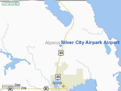
Silver City Airpark Airport |
Location & QuickFacts
| FAA Information Effective: | 2008-09-25 |
| Airport Identifier: | 53M |
| Airport Status: | Operational |
| Longitude/Latitude: | 083-26-52.9000W/45-07-56.4500N
-83.448028/45.132347 (Estimated) |
| Elevation: | 680 ft / 207.26 m (Estimated) |
| Land: | 73 acres |
| From nearest city: | 4 nautical miles N of Alpena, MI |
| Location: | Alpena County, MI |
| Magnetic Variation: | 07W (1995) |
Owner & Manager
| Ownership: | Privately owned |
| Owner: | Don Dziesinski |
| Address: | 5280 Us 23 North
Alpena, MI 49707
ARPT LCTD AT SW CORNER OF BLOOM ROAD & US 23 N. |
| Phone number: | 989-354-5161 |
| Manager: | Larry Dziesinski |
| Address: | 13361 White Ash
Alpena, MI 49707 |
| Phone number: | 989-595-2344 |
Airport Operations and Facilities
| Airport Use: | Open to public |
| Wind indicator: | Yes |
| Segmented Circle: | Yes |
| Control Tower: | No |
| Sectional chart: | Lake Huron |
| Region: | AGL - Great Lakes |
| Traffic Pattern Alt: | 800 ft |
| Boundary ARTCC: | ZMP - Minneapolis |
| Tie-in FSS: | LAN - Lansing |
| FSS on Airport: | No |
| FSS Toll Free: | 1-800-WX-BRIEF |
| NOTAMs Facility: | LAN (NOTAM-d service avaliable) |
Airport Communications
Airport Services
Runway Information
Runway 08/26
| Dimension: | 2400 x 100 ft / 731.5 x 30.5 m |
| Surface: | TURF, Good Condition |
| |
Runway 08 |
Runway 26 |
| Traffic Pattern: | Left | Left |
| Displaced threshold: | 600.00 ft | 400.00 ft |
| Obstruction: | 50 ft trees, 125 ft left of centerline
RWY 08 APCH RATIO 1:1 AT DSPLCD THLD OVR +60 FT. TREES, 100 FT FM DSPLCD THR, 135 FT L, 20:1 BASED ON STRAIGHT OUT. | 48 ft trees, 560.0 ft from runway, 60 ft left of centerline, 11:1 slope to clear
RWY 26 APCH RATIO 22:1 AT DSPLCD THLD. |
|
Radio Navigation Aids
| ID |
Type |
Name |
Ch |
Freq |
Var |
Dist |
| PZQ | NDB | Rogers City | | 215.00 | 07W | 22.7 nm |
| ASP | VOR/DME | Au Sable | 108X | 116.10 | 07W | 41.1 nm |
| APN | VORTAC | Alpena | 025X | 108.80 | 07W | 5.5 nm |
Remarks
- 30 FT POWERLINES IN RY 08 APCH NOT MARKED.
- 35 FT POWERLINE IN RY 26 APCH MKD WITH ORANGE BALLS.
- 300 FT ANTENNA 1/5 MI N OF ARPT.
- NO SNOW REMOVAL. ARPT CLSD NOV-MAR AND WHEN SNOW COVERED EXCEPT FOR SKI EQUIPPED ACFT.
- PRVDD THE AREA 125 FT EITHER SIDE OF RY AND 200 FT OFF RY ENDS IS CLEAR; OBSTN IN APCHS ARE REMOVED OR LOWERED OR THLD DSPLCD; SPONSER AGREE TO USE 800 FT TPA WHICH IS A NSTD TPA.
Images and information placed above are from
http://www.airport-data.com/airport/53M/
We thank them for the data!
| General Info
|
| Country |
United States
|
| State |
MICHIGAN
|
| FAA ID |
53M
|
| Latitude |
45-07-56.450N
|
| Longitude |
083-26-52.900W
|
| Elevation |
680 feet
|
| Near City |
ALPENA
|
We don't guarantee the information is fresh and accurate. The data may
be wrong or outdated.
For more up-to-date information please refer to other sources.
|
|


