 |
|
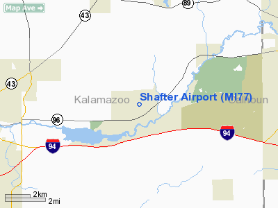
Location & QuickFacts
| FAA Information Effective: | 2008-09-25 |
| Airport Identifier: | MI77 |
| Airport Status: | Operational |
| Longitude/Latitude: | 085-25-00.0030W/42-18-00.1490N
-85.416668/42.300041 (Estimated) |
| Elevation: | 805 ft / 245.36 m (Surveyed) |
| Land: | 0 acres |
| From nearest city: | 0 nautical miles N of Galesburg, MI |
| Location: | Kalamazoo County, MI |
| Magnetic Variation: | 04W (1985) |
Owner & Manager
| Ownership: | Privately owned |
| Owner: | H. A. Matheson |
| Address: | 820 N 35th St
Galesburg, MI 49053 |
| Phone number: | 616-665-7783 |
| Manager: | H. A. Matheson |
| Address: | 820 N 35th St
Galesburg, MI 49053 |
| Phone number: | 616-665-7783 |
Airport Operations and Facilities
| Airport Use: | Private |
| Wind indicator: | Yes |
| Segmented Circle: | No |
| Control Tower: | No |
| Landing fee charge: | No |
| Sectional chart: | Chicago |
| Region: | AGL - Great Lakes |
| Boundary ARTCC: | ZAU - Chicago |
| Tie-in FSS: | LAN - Lansing |
| FSS on Airport: | No |
| FSS Toll Free: | 1-800-WX-BRIEF |
Airport Services
| Airframe Repair: | NONE |
| Power Plant Repair: | NONE |
Runway Information
Runway 08/26
| Dimension: | 1900 x 80 ft / 579.1 x 24.4 m |
| Surface: | TURF, Poor Condition
RUTS IN RY |
| |
Runway 08 |
Runway 26 |
| Traffic Pattern: | Left | Left |
| Displaced threshold: | 700.00 ft
08/26 DSPLCD THRS MKD WITH YELLOW TIRES. | 340.00 ft |
| Obstruction: | 15 ft trees, 30 ft right of centerline
APCH RATIO 5:1 AT DSPLCD THR; +70 FT TREE 110 FT R 420 FT DIST. | 25 ft trees, 0.0 ft from runway, 82 ft right of centerline
APCH RATIO 0:1 AT DSPLCD THR; +18 FT TREE 80 FT L O FT DIST. |
|
Radio Navigation Aids
| ID |
Type |
Name |
Ch |
Freq |
Var |
Dist |
| BT | NDB | Batol | | 272.00 | 04W | 11.0 nm |
| HAI | NDB | Three Rivers | | 407.00 | 02W | 22.0 nm |
| IRS | NDB | Sturgis | | 382.00 | 04W | 29.3 nm |
| ANQ | NDB | Angola | | 347.00 | 05W | 42.3 nm |
| HLM | NDB | Holland | | 233.00 | 03W | 44.3 nm |
| AZO | VOR/DME | Kalamazoo | 027X | 109.00 | 01W | 7.2 nm |
| GRR | VOR/DME | Grand Rapids | 106Y | 115.95 | 04W | 29.5 nm |
| PMM | VOR/DME | Pullman | 058X | 112.10 | 00E | 32.1 nm |
| LFD | VOR/DME | Litchfield | 049X | 111.20 | 05W | 32.3 nm |
| ELX | VOR/DME | Keeler | 113X | 116.60 | 00E | 32.8 nm |
| JXN | VOR/DME | Jackson | 033X | 109.60 | 05W | 42.7 nm |
| BTL | VORTAC | Battle Creek | 031X | 109.40 | 02W | 7.3 nm |
| LAN | VORTAC | Lansing | 045X | 110.80 | 05W | 40.5 nm |
Remarks
- RDO-CTL MODEL ACFT OPER ON ARPT.
- TREES & BRUSH IN PRIM SFC.
- (E111-2) A 250' BLDG RESTRICTION LINE BE ESTASBLISHED;ALL OBSTR WITHIN 1000' OF RY ENDS REMOVED TO PROVIDE 250'X 1000' X 450' CLEAR ZONE; ALL OBSTR WITHIN 250' OF RY C/L REMOVED.
- PRVDD OBSTR ARE REMOVED /LOWERED OR RY THR DSPLCD TO PROVIDE A 20:1 CLEARANCE; A 240' PRIMARY SURFACE & OBSTACLE FREE ZONE BE PROVIDED;
Images and information placed above are from
http://www.airport-data.com/airport/MI77/
We thank them for the data!
| General Info
|
| Country |
United States
|
| State |
MICHIGAN
|
| FAA ID |
MI77
|
| Latitude |
42-18-00.149N
|
| Longitude |
085-25-00.003W
|
| Elevation |
805 feet
|
| Near City |
GALESBURG
|
We don't guarantee the information is fresh and accurate. The data may
be wrong or outdated.
For more up-to-date information please refer to other sources.
|
|


