 |
|
Location & QuickFacts
| FAA Information Effective: | 2008-09-25 |
| Airport Identifier: | 98G |
| Airport Status: | Operational |
| Longitude/Latitude: | 083-27-44.8620W/43-43-45.0620N
-83.462462/43.729184 (Estimated) |
| Elevation: | 584 ft / 178.00 m (Estimated) |
| Land: | 60 acres |
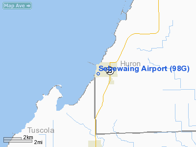
| From nearest city: | 0 nautical miles W of Sebewaing, MI |
| Location: | Huron County, MI |
| Magnetic Variation: | 06W (1985) |
Owner & Manager
| Ownership: | Publicly owned |
| Owner: | Sebewaing Township |
| Address: | 14 Sharpsteen St
Sebewaing, MI 48759 |
| Phone number: | 989-883-2120 |
| Manager: | Dennis Montei
DOUGLAS ELSTON: ASST AMGR - PHONE 989-883-3787. |
| Address: | P O Box 687, 14 Sharpsteen St
Sebewaing, MI 48759 |
| Phone number: | 989-883-2120 |
Airport Operations and Facilities
| Airport Use: | Open to public |
| Wind indicator: | Yes |
| Segmented Circle: | Yes |
| Control Tower: | No |
| Lighting Schedule: | DUSK-DAWN
ACTVT LIRL RY 18/36 - CTAF. |
| Landing fee charge: | No |
| Sectional chart: | Detroit |
| Region: | AGL - Great Lakes |
| Boundary ARTCC: | ZOB - Cleveland |
| Tie-in FSS: | LAN - Lansing |
| FSS on Airport: | No |
| FSS Toll Free: | 1-800-WX-BRIEF |
| NOTAMs Facility: | LAN (NOTAM-d service avaliable) |
| Federal Agreements: | 1 |
Airport Communications
| CTAF: | 122.800 |
| Unicom: | 122.800 |
Airport Services
| Fuel available: | 100LL |
| Bottled Oxygen: | NONE |
| Bulk Oxygen: | NONE |
Runway Information
Runway 06/24
| Dimension: | 2150 x 130 ft / 655.3 x 39.6 m |
| Surface: | TURF, Good Condition
RWY 18/36 NUMEROUS CRACKS, VEGETATION & DETERIORATION. |
| |
Runway 06 |
Runway 24 |
| Longitude: | 083-27-55.7100W | 083-27-34.5700W |
| Latitude: | 43-43-40.5100N | 43-43-48.4900N |
| Elevation: | 584.00 ft | 584.00 ft |
| Traffic Pattern: | Left | Left |
| Displaced threshold: | 0.00 ft | 483.00 ft |
| Touchdown Lights: | No | No |
| Obstruction: | 10 ft brush, 400.0 ft from runway, 40:1 slope to clear | 26 ft rr, 70.0 ft from runway, 132 ft left of centerline, 2:1 slope to clear
RY 24 APCH RATIO 21:1 AT DSPLCD THLD. |
|
Runway 18/36
| Dimension: | 2178 x 50 ft / 663.9 x 15.2 m |
| Surface: | ASPH, Poor Condition
RWY 18/36 NUMEROUS CRACKS, VEGETATION & DETERIORATION. |
| Weight Limit: | Single wheel: 10000 lbs. |
| Edge Lights: | Low |
| |
Runway 18 |
Runway 36 |
| Longitude: | 083-27-45.0600W | 083-27-42.9900W |
| Latitude: | 43-43-56.6100N | 43-43-35.1500N |
| Elevation: | 584.00 ft | 584.00 ft |
| Traffic Pattern: | Left | Left |
| Markings: | Basic, Poor Condition | Basic, Poor Condition
RY 18/36 MARKINGS FADED. |
| Displaced threshold: | 0.00 ft | 245.00 ft |
| Touchdown Lights: | No | No |
| Obstruction: | 20 ft trees, 201.0 ft from runway, 90 ft right of centerline | 26 ft rr, 278.0 ft from runway, 133 ft right of centerline, 3:1 slope to clear
APCH RATIO 20:1 AT DSPLCD THLD. |
|
Radio Navigation Aids
| ID |
Type |
Name |
Ch |
Freq |
Var |
Dist |
| HYX | NDB | Browne | | 385.00 | 06W | 24.8 nm |
| BHW | NDB | Hardwood | | 236.00 | 06W | 41.2 nm |
| GDW | NDB | Wiggins | | 209.00 | 04W | 46.2 nm |
| BAX | VOR/DME | Bad Axe | 019X | 108.20 | 05W | 21.1 nm |
| MBS | VOR/DME | Saginaw | 076X | 112.90 | 03W | 29.3 nm |
| ASP | VOR/DME | Au Sable | 108X | 116.10 | 07W | 43.4 nm |
| BXZ | VOR/DME | West Branch | 079X | 113.20 | 06W | 43.9 nm |
| ECK | VORTAC | Peck | 087X | 114.00 | 07W | 43.2 nm |
| FNT | VORTAC | Flint | 116X | 116.90 | 06W | 47.5 nm |
Remarks
- RY 06/24 NOT PLOWED WINTER MONTHS; MAY BE WET OR UNUSBL DURING SPRING THAW.
- SEAGULLS & DEER ON & INVOF RYS.
- SPB ESTABD PRIOR TO 1959.
Images and information placed above are from
http://www.airport-data.com/airport/98G/
We thank them for the data!
| General Info
|
| Country |
United States
|
| State |
MICHIGAN
|
| FAA ID |
98G
|
| Latitude |
43-43-45.062N
|
| Longitude |
083-27-44.862W
|
| Elevation |
584 feet
|
| Near City |
SEBEWAING
|
We don't guarantee the information is fresh and accurate. The data may
be wrong or outdated.
For more up-to-date information please refer to other sources.
|
|


