 |
|
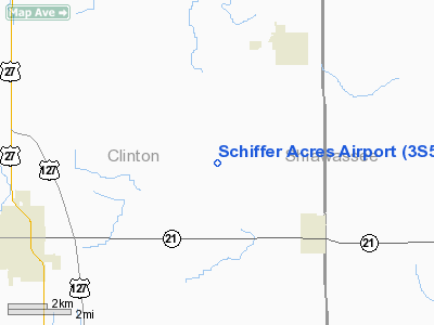
Location & QuickFacts
| FAA Information Effective: | 2008-09-25 |
| Airport Identifier: | 3S5 |
| Airport Status: | Operational |
| Longitude/Latitude: | 084-26-01.9320W/43-02-09.1060N
-84.433870/43.035863 (Estimated) |
| Elevation: | 735 ft / 224.03 m (Estimated) |
| Land: | 94 acres |
| From nearest city: | 4 nautical miles E of St Johns, MI |
| Location: | Clinton County, MI |
| Magnetic Variation: | 05W (1985) |
Owner & Manager
| Ownership: | Privately owned |
| Owner: | Michael & Albert Schiffer |
| Address: | 3473 N. Shepardsville Road
Ovid, MI 48866 |
| Phone number: | 989-834-5067 |
| Manager: | Michael Schiffer |
| Address: | 3473 N. Shepardsville Rd
Ovid, MI 48866 |
| Phone number: | 989-834-5067 |
Airport Operations and Facilities
| Airport Use: | Open to public |
| Wind indicator: | Yes |
| Segmented Circle: | Yes |
| Control Tower: | No |
| Sectional chart: | Detroit |
| Region: | AGL - Great Lakes |
| Boundary ARTCC: | ZOB - Cleveland |
| Tie-in FSS: | LAN - Lansing |
| FSS Toll Free: | 1-800-WX-BRIEF |
| NOTAMs Facility: | LAN (NOTAM-d service avaliable) |
Airport Communications
Airport Services
| Airframe Repair: | MAJOR
AIRFRAME REPAIRS ARE FOR EMERGENCY USE ONLY. |
| Power Plant Repair: | MAJOR
POWER PLANT REPAIRS ARE FOR EMERGENCY USE ONLY. |
Runway Information
Runway 07/25
| Dimension: | 2777 x 120 ft / 846.4 x 36.6 m |
| Surface: | TURF, Good Condition |
| |
Runway 07 |
Runway 25 |
| Traffic Pattern: | Right | Left |
| Displaced threshold: | 0.00 ft | 798.00 ft |
| Obstruction: | 50 ft trees, 66 ft right of centerline | 30 ft trees, 0.0 ft from runway, 62 ft left of centerline |
|
Radio Navigation Aids
| ID |
Type |
Name |
Ch |
Freq |
Var |
Dist |
| AMN | NDB | Alma | | 329.00 | 05W | 23.1 nm |
| OZW | NDB | Howell | | 243.00 | 05W | 31.2 nm |
| HYX | NDB | Browne | | 385.00 | 06W | 34.7 nm |
| MBS | VOR/DME | Saginaw | 076X | 112.90 | 03W | 33.6 nm |
| MOP | VOR/DME | Mount Pleasant | 043X | 110.60 | 05W | 37.7 nm |
| JXN | VOR/DME | Jackson | 033X | 109.60 | 05W | 46.7 nm |
| GRR | VOR/DME | Grand Rapids | 106Y | 115.95 | 04W | 49.1 nm |
| LAN | VORTAC | Lansing | 045X | 110.80 | 05W | 22.4 nm |
| FNT | VORTAC | Flint | 116X | 116.90 | 06W | 30.5 nm |
| PSI | VORTAC | Pontiac | 047X | 111.00 | 03W | 44.5 nm |
Remarks
- EXTENSIVE SUMMER AGRI OPERS.
- DEER & TURKEYS ON & INVOF RY.
- OBSTNS IN RWY APCH SLOPE SFCS RMVD/LWRD OR RWY THR DSPLCD/MKD TO PRVDMIN 20:1 CLRNC OVR OBSTNS.
Images and information placed above are from
http://www.airport-data.com/airport/3S5/
We thank them for the data!
| General Info
|
| Country |
United States
|
| State |
MICHIGAN
|
| FAA ID |
3S5
|
| Latitude |
43-02-09.106N
|
| Longitude |
084-26-01.932W
|
| Elevation |
735 feet
|
| Near City |
ST JOHNS
|
We don't guarantee the information is fresh and accurate. The data may
be wrong or outdated.
For more up-to-date information please refer to other sources.
|
|


