 |
|
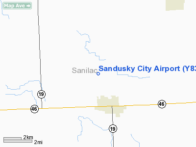
Location & QuickFacts
| FAA Information Effective: | 2008-09-25 |
| Airport Identifier: | Y83 |
| Airport Status: | Operational |
| Longitude/Latitude: | 082-50-57.7690W/43-27-15.0730N
-82.849380/43.454187 (Estimated) |
| Elevation: | 776 ft / 236.52 m (Estimated) |
| Land: | 63 acres |
| From nearest city: | 3 nautical miles N of Sandusky, MI |
| Location: | Sanilac County, MI |
| Magnetic Variation: | 07W (1985) |
Owner & Manager
| Ownership: | Publicly owned |
| Owner: | City Of Sandusky |
| Address: | 26 W. Speaker
Sandusky, MI 48471 |
| Phone number: | 810-648-4444 |
| Manager: | Joseph Allen |
| Address: | 26 West Speaker Street
Sandusky, MI 48471 |
| Phone number: | 810-414-3009
OFFICE/RES. |
Airport Operations and Facilities
| Airport Use: | Open to public |
| Wind indicator: | Yes |
| Segmented Circle: | Yes |
| Control Tower: | No |
| Lighting Schedule: | DUSK-DAWN
ACTVT MIRL RY 09/27 - CTAF. |
| Beacon Color: | Clear-Green (lighted land airport) |
| Landing fee charge: | No |
| Sectional chart: | Detroit |
| Region: | AGL - Great Lakes |
| Boundary ARTCC: | ZOB - Cleveland |
| Tie-in FSS: | LAN - Lansing |
| FSS on Airport: | No |
| FSS Toll Free: | 1-800-WX-BRIEF |
| NOTAMs Facility: | LAN (NOTAM-d service avaliable) |
| Federal Agreements: | NGY |
Airport Communications
| CTAF: | 122.800 |
| Unicom: | 122.800
UNICOM MONITORED IREGLY. |
Airport Services
| Fuel available: | 100LL
FOR FUEL CALL SHERIFF DEPT 810-648-2000. |
| Airframe Repair: | MAJOR
REPAIRS IREG OR BY ARRANGEMENT CALL 810-648-4194 |
| Power Plant Repair: | MAJOR |
| Bottled Oxygen: | NONE |
| Bulk Oxygen: | NONE |
Runway Information
Runway 09/27
| Dimension: | 3105 x 75 ft / 946.4 x 22.9 m |
| Surface: | ASPH, Fair Condition |
| Weight Limit: | Single wheel: 16000 lbs. |
| Edge Lights: | Medium |
| |
Runway 09 |
Runway 27 |
| Longitude: | 082-50-45.8000W | 082-50-03.7000W |
| Latitude: | 43-27-25.1000N | 43-27-25.7000N |
| Alignment: | 88 | 127 |
| Traffic Pattern: | Left | Left |
| Markings: | Basic, Good Condition | Basic, Good Condition |
| Crossing Height: | 31.00 ft | 39.00 ft |
| VASI: | 2-light PAPI on left side | 2-light PAPI on left side |
| Visual Glide Angle: | 3.00° | 3.00° |
| Runway End Identifier: | Yes | No |
| Centerline Lights: | No | No |
| Touchdown Lights: | No | No |
| Obstruction: | 54 ft tree, 1721.0 ft from runway, 175 ft left of centerline, 28:1 slope to clear | 15 ft road, 500.0 ft from runway, 20:1 slope to clear |
|
Runway 18/36
| Dimension: | 2300 x 150 ft / 701.0 x 45.7 m |
| Surface: | TURF, Good Condition |
| |
Runway 18 |
Runway 36 |
| Longitude: | 082-50-34.1500W | 082-50-34.1500W |
| Latitude: | 43-27-22.5500N | 43-26-59.8400N |
| Elevation: | 775.00 ft | 774.00 ft |
| Traffic Pattern: | Left | Left |
| Displaced threshold: | 0.00 ft | 383.00 ft |
| Obstruction: | , 50:1 slope to clear | 18 ft road, 60.0 ft from runway, 3:1 slope to clear
RY 36 APCH RATIO 6:1 TO DSPLCD THLD, 63 FT TREE 380 FT DSNT 150 FT R. |
|
Radio Navigation Aids
| ID |
Type |
Name |
Ch |
Freq |
Var |
Dist |
| ZR | NDB | Sarnia | | 404.00 | 06W | 41.0 nm |
| HYX | NDB | Browne | | 385.00 | 06W | 44.0 nm |
| BAX | VOR/DME | Bad Axe | 019X | 108.20 | 05W | 20.6 nm |
| ECK | VORTAC | Peck | 087X | 114.00 | 07W | 13.2 nm |
| FNT | VORTAC | Flint | 116X | 116.90 | 06W | 49.0 nm |
Remarks
- +3 FT EMBANKMENT 50 FT FM RY 36 THLD.
- BIRDS & DEER ON AND INVOF ARPT.
Images and information placed above are from
http://www.airport-data.com/airport/Y83/
We thank them for the data!
| General Info
|
| Country |
United States
|
| State |
MICHIGAN
|
| FAA ID |
Y83
|
| Latitude |
43-27-15.073N
|
| Longitude |
082-50-57.769W
|
| Elevation |
776 feet
|
| Near City |
SANDUSKY
|
We don't guarantee the information is fresh and accurate. The data may
be wrong or outdated.
For more up-to-date information please refer to other sources.
|
|


