 |
|
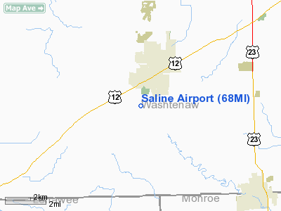
Location & QuickFacts
| FAA Information Effective: | 2008-09-25 |
| Airport Identifier: | 68MI |
| Airport Status: | Closed Indefinitely |
| Longitude/Latitude: | 083-47-31.0000W/42-08-47.0000N
-83.791944/42.146389 (Estimated) |
| Elevation: | 820 ft / 249.94 m (Estimated) |
| Land: | 12 acres |
| From nearest city: | 1 nautical miles SW of Saline, MI |
| Location: | Washtenaw County, MI |
| Magnetic Variation: | 06W (1995) |
Owner & Manager
| Ownership: | Privately owned |
| Owner: | Terence J. Schumaier |
| Address: | 391 Riley St
Dundee, MI 48176 |
| Phone number: | 734-529-3606 |
| Manager: | Terence J. Schumaier |
| Address: | 391 Riley St
Dundee, MI 48176 |
| Phone number: | 734-529-3606 |
Airport Operations and Facilities
| Airport Use: | Private |
| Wind indicator: | Yes |
| Segmented Circle: | Yes |
| Control Tower: | No |
| Sectional chart: | Detroit |
| Region: | AGL - Great Lakes |
| Boundary ARTCC: | ZOB - Cleveland |
| Tie-in FSS: | LAN - Lansing |
| FSS Toll Free: | 1-800-WX-BRIEF |
Runway Information
Runway 03/21
| Dimension: | 1665 x 125 ft / 507.5 x 38.1 m |
| Surface: | TURF, Poor Condition
& RY 09/27 ROUGH AND NOT MOWED. |
| |
Runway 03 |
Runway 21 |
| Traffic Pattern: | Left | Left |
| Obstruction: | 60 ft trees, 50.0 ft from runway, 40 ft right of centerline | 25 ft trees, 45.0 ft from runway, 1:1 slope to clear |
|
Runway 09/27
| Dimension: | 1850 x 125 ft / 563.9 x 38.1 m |
| Surface: | TURF, Poor Condition
& RY 09/27 ROUGH AND NOT MOWED. |
| |
Runway 09 |
Runway 27 |
| Traffic Pattern: | Right | Left |
| Obstruction: | 22 ft trees, 450.0 ft from runway, 20:1 slope to clear | 30 ft trees, 375.0 ft from runway, 86 ft left of centerline, 12:1 slope to clear
DOWNSLOPING TERRAIN. |
|
Radio Navigation Aids
| ID |
Type |
Name |
Ch |
Freq |
Var |
Dist |
| TCU | NDB | Tecumseh | | 239.00 | 04W | 7.7 nm |
| ADG | NDB | Adrian | | 278.00 | 06W | 20.9 nm |
| RYS | NDB | Grosse Ile | | 419.00 | 06W | 28.6 nm |
| OZW | NDB | Howell | | 243.00 | 05W | 30.6 nm |
| G | NDB | Golf | | 398.00 | 05W | 33.7 nm |
| USE | NDB | Fulton | | 375.00 | 05W | 35.7 nm |
| VQ | NDB | Cargl | | 230.00 | 05W | 39.3 nm |
| QG | NDB | Windsor | | 353.00 | 06W | 42.3 nm |
| TOL | TACAN | Toledo | 072X | | 05W | 33.2 nm |
| DXO | VOR/DME | Detroit | 081X | 113.40 | 06W | 19.4 nm |
| JXN | VOR/DME | Jackson | 033X | 109.60 | 05W | 30.4 nm |
| VWV | VOR/DME | Waterville | 078X | 113.10 | 02W | 42.3 nm |
| YQG | VOR/DME | Windsor | 085X | 113.80 | 06W | 43.3 nm |
| LFD | VOR/DME | Litchfield | 049X | 111.20 | 05W | 43.7 nm |
| CRL | VORTAC | Carleton | 104X | 115.70 | 03W | 16.0 nm |
| SVM | VORTAC | Salem | 090X | 114.30 | 03W | 18.1 nm |
| PSI | VORTAC | Pontiac | 047X | 111.00 | 03W | 35.3 nm |
| FNT | VORTAC | Flint | 116X | 116.90 | 06W | 49.4 nm |
| YIP | VOT | Willow Run | | 112.00 | | 13.1 nm |
| DTW | VOT | Detroit Met Wayne | | 109.80 | | 19.6 nm |
| DET | VOT | Detroit City | | 111.60 | | 37.8 nm |
Remarks
- RDO CTL ACFT OPERATE ON SE OF RY 03/21.
- HANG GLIDING ON & INVOF ARPT.
- 200 FT TOWER 3000 FT W OF ARPT.
- (ARPT STATUS) ARPT CLSD INDEFLY.
- PRVDD AREA 125 FT EITHER SIDE OF RY CNTRLN & 200 FT OFF RY ENDS ARE CLEAR; OBSTN IN APCH ARE REMOVED OR LOWERED OR THLD DSPLCD.
Images and information placed above are from
http://www.airport-data.com/airport/68MI/
We thank them for the data!
We don't guarantee the information is fresh and accurate. The data may
be wrong or outdated.
For more up-to-date information please refer to other sources.
|
|


