 |
|
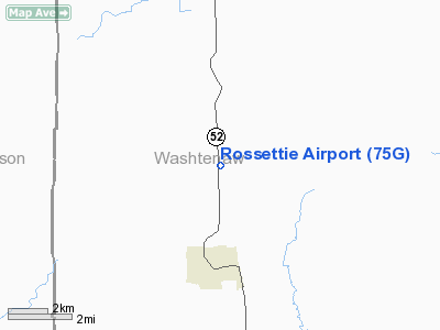
Location & QuickFacts
| FAA Information Effective: | 2008-09-25 |
| Airport Identifier: | 75G |
| Airport Status: | Operational |
| Longitude/Latitude: | 084-01-50.8520W/42-11-42.1340N
-84.030792/42.195037 (Estimated) |
| Elevation: | 1005 ft / 306.32 m (Surveyed) |
| Land: | 13 acres |
| From nearest city: | 3 nautical miles N of Manchester, MI |
| Location: | Washtenaw County, MI |
| Magnetic Variation: | 05W (1985) |
Owner & Manager
| Ownership: | Privately owned |
| Owner: | Alice G. Rossettie |
| Address: | 8875 Chelsea Rd
Manchester, MI 48158 |
| Phone number: | 734-428-8954 |
| Manager: | Alice G. Rossettie
AMGR LIVES AT ARPT. |
| Address: | Rossettie Airport Inc, 8875 Chelsea Rd
Manchester, MI 48158 |
| Phone number: | 734-428-8954 |
Airport Operations and Facilities
| Airport Use: | Open to public |
| Wind indicator: | Yes |
| Segmented Circle: | Yes |
| Control Tower: | No |
| Lighting Schedule: | DUSK-DAWN |
| Landing fee charge: | No |
| Sectional chart: | Detroit |
| Region: | AGL - Great Lakes |
| Boundary ARTCC: | ZOB - Cleveland |
| Tie-in FSS: | LAN - Lansing |
| FSS on Airport: | No |
| FSS Toll Free: | 1-800-WX-BRIEF |
| NOTAMs Facility: | LAN (NOTAM-d service avaliable) |
Airport Communications
Airport Services
| Fuel available: | 100LLMOGAS |
| Airframe Repair: | NONE |
| Power Plant Repair: | NONE |
| Bottled Oxygen: | NONE |
| Bulk Oxygen: | NONE |
Runway Information
Runway 18/36
| Dimension: | 2480 x 100 ft / 755.9 x 30.5 m |
| Surface: | TURF, Fair Condition |
| Edge Lights: | Non-standard lighting system
NSTD LIRL DUE TO SPACING. |
| |
Runway 18 |
Runway 36 |
| Longitude: | 084-01-51.4000W | 084-01-50.8000W |
| Latitude: | 42-11-54.6000N | 42-11-30.1000N |
| Elevation: | 1005.00 ft | 1005.00 ft |
| Traffic Pattern: | Left | Right |
| Displaced threshold: | 0.00 ft | 665.00 ft |
| Runway End Identifier: | No | No |
| Centerline Lights: | No | No |
| Touchdown Lights: | No | No |
| Obstruction: | 40 ft trees, 321.0 ft from runway, 120 ft right of centerline, 8:1 slope to clear | 14 ft tree, 73.0 ft from runway, 5:1 slope to clear
RWY 36 APCH RATIO 25:1 AT DSPLCD THR; DSPLCD THR EST -13' BLO THR. |
|
Radio Navigation Aids
| ID |
Type |
Name |
Ch |
Freq |
Var |
Dist |
| TCU | NDB | Tecumseh | | 239.00 | 04W | 11.7 nm |
| ADG | NDB | Adrian | | 278.00 | 06W | 19.6 nm |
| OZW | NDB | Howell | | 243.00 | 05W | 26.4 nm |
| USE | NDB | Fulton | | 375.00 | 05W | 35.5 nm |
| RYS | NDB | Grosse Ile | | 419.00 | 06W | 39.5 nm |
| G | NDB | Golf | | 398.00 | 05W | 43.9 nm |
| BYN | NDB | Bryan | | 260.00 | 04W | 47.2 nm |
| VQ | NDB | Cargl | | 230.00 | 05W | 48.8 nm |
| TOL | TACAN | Toledo | 072X | | 05W | 37.6 nm |
| JXN | VOR/DME | Jackson | 033X | 109.60 | 05W | 19.4 nm |
| DXO | VOR/DME | Detroit | 081X | 113.40 | 06W | 29.6 nm |
| LFD | VOR/DME | Litchfield | 049X | 111.20 | 05W | 33.7 nm |
| VWV | VOR/DME | Waterville | 078X | 113.10 | 02W | 48.0 nm |
| SVM | VORTAC | Salem | 090X | 114.30 | 03W | 23.3 nm |
| CRL | VORTAC | Carleton | 104X | 115.70 | 03W | 27.0 nm |
| PSI | VORTAC | Pontiac | 047X | 111.00 | 03W | 37.6 nm |
| LAN | VORTAC | Lansing | 045X | 110.80 | 05W | 43.1 nm |
| FNT | VORTAC | Flint | 116X | 116.90 | 06W | 48.1 nm |
| YIP | VOT | Willow Run | | 112.00 | | 22.7 nm |
| DTW | VOT | Detroit Met Wayne | | 109.80 | | 29.7 nm |
| DET | VOT | Detroit City | | 111.60 | | 46.8 nm |
Remarks
- FIELD GETS MUDDY IN SPRING.
- GLIDER INSTRUCTION 123.3.
- RWY ON ROLLING TERRAIN.
- EXTENSIVE GLIDER OPNS ON & INVOF ARPT.
- GLIDERS STAGE ON THE RY.
- AIRSPACE ANALYSIS CONDITION: VFR WEATHER CONDS.
Images and information placed above are from
http://www.airport-data.com/airport/75G/
We thank them for the data!
| General Info
|
| Country |
United States
|
| State |
MICHIGAN
|
| FAA ID |
75G
|
| Latitude |
42-11-42.134N
|
| Longitude |
084-01-50.852W
|
| Elevation |
1005 feet
|
| Near City |
MANCHESTER
|
We don't guarantee the information is fresh and accurate. The data may
be wrong or outdated.
For more up-to-date information please refer to other sources.
|
|


