 |
|
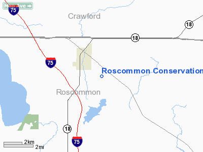
Roscommon Conservation Airport |
Location & QuickFacts
| FAA Information Effective: | 2008-09-25 |
| Airport Identifier: | 3RC |
| Airport Status: | Operational |
| Longitude/Latitude: | 084-34-00.5540W/44-28-24.2784N
-84.566821/44.473411 (Estimated) |
| Elevation: | 1156 ft / 352.35 m (Estimated) |
| Land: | 100 acres |
| From nearest city: | 2 nautical miles SE of Roscommon, MI |
| Location: | Roscommon County, MI |
| Magnetic Variation: | 05W (1985) |
Owner & Manager
| Ownership: | Publicly owned |
| Owner: | Mi Dept Of Natural Resources |
| Address: | 8717 N Roscommon
Roscommon, MI 48653 |
| Phone number: | 989-275-5151(DNR |
| Manager: | Bill Green |
| Address: | 8717 N Roscommon
Roscommon, MI 48653 |
| Phone number: | 989-275-5151(DNR
ALSO EXT 2051 FOR OFFICE & EXT 2247 FOR HGR. |
Airport Operations and Facilities
| Airport Use: | Open to public |
| Wind indicator: | Yes |
| Segmented Circle: | No |
| Control Tower: | No |
| Lighting Schedule: | RDO-CTL
ACTVT LIRL RY 09/27 - 122.7. |
| Landing fee charge: | No |
| Sectional chart: | Lake Huron |
| Region: | AGL - Great Lakes |
| Boundary ARTCC: | ZMP - Minneapolis |
| Tie-in FSS: | LAN - Lansing |
| FSS on Airport: | No |
| FSS Toll Free: | 1-800-WX-BRIEF |
| NOTAMs Facility: | LAN (NOTAM-d service avaliable) |
Airport Communications
Airport Services
Runway Information
Runway 09/27
| Dimension: | 3552 x 75 ft / 1082.6 x 22.9 m |
| Surface: | ASPH, Fair Condition
SFC ROUGH WITH PATCHES OF GRVL. |
| Edge Lights: | Non-standard lighting system
NSTD LIRL LOCATED 20 FT FM RY EDGE WITH 30-INCH RISERS. |
| |
Runway 09 |
Runway 27 |
| Longitude: | 084-34-16.3000W | 084-33-27.3300W |
| Latitude: | 44-28-23.7000N | 44-28-24.6000N |
| Traffic Pattern: | Left | Left |
| Markings: | Basic, Good Condition
RY 09/27 MARKINGS FADED. | Basic, Good Condition
RWY 27 MARKINGS FADED |
| Displaced threshold: | 165.00 ft | 0.00 ft |
| Runway End Identifier: | Yes
09/27 REILS NON-STD; NON-FLASHING. | Yes |
| Centerline Lights: | No | No |
| Touchdown Lights: | No | No |
| Obstruction: | 17 ft trees, 201.0 ft from runway
APCH RATIO 17:1 TO DSPLCD THLD OVER 20 FT TREES, 342 FT DSTC, 30 L&R.
+15 FT ROAD 145 FT FM THLD, & +4 FT FENCE 85 FT FM THLD L/R. | 60 ft trees, 1706.0 ft from runway, 25:1 slope to clear |
|
Runway 18/36
| Dimension: | 2160 x 100 ft / 658.4 x 30.5 m |
| Surface: | TURF, Poor Condition
SFC ROUGH WITH PATCHES OF GRVL. |
| |
Runway 18 |
Runway 36 |
| Longitude: | 084-33-57.4500W | 084-33-57.4500W |
| Latitude: | 44-28-38.5400N | 44-28-17.2100N |
| Elevation: | 1156.00 ft | 1156.00 ft |
| Traffic Pattern: | Left | Left |
| Displaced threshold: | 0.00 ft | 600.00 ft |
| Runway End Identifier: | No | No |
| Centerline Lights: | No | No |
| Touchdown Lights: | No | No |
| Obstruction: | 30 ft trees, 210.0 ft from runway, 133 ft right of centerline, 7:1 slope to clear | 38 ft trees, 417.0 ft from runway, 10:1 slope to clear
RWY 36 APCH RATIO 20:1 AT DSPLCD THLD OVER 53 FT TREES, 1060 FT DSTC, 0B. |
|
Radio Navigation Aids
| ID |
Type |
Name |
Ch |
Freq |
Var |
Dist |
| GYG | NDB | Grayling | | 359.00 | 06W | 20.0 nm |
| BHW | NDB | Hardwood | | 236.00 | 06W | 24.8 nm |
| GDW | NDB | Wiggins | | 209.00 | 04W | 30.5 nm |
| CAD | NDB | Cadillac | | 269.00 | 04W | 38.3 nm |
| CXK | NDB | Clam Lake | | 251.00 | 05W | 38.5 nm |
| TV | NDB | Gwenn | | 365.00 | 05W | 40.1 nm |
| BFA | NDB | Boyne Falls | | 263.00 | 06W | 44.3 nm |
| CGG | VOR | Grayling | | 109.80 | 06W | 14.3 nm |
| HTL | VOR/DME | Houghton Lake | 053X | 111.60 | 05W | 8.1 nm |
| BXZ | VOR/DME | West Branch | 079X | 113.20 | 06W | 21.5 nm |
| GLR | VOR/DME | Gaylord | 029X | 109.20 | 06W | 32.9 nm |
| TVC | VORTAC | Traverse City | 093X | 114.60 | 02W | 43.7 nm |
Remarks
- RY 18/36 CLSD NOV-APR & WHEN SNOW COVERED.
- DEER ON & INVOF ARPT.
Images and information placed above are from
http://www.airport-data.com/airport/3RC/
We thank them for the data!
| General Info
|
| Country |
United States
|
| State |
MICHIGAN
|
| FAA ID |
3RC
|
| Latitude |
44-28-30.062N
|
| Longitude |
084-34-00.081W
|
| Elevation |
1156 feet
|
| Near City |
ROSCOMMON
|
We don't guarantee the information is fresh and accurate. The data may
be wrong or outdated.
For more up-to-date information please refer to other sources.
|
|


