|
|
|
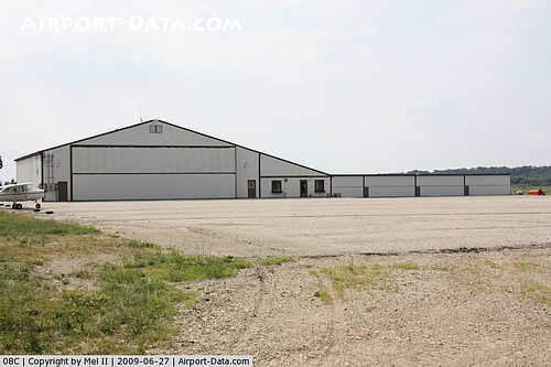 |
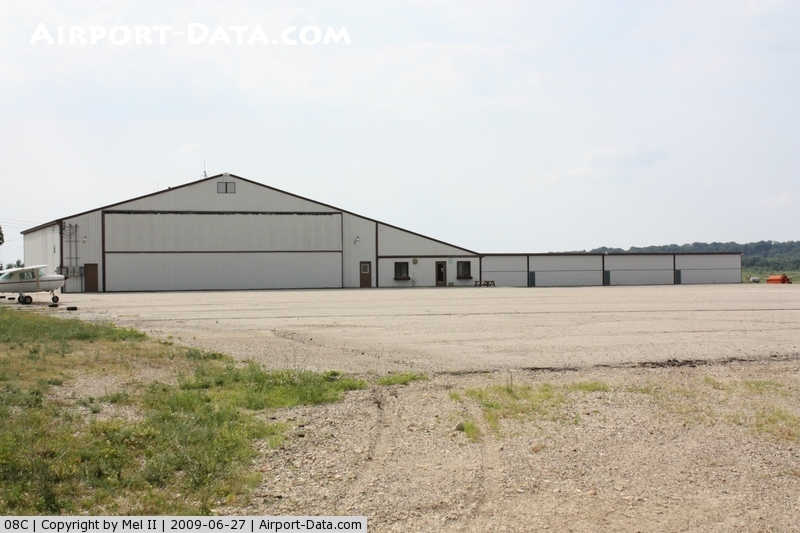
(Click on the photo to enlarge) |
|
 |
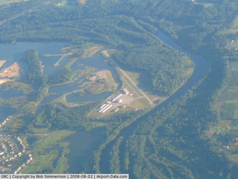
(Click on the photo to enlarge) |
Location & QuickFacts
| FAA Information Effective: | 2008-09-25 |
| Airport Identifier: | 08C |
| Airport Status: | Operational |
| Longitude/Latitude: | 085-48-18.1270W/42-56-09.0900N
-85.805035/42.935858 (Estimated) |
| Elevation: | 603 ft / 183.79 m (Estimated) |
| Land: | 20 acres |
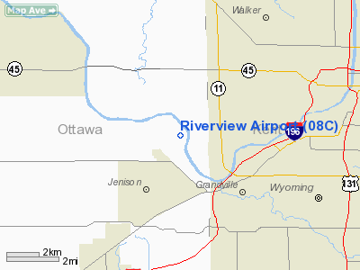
| From nearest city: | 3 nautical miles NW of Jenison, MI |
| Location: | Ottawa County, MI |
| Magnetic Variation: | 03W (1985) |
Owner & Manager
| Ownership: | Privately owned |
| Owner: | Rivertown Airport Lcc |
| Address: | 1129 Taylor
Jenison, MI 49428
ARPT PHYSICAL ADDR 805 TAYLOR, JENISON, MI 49428 |
| Phone number: | 616-457-5040 |
| Manager: | Nathan D. Boynton |
| Address: | 1129 Taylor
Jenison, MI 49428 |
| Phone number: | 616-457-5040 |
Airport Operations and Facilities
| Airport Use: | Open to public |
| Wind indicator: | Yes |
| Segmented Circle: | Yes |
| Control Tower: | No |
| Lighting Schedule: | DUSK-DAWN
ACTVT MIRL RY 14/32 - CTAF. |
| Beacon Color: | Clear-Green (lighted land airport) |
| Landing fee charge: | No |
| Sectional chart: | Chicago |
| Region: | AGL - Great Lakes |
| Boundary ARTCC: | ZAU - Chicago |
| Tie-in FSS: | LAN - Lansing |
| FSS on Airport: | No |
| FSS Toll Free: | 1-800-WX-BRIEF |
| NOTAMs Facility: | LAN (NOTAM-d service avaliable) |
Airport Communications
| CTAF: | 122.900 |
| Unicom: | 123.000 |
Airport Services
| Fuel available: | 100LL
FUEL 24 HR SELF SERVE. |
Runway Information
Runway 14/32
| Dimension: | 3920 x 49 ft / 1194.8 x 14.9 m |
| Surface: | ASPH, Fair Condition |
| Edge Lights: | Medium |
| |
Runway 14 |
Runway 32 |
| Longitude: | 085-48-38.1000W | 085-47-58.1300W |
| Latitude: | 42-56-23.4600N | 42-56-00.7100N |
| Elevation: | 603.00 ft | 603.00 ft |
| Traffic Pattern: | Left | Left |
| Markings: | Basic, Fair Condition | Basic, Fair Condition |
| Displaced threshold: | 0.00 ft | 1196.00 ft |
| Obstruction: | 50 ft trees, 1000.0 ft from runway, 55 ft right of centerline, 16:1 slope to clear
RWY 14 APCH RATIO 20:1 AT PAVEMENT END.
+10 FT BRUSH, 0 FT DSTC, 120 FT R/L. | 20 ft trees, 0.0 ft from runway, 120 ft left of centerline
APCH RATIO 20:1 AT DSPLCD THLD, BASED ON 77 FT TREE, 1540 DSTC.
-12 FT EMBANKMENT & RIVER IN PRIM SFC PLUS 20-30 FT TREES ALONG RIVER EMBANKMENT, 600 FT FM RWY END, 100 FT R/L. |
|
Radio Navigation Aids
| ID |
Type |
Name |
Ch |
Freq |
Var |
Dist |
| HLM | NDB | Holland | | 233.00 | 03W | 17.6 nm |
| BT | NDB | Batol | | 272.00 | 04W | 44.1 nm |
| GRR | VOR/DME | Grand Rapids | 106Y | 115.95 | 04W | 16.3 nm |
| PMM | VOR/DME | Pullman | 058X | 112.10 | 00E | 31.2 nm |
| HIC | VOR/DME | White Cloud | 123X | 117.60 | 01W | 38.6 nm |
| AZO | VOR/DME | Kalamazoo | 027X | 109.00 | 01W | 43.5 nm |
| ELX | VOR/DME | Keeler | 113X | 116.60 | 00E | 49.6 nm |
| MKG | VORTAC | Muskegon | 099X | 115.20 | 01W | 17.4 nm |
| BTL | VORTAC | Battle Creek | 031X | 109.40 | 02W | 44.9 nm |
Remarks
- RY 14/32 TREES & SHRUBS IN TRSN ZONE BOTH SIDES.
- DEER & BIRDS ON & INVOF ARPT.
Images and information placed above are from
http://www.airport-data.com/airport/08C/
We thank them for the data!
| General Info
|
| Country |
United States
|
| State |
MICHIGAN
|
| FAA ID |
08C
|
| Latitude |
42-56-09.090N
|
| Longitude |
085-48-18.127W
|
| Elevation |
603 feet
|
| Near City |
JENISON
|
We don't guarantee the information is fresh and accurate. The data may
be wrong or outdated.
For more up-to-date information please refer to other sources.
|
|