 |
|
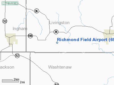
Location & QuickFacts
| FAA Information Effective: | 2008-09-25 |
| Airport Identifier: | 69G |
| Airport Status: | Operational |
| Longitude/Latitude: | 084-03-59.8270W/42-26-30.1260N
-84.066619/42.441702 (Estimated) |
| Elevation: | 921 ft / 280.72 m (Surveyed) |
| Land: | 145 acres |
| From nearest city: | 2 nautical miles SE of Gregory, MI |
| Location: | Livingston County, MI |
| Magnetic Variation: | 05W (1985) |
Owner & Manager
| Ownership: | Privately owned |
| Owner: | James Barnes |
| Address: | 524 Lakeview Ave
Ann Arbor, MI 48103 |
| Phone number: | 734-761-6107 |
| Manager: | Michael S. Campbell |
| Address: | 19935 Doyle Rd
Gregory, MI 48137 |
| Phone number: | 734-498-2075 |
Airport Operations and Facilities
| Airport Use: | Open to public |
| Wind indicator: | Yes |
| Segmented Circle: | Yes |
| Control Tower: | No |
| Landing fee charge: | No |
| Sectional chart: | Detroit |
| Region: | AGL - Great Lakes |
| Boundary ARTCC: | ZOB - Cleveland |
| Tie-in FSS: | LAN - Lansing |
| FSS on Airport: | No |
| FSS Toll Free: | 1-800-WX-BRIEF |
| NOTAMs Facility: | LAN (NOTAM-d service avaliable) |
Airport Communications
Airport Services
| Airframe Repair: | NONE |
| Power Plant Repair: | NONE |
| Bottled Oxygen: | NONE |
| Bulk Oxygen: | NONE |
Runway Information
Runway 18/36
| Dimension: | 2471 x 100 ft / 753.2 x 30.5 m |
| Surface: | TURF, Good Condition |
| |
Runway 18 |
Runway 36 |
| Longitude: | 084-03-52.3000W | 084-03-51.1000W |
| Latitude: | 42-26-43.7000N | 42-26-19.3000N |
| Elevation: | 921.00 ft | 921.00 ft |
| Traffic Pattern: | Left | Left |
| Displaced threshold: | 800.00 ft
DSPLCD THLDS MKD WITH 2 FT CONES. | 0.00 ft |
| Runway End Identifier: | No | No |
| Centerline Lights: | No | No |
| Touchdown Lights: | No | No |
| Obstruction: | 60 ft tree, 96.0 ft from runway, 105 ft right of centerline, 1:1 slope to clear
APCH RATIO 15:1 STRAIGHT OUT FROM DSPLCD THR; 71 FT TREE 1062 FT FM DSPLCD THR. | 62 ft trees, 678.0 ft from runway, 124 ft right of centerline, 11:1 slope to clear
APCH RATIO 28:1STRAIGHT OUT FROM THR. |
|
Radio Navigation Aids
| ID |
Type |
Name |
Ch |
Freq |
Var |
Dist |
| OZW | NDB | Howell | | 243.00 | 05W | 12.1 nm |
| TCU | NDB | Tecumseh | | 239.00 | 04W | 25.7 nm |
| ADG | NDB | Adrian | | 278.00 | 06W | 34.4 nm |
| RYS | NDB | Grosse Ile | | 419.00 | 06W | 45.5 nm |
| G | NDB | Golf | | 398.00 | 05W | 46.8 nm |
| VQ | NDB | Cargl | | 230.00 | 05W | 49.6 nm |
| BT | NDB | Batol | | 272.00 | 04W | 49.8 nm |
| JXN | VOR/DME | Jackson | 033X | 109.60 | 05W | 20.6 nm |
| DXO | VOR/DME | Detroit | 081X | 113.40 | 06W | 34.0 nm |
| LFD | VOR/DME | Litchfield | 049X | 111.20 | 05W | 38.5 nm |
| SVM | VORTAC | Salem | 090X | 114.30 | 03W | 21.1 nm |
| PSI | VORTAC | Pontiac | 047X | 111.00 | 03W | 28.3 nm |
| LAN | VORTAC | Lansing | 045X | 110.80 | 05W | 32.5 nm |
| FNT | VORTAC | Flint | 116X | 116.90 | 06W | 34.6 nm |
| CRL | VORTAC | Carleton | 104X | 115.70 | 03W | 36.0 nm |
| YIP | VOT | Willow Run | | 112.00 | | 27.2 nm |
| DTW | VOT | Detroit Met Wayne | | 109.80 | | 33.7 nm |
| DET | VOT | Detroit City | | 111.60 | | 46.7 nm |
Remarks
- RWY NOT PLOWED WINTER.
- GLIDERS ALSO USE THE TURF AREA WEST OF RWY 18/36, GLIDER FREQUENCY 123.5.
- EXTENSIVE GLIDER OPNS ON & INVOF ARPT.
- EXISTED PRIOR TO 1959.
Images and information placed above are from
http://www.airport-data.com/airport/69G/
We thank them for the data!
| General Info
|
| Country |
United States
|
| State |
MICHIGAN
|
| FAA ID |
69G
|
| Latitude |
42-26-30.126N
|
| Longitude |
084-03-59.827W
|
| Elevation |
921 feet
|
| Near City |
GREGORY
|
We don't guarantee the information is fresh and accurate. The data may
be wrong or outdated.
For more up-to-date information please refer to other sources.
|
|


