 |
|
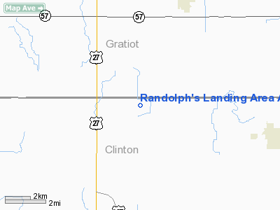
Randolph's Landing Area Airport |
|
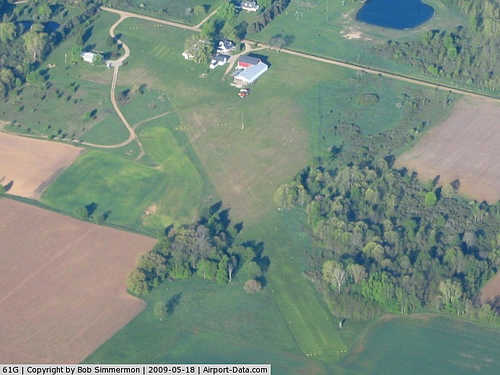 |
(Click on the photo to enlarge) |
Location & QuickFacts
| FAA Information Effective: | 2008-09-25 |
| Airport Identifier: | 61G |
| Airport Status: | Operational |
| Longitude/Latitude: | 084-31-14.9590W/43-06-45.1100N
-84.520822/43.112531 (Estimated) |
| Elevation: | 700 ft / 213.36 m (Estimated) |
| Land: | 6 acres |
| From nearest city: | 7 nautical miles NE of St Johns, MI |
| Location: | Clinton County, MI |
| Magnetic Variation: | 05W (1985) |
Owner & Manager
| Ownership: | Privately owned |
| Owner: | Larry Randolph |
| Address: | 8516 North Williams Rd
St Johns, MI 48879 |
| Phone number: | 989-224-3882
COMPANY PHONE # 989-224-3766 |
| Manager: | Larry Randolph |
| Address: | 8516 North Williams Rd
St Johns, MI 48879 |
| Phone number: | 989-224-3882 |
Airport Operations and Facilities
| Airport Use: | Open to public |
| Wind indicator: | Yes |
| Segmented Circle: | No |
| Control Tower: | No |
| Landing fee charge: | No |
| Sectional chart: | Detroit |
| Region: | AGL - Great Lakes |
| Boundary ARTCC: | ZOB - Cleveland |
| Tie-in FSS: | LAN - Lansing |
| FSS on Airport: | No |
| FSS Toll Free: | 1-800-WX-BRIEF |
| NOTAMs Facility: | LAN (NOTAM-d service avaliable) |
Airport Communications
Airport Services
| Airframe Repair: | NONE |
| Power Plant Repair: | NONE |
Runway Information
Runway 05/23
| Dimension: | 2175 x 100 ft / 662.9 x 30.5 m |
| Surface: | TURF, Good Condition |
| |
Runway 05 |
Runway 23 |
| Longitude: | 084-31-23.2000W | 084-31-00.7400W |
| Latitude: | 43-06-41.5000N | 43-06-55.3100N |
| Elevation: | 700.00 ft | 700.00 ft |
| Traffic Pattern: | Left | Left |
| Displaced threshold: | 767.00 ft | 0.00 ft |
| Obstruction: | 15 ft road, 90 ft left of centerline
RWY 05 APCH RATIO 12:1 AT DSPLCD THLD STRAIGHT OUT | , 50:1 slope to clear |
|
Radio Navigation Aids
| ID |
Type |
Name |
Ch |
Freq |
Var |
Dist |
| AMN | NDB | Alma | | 329.00 | 05W | 17.2 nm |
| HYX | NDB | Browne | | 385.00 | 06W | 34.8 nm |
| OZW | NDB | Howell | | 243.00 | 05W | 37.1 nm |
| MBS | VOR/DME | Saginaw | 076X | 112.90 | 03W | 31.8 nm |
| MOP | VOR/DME | Mount Pleasant | 043X | 110.60 | 05W | 32.1 nm |
| GRR | VOR/DME | Grand Rapids | 106Y | 115.95 | 04W | 47.2 nm |
| LAN | VORTAC | Lansing | 045X | 110.80 | 05W | 25.0 nm |
| FNT | VORTAC | Flint | 116X | 116.90 | 06W | 35.1 nm |
Remarks
- RY 23, 3 FT FENCE L SIDE 65 FT FM CNTRLN.
- DEER ON AND INVOF OF AIRPORT.
Images and information placed above are from
http://www.airport-data.com/airport/61G/
We thank them for the data!
| General Info
|
| Country |
United States
|
| State |
MICHIGAN
|
| FAA ID |
61G
|
| Latitude |
43-06-45.110N
|
| Longitude |
084-31-14.959W
|
| Elevation |
700 feet
|
| Near City |
ST JOHNS
|
We don't guarantee the information is fresh and accurate. The data may
be wrong or outdated.
For more up-to-date information please refer to other sources.
|
|


