 |
|
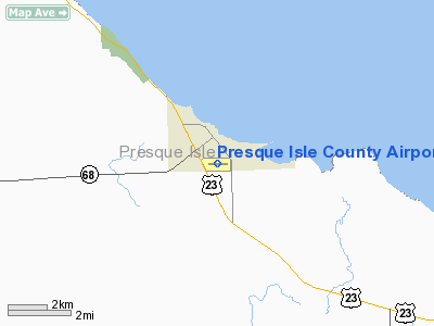
Presque Isle County Airport |
Location & QuickFacts
| FAA Information Effective: | 2008-09-25 |
| Airport Identifier: | PZQ |
| Airport Status: | Operational |
| Longitude/Latitude: | 083-48-46.3150W/45-24-25.5450N
-83.812865/45.407096 (Estimated) |
| Elevation: | 670 ft / 204.22 m (Estimated) |
| Land: | 80 acres |
| From nearest city: | 1 nautical miles S of Rogers City, MI |
| Location: | Presque Isle County, MI |
| Magnetic Variation: | 07W (1985) |
Owner & Manager
| Ownership: | Publicly owned |
| Owner: | Presque Isle County |
| Address: | 657 S Bradley Hwy
Rogers City, MI 49779 |
| Phone number: | 989-734-2216 |
| Manager: | Michael T Jermeay
ASST AMGR RONALD DUGAN; RES PHONE 989-734-2596 |
| Address: | 657 S. Bradley Hwy
Rogers City, MI 49779 |
| Phone number: | 989-734-4309 |
Airport Operations and Facilities
| Airport Use: | Open to public |
| Wind indicator: | Yes |
| Segmented Circle: | Yes |
| Control Tower: | No |
| Lighting Schedule: | DUSK-DAWN
ACTVT MIRL RY 09/27, PAPI RYS 09 & 27, REIL RYS 09 & 27 - CTAF. |
| Beacon Color: | Clear-Green (lighted land airport) |
| Landing fee charge: | No |
| Sectional chart: | Lake Huron |
| Region: | AGL - Great Lakes |
| Boundary ARTCC: | ZMP - Minneapolis |
| Tie-in FSS: | LAN - Lansing |
| FSS on Airport: | No |
| FSS Toll Free: | 1-800-WX-BRIEF |
| NOTAMs Facility: | LAN (NOTAM-d service avaliable) |
| Federal Agreements: | NGY |
Airport Communications
Airport Services
| Airframe Repair: | NONE |
| Power Plant Repair: | NONE |
| Bottled Oxygen: | NONE |
| Bulk Oxygen: | NONE |
Runway Information
Runway 09/27
| Dimension: | 4105 x 75 ft / 1251.2 x 22.9 m |
| Surface: | ASPH, Good Condition |
| Weight Limit: | Single wheel: 22000 lbs. |
| Edge Lights: | Medium |
| |
Runway 09 |
Runway 27 |
| Longitude: | 083-49-15.0700W | 083-48-17.5600W |
| Latitude: | 45-24-24.9200N | 45-24-26.1700N |
| Elevation: | 669.00 ft | 670.00 ft |
| Alignment: | 88 | 127 |
| Traffic Pattern: | Left | Left |
| Markings: | Non-precision instrument, Poor Condition
RY 09/27 MKGS FADED. | Non-precision instrument, Poor Condition |
| Crossing Height: | 35.00 ft | 34.00 ft |
| Displaced threshold: | 220.00 ft | 380.00 ft |
| VASI: | 4-light PAPI on left side | 4-light PAPI on left side |
| Visual Glide Angle: | 3.00° | 3.00° |
| Runway End Identifier: | Yes | Yes |
| Centerline Lights: | No | No |
| Touchdown Lights: | No | No |
| Obstruction: | 82 ft trees, 1840.0 ft from runway, 20:1 slope to clear
RWY 09 APCH RATIO 25:1 AT DSPLCD THLD. | 42 ft pline, 1040.0 ft from runway, 20:1 slope to clear
TWO +42 FT MKD/LGTD PLINES, 1040 FT FM RY END, APCH RATIO 32:1 AT DSPLCD THLD. |
|
Radio Navigation Aids
| ID |
Type |
Name |
Ch |
Freq |
Var |
Dist |
| PZQ | NDB | Rogers City | | 215.00 | 07W | 0.3 nm |
| DRM | NDB | Drummond Island | | 218.00 | 07W | 36.2 nm |
| BFA | NDB | Boyne Falls | | 263.00 | 06W | 49.1 nm |
| GLR | VOR/DME | Gaylord | 029X | 109.20 | 06W | 44.6 nm |
| APN | VORTAC | Alpena | 025X | 108.80 | 07W | 22.3 nm |
| PLN | VORTAC | Pellston | 055X | 111.80 | 06W | 38.3 nm |
Remarks
- DEER AND BIRDS ON & INVOF ARPT.
- CONFIRM SNOW REMOVAL & WINTER CONDITIONS; PHONE 989-734-2216 OR AMGR 989-734-4309.
- PRIOR TO 1959.
Images and information placed above are from
http://www.airport-data.com/airport/PZQ/
We thank them for the data!
| General Info
|
| Country |
United States
|
| State |
MICHIGAN
|
| FAA ID |
PZQ
|
| Latitude |
45-24-25.548N
|
| Longitude |
083-48-46.388W
|
| Elevation |
670 feet
|
| Near City |
ROGERS CITY
|
We don't guarantee the information is fresh and accurate. The data may
be wrong or outdated.
For more up-to-date information please refer to other sources.
|
|


