 |
|
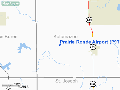
Location & QuickFacts
| FAA Information Effective: | 2008-09-25 |
| Airport Identifier: | P97 |
| Airport Status: | Operational |
| Longitude/Latitude: | 085-42-37.0000W/42-07-25.5000N
-85.710278/42.123750 (Estimated) |
| Elevation: | 890 ft / 271.27 m (Estimated) |
| Land: | 10 acres |
| From nearest city: | 4 nautical miles W of Schoolcraft, MI |
| Location: | Kalamazoo County, MI |
| Magnetic Variation: | 04W (1995) |
Owner & Manager
| Ownership: | Privately owned |
| Owner: | Gary Scott |
| Address: | 13309 South 5th Street
Schoolcraft, MI 49087 |
| Phone number: | 269-679-4641 |
| Manager: | Gary Scott |
| Address: | 13309 South 5th Street
Schoolcraft, MI 49087 |
| Phone number: | 269-679-4641 |
Airport Operations and Facilities
| Airport Use: | Open to public |
| Wind indicator: | Yes |
| Segmented Circle: | No |
| Control Tower: | No |
| Sectional chart: | Chicago |
| Region: | AGL - Great Lakes |
| Boundary ARTCC: | ZAU - Chicago |
| Tie-in FSS: | LAN - Lansing |
| FSS on Airport: | No |
| FSS Toll Free: | 1-800-WX-BRIEF |
| NOTAMs Facility: | LAN (NOTAM-d service avaliable) |
Airport Communications
Airport Services
Runway Information
Runway 09/27
| Dimension: | 2450 x 75 ft / 746.8 x 22.9 m |
| Surface: | TURF, Good Condition |
| |
Runway 09 |
Runway 27 |
| Traffic Pattern: | Left | Left |
| Displaced threshold: | 780.00 ft | 1233.00 ft |
| Obstruction: | 50 ft trees, 228.0 ft from runway, 1 ft left of centerline, 4:1 slope to clear
RWY 09 RWY 09 APCH RATIO 0:1 AT DSLPD THLD BASED ON 15 FT TREE, 113 FT LEFT, 7 FT FROM DSPLD THLD. | 50 ft trees, 25.0 ft from runway, 119 ft right of centerline
RWY 27 RWY 27 APCH RATIO 5:1 AT DSPLCD THLD BASED ON 63 FT TREE, 351 FT DSTC, 76L. |
|
Radio Navigation Aids
| ID |
Type |
Name |
Ch |
Freq |
Var |
Dist |
| HAI | NDB | Three Rivers | | 407.00 | 02W | 11.3 nm |
| IRS | NDB | Sturgis | | 382.00 | 04W | 22.4 nm |
| BT | NDB | Batol | | 272.00 | 04W | 27.4 nm |
| ANQ | NDB | Angola | | 347.00 | 05W | 40.3 nm |
| HLM | NDB | Holland | | 233.00 | 03W | 45.0 nm |
| AZO | VOR/DME | Kalamazoo | 027X | 109.00 | 01W | 9.8 nm |
| ELX | VOR/DME | Keeler | 113X | 116.60 | 00E | 18.4 nm |
| PMM | VOR/DME | Pullman | 058X | 112.10 | 00E | 27.0 nm |
| GRR | VOR/DME | Grand Rapids | 106Y | 115.95 | 04W | 41.0 nm |
| LFD | VOR/DME | Litchfield | 049X | 111.20 | 05W | 42.3 nm |
| BTL | VORTAC | Battle Creek | 031X | 109.40 | 02W | 23.3 nm |
| GIJ | VORTAC | Gipper | 101X | 115.40 | 00E | 34.6 nm |
| GSH | VORTAC | Goshen | 084X | 113.70 | 00E | 38.7 nm |
Remarks
- DEER ON & INVOF ARPT.
- RY 09, +25 FT PLINE 175 FT DSTC.
- MAN-MADE OR NATURAL OBJECTS EXIST WITHIN ASP NEEDED TO ENSURE SAFETY IN TKOF/LNDG.
Images and information placed above are from
http://www.airport-data.com/airport/P97/
We thank them for the data!
| General Info
|
| Country |
United States
|
| State |
MICHIGAN
|
| FAA ID |
P97
|
| Latitude |
42-07-25.500N
|
| Longitude |
085-42-37.000W
|
| Elevation |
890 feet
|
| Near City |
SCHOOLCRAFT
|
We don't guarantee the information is fresh and accurate. The data may
be wrong or outdated.
For more up-to-date information please refer to other sources.
|
|


