 |
|
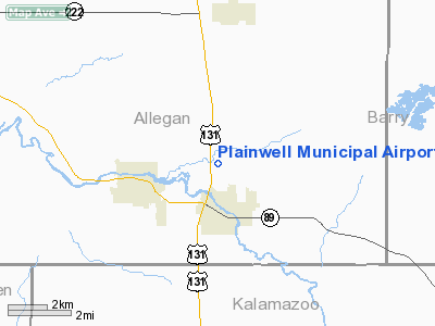
Plainwell Municipal Airport |
Location & QuickFacts
| FAA Information Effective: | 2008-09-25 |
| Airport Identifier: | 61D |
| Airport Status: | Operational |
| Longitude/Latitude: | 085-38-52.9659W/42-28-04.0553N
-85.648046/42.467793 (Estimated) |
| Elevation: | 722 ft / 220.07 m (Estimated) |
| Land: | 80 acres |
| From nearest city: | 2 nautical miles N of Plainwell, MI |
| Location: | Allegan County, MI |
| Magnetic Variation: | 03W (1985) |
Owner & Manager
| Ownership: | Publicly owned |
| Owner: | Erik Wilson, City Mgr |
| Address: | 141 N. Main
Plainwell, MI 49080 |
| Phone number: | 269-685-6821 |
| Manager: | Virgil Williams |
| Address: | 141 N. Main
Plainwell, MI 49080 |
| Phone number: | 269-685-6268 |
Airport Operations and Facilities
| Airport Use: | Open to public |
| Wind indicator: | Yes |
| Segmented Circle: | No |
| Control Tower: | No |
| Lighting Schedule: | RDO-CTL
FOR LIRL RY 09/27 KEY 122.8 5 TIMES ON. |
| Landing fee charge: | No |
| Sectional chart: | Chicago |
| Region: | AGL - Great Lakes |
| Boundary ARTCC: | ZAU - Chicago |
| Tie-in FSS: | LAN - Lansing |
| FSS on Airport: | No |
| FSS Toll Free: | 1-800-WX-BRIEF |
| NOTAMs Facility: | LAN (NOTAM-d service avaliable) |
Airport Communications
| CTAF: | 122.800 |
| Unicom: | 122.800 |
Airport Services
| Fuel available: | 100LL |
| Airframe Repair: | MAJOR |
| Power Plant Repair: | MAJOR |
| Bottled Oxygen: | NONE |
| Bulk Oxygen: | NONE |
Runway Information
Runway 01/19
| Dimension: | 2550 x 150 ft / 777.2 x 45.7 m |
| Surface: | TURF, Good Condition
EXTENSIVE CRACKING. |
| |
Runway 01 |
Runway 19 |
| Longitude: | 085-38-58.2000W | 085-38-54.0000W |
| Latitude: | 42-27-52.6000N | 42-28-17.6000N |
| Elevation: | 722.00 ft | 722.00 ft |
| Alignment: | 7 | 127 |
| Traffic Pattern: | Left | Left |
| Displaced threshold: | 268.00 ft | 980.00 ft |
| Runway End Identifier: | No | No |
| Centerline Lights: | No | No |
| Touchdown Lights: | No | No |
| Obstruction: | 50 ft tree, 66.0 ft from runway, 91 ft right of centerline, 1:1 slope to clear
RY 01 APCH RATIO 2:1 TO DSPLCD THLD BASED ON 50 FT TREE 102 FT FM DSPLCD THLD 130 FT R. | 50 ft trees, 96.0 ft from runway, 91 ft left of centerline, 1:1 slope to clear
APCH RATIO 8:1 TO DSPLCD THLD BASED ON 50 FT TREES 360 FT FM DSPLCD THLD 105R. |
|
Runway 09/27
| Dimension: | 2650 x 50 ft / 807.7 x 15.2 m |
| Surface: | ASPH, Poor Condition
EXTENSIVE CRACKING. |
| Edge Lights: | Low |
| |
Runway 09 |
Runway 27 |
| Longitude: | 085-39-07.6000W | 085-38-32.3000W |
| Latitude: | 42-28-02.9000N | 42-28-03.2000N |
| Elevation: | 722.00 ft | 722.00 ft |
| Alignment: | 89 | 127 |
| Traffic Pattern: | Left | Left |
| Markings: | Basic, Fair Condition | Basic, Fair Condition |
| Displaced threshold: | 191.00 ft | 775.00 ft |
| Runway End Identifier: | No | No |
| Centerline Lights: | No | No |
| Touchdown Lights: | No | No |
| Obstruction: | 17 ft road, 200.0 ft from runway
APCH RATIO 20:1 TO DSPLCD THLD BASED ON 74 FT TREE 1,480 FT FM DSPLCD THLD 115L.
4 FT FENCE, 50 FT DST FROM RWY END; + 15 FT RD, 115 FT FROM RWY END. | 50 ft trees, 200.0 ft from runway
APCH RATIO 21:1 TO DSPLCD THLD BASED ON 50 FT TREE 1000 FT FM DSPLCD THLD 90 FT R.
RWY 27 ROAD 100 FT FM RWY END & FENCE 62 FT FM RWY END. |
|
Radio Navigation Aids
| ID |
Type |
Name |
Ch |
Freq |
Var |
Dist |
| BT | NDB | Batol | | 272.00 | 04W | 21.5 nm |
| HLM | NDB | Holland | | 233.00 | 03W | 30.0 nm |
| HAI | NDB | Three Rivers | | 407.00 | 02W | 30.7 nm |
| IRS | NDB | Sturgis | | 382.00 | 04W | 40.5 nm |
| AZO | VOR/DME | Kalamazoo | 027X | 109.00 | 01W | 14.5 nm |
| PMM | VOR/DME | Pullman | 058X | 112.10 | 00E | 20.3 nm |
| GRR | VOR/DME | Grand Rapids | 106Y | 115.95 | 04W | 20.3 nm |
| ELX | VOR/DME | Keeler | 113X | 116.60 | 00E | 28.7 nm |
| LFD | VOR/DME | Litchfield | 049X | 111.20 | 05W | 46.2 nm |
| BTL | VORTAC | Battle Creek | 031X | 109.40 | 02W | 20.0 nm |
| LAN | VORTAC | Lansing | 045X | 110.80 | 05W | 44.6 nm |
| MKG | VORTAC | Muskegon | 099X | 115.20 | 01W | 45.6 nm |
Images and information placed above are from
http://www.airport-data.com/airport/61D/
We thank them for the data!
| General Info
|
| Country |
United States
|
| State |
MICHIGAN
|
| FAA ID |
61D
|
| Latitude |
42-28-05.126N
|
| Longitude |
085-38-50.056W
|
| Elevation |
722 feet
|
| Near City |
PLAINWELL
|
We don't guarantee the information is fresh and accurate. The data may
be wrong or outdated.
For more up-to-date information please refer to other sources.
|
|


