 |
|
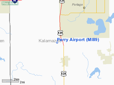
Location & QuickFacts
| FAA Information Effective: | 2008-09-25 |
| Airport Identifier: | MI89 |
| Airport Status: | Operational |
| Longitude/Latitude: | 085-39-10.0060W/42-08-55.1540N
-85.652779/42.148654 (Estimated) |
| Elevation: | 894 ft / 272.49 m (Estimated) |
| Land: | 0 acres |
| From nearest city: | 3 nautical miles N of Schoolcraft, MI |
| Location: | Kalamazoo County, MI |
| Magnetic Variation: | 03W (1985) |
Owner & Manager
| Ownership: | Privately owned |
| Owner: | Richard Perry |
| Address: | 11726 South 12th St
Schoolcraft, MI 49087 |
| Phone number: | 616-679-4182 |
| Address: |
|
Airport Operations and Facilities
| Airport Use: | Private |
| Wind indicator: | Yes |
| Segmented Circle: | No |
| Control Tower: | No |
| Landing fee charge: | No |
| Sectional chart: | Chicago |
| Region: | AGL - Great Lakes |
| Boundary ARTCC: | ZAU - Chicago |
| Tie-in FSS: | LAN - Lansing |
| FSS on Airport: | No |
| FSS Toll Free: | 1-800-WX-BRIEF |
Airport Services
| Airframe Repair: | NONE |
| Power Plant Repair: | NONE |
Runway Information
Runway 09/27
| Dimension: | 2500 x 150 ft / 762.0 x 45.7 m |
| Surface: | TURF, |
| |
Runway 09 |
Runway 27 |
| Traffic Pattern: | Left | Left |
|
Runway 18/36
| Dimension: | 2400 x 150 ft / 731.5 x 45.7 m |
| Surface: | TURF, |
| |
Runway 18 |
Runway 36 |
| Traffic Pattern: | Left | Left |
|
Radio Navigation Aids
| ID |
Type |
Name |
Ch |
Freq |
Var |
Dist |
| HAI | NDB | Three Rivers | | 407.00 | 02W | 11.8 nm |
| IRS | NDB | Sturgis | | 382.00 | 04W | 22.4 nm |
| BT | NDB | Batol | | 272.00 | 04W | 24.5 nm |
| ANQ | NDB | Angola | | 347.00 | 05W | 39.7 nm |
| HLM | NDB | Holland | | 233.00 | 03W | 44.9 nm |
| AZO | VOR/DME | Kalamazoo | 027X | 109.00 | 01W | 6.9 nm |
| ELX | VOR/DME | Keeler | 113X | 116.60 | 00E | 20.9 nm |
| PMM | VOR/DME | Pullman | 058X | 112.10 | 00E | 27.7 nm |
| GRR | VOR/DME | Grand Rapids | 106Y | 115.95 | 04W | 39.0 nm |
| LFD | VOR/DME | Litchfield | 049X | 111.20 | 05W | 39.9 nm |
| BTL | VORTAC | Battle Creek | 031X | 109.40 | 02W | 20.3 nm |
| GIJ | VORTAC | Gipper | 101X | 115.40 | 00E | 37.5 nm |
| GSH | VORTAC | Goshen | 084X | 113.70 | 00E | 41.1 nm |
Images and information placed above are from
http://www.airport-data.com/airport/MI89/
We thank them for the data!
| General Info
|
| Country |
United States
|
| State |
MICHIGAN
|
| FAA ID |
MI89
|
| Latitude |
42-08-55.154N
|
| Longitude |
085-39-10.006W
|
| Elevation |
894 feet
|
| Near City |
SCHOOLCRAFT
|
We don't guarantee the information is fresh and accurate. The data may
be wrong or outdated.
For more up-to-date information please refer to other sources.
|
|


