 |
|
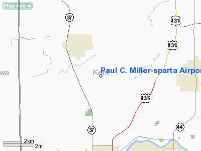
Paul C. Miller - Sparta Airport |
| Paul C. Miller - Sparta Airport |
| IATA: none – ICAO: 8D4 |
| Summary |
| Airport type |
Public |
| Operator |
Village of Sparta |
| Location |
Sparta, Michigan |
| Elevation AMSL |
775 ft / 236.2 m |
| Coordinates |
43°07′38″N 85°40′42″W / 43.12722°N 85.67833°W / 43.12722; -85.67833Coordinates: 43°07′38″N 85°40′42″W / 43.12722°N 85.67833°W / 43.12722; -85.67833 |
| Runways |
| Direction |
Length |
Surface |
| ft |
m |
| 7/25 |
4,033 |
1,229 |
Asphalt |
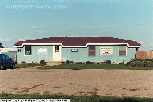
Paul C. Miller - Sparta Airport (FAA LID: 8D4) is a public airport located 3 mi (5 km) southeast of Sparta, Michigan. Established in 1941, the airport is currently owned and operated by the Village of Sparta and is self-supporting, requiring no public funding.
The airport has a 4,033 x 75 ft. E-W primary runway.
The airport is used for general aviation and has no regularly scheduled commercial flights. Paramount Aviation operates on the field, offering aircraft rental, charter flights, and flight training.
The above content comes from Wikipedia and is published under free licenses – click here to read more.
|
 |
(Click on the photo to enlarge) |
Location & QuickFacts
| FAA Information Effective: | 2008-09-25 |
| Airport Identifier: | 8D4 |
| Airport Status: | Operational |
| Longitude/Latitude: | 085-40-42.2000W/43-07-38.0000N
-85.678389/43.127222 (Estimated) |
| Elevation: | 775 ft / 236.22 m (Surveyed) |
| Land: | 160 acres |
| From nearest city: | 3 nautical miles SE of Sparta, MI |
| Location: | Kent County, MI |
| Magnetic Variation: | 04W (1980) |
Owner & Manager
| Ownership: | Publicly owned |
| Owner: | City Of Sparta |
| Address: | 156 E. Division
Sparta, MI 49345 |
| Phone number: | 616-887-8251 |
| Manager: | Richard Roberts |
| Address: | 9100 Vinton Ave
Sparta, MI 49345 |
| Phone number: | 616-887-5744
CELL 616-520-1834. |
Airport Operations and Facilities
| Airport Use: | Open to public |
| Wind indicator: | Yes |
| Segmented Circle: | No |
| Control Tower: | No |
| Lighting Schedule: | DUSK-DAWN
ACTVT MIRL & PAPI RY 07/25 - CTAF. |
| Beacon Color: | Clear-Green (lighted land airport) |
| Landing fee charge: | No |
| Sectional chart: | Chicago |
| Region: | AGL - Great Lakes |
| Boundary ARTCC: | ZAU - Chicago |
| Tie-in FSS: | LAN - Lansing |
| FSS on Airport: | No |
| FSS Toll Free: | 1-800-WX-BRIEF |
| NOTAMs Facility: | LAN (NOTAM-d service avaliable) |
| Federal Agreements: | N |
Airport Communications
| CTAF: | 122.800 |
| Unicom: | 122.800 |
Airport Services
| Fuel available: | 100LLMOGAS |
| Airframe Repair: | MAJOR |
| Power Plant Repair: | MAJOR |
| Bulk Oxygen: | NONE |
Runway Information
Runway 07/25
| Dimension: | 4033 x 75 ft / 1229.3 x 22.9 m |
| Surface: | ASPH, Good Condition |
| Weight Limit: | Single wheel: 24000 lbs. |
| Edge Lights: | Medium |
| |
Runway 07 |
Runway 25 |
| Longitude: | 085-41-09.3234W | 085-40-21.0932W |
| Latitude: | 43-07-29.5492N | 43-07-47.9710N |
| Elevation: | 775.00 ft | 775.00 ft |
| Alignment: | 63 | 127 |
| Traffic Pattern: | Left | Left |
| Markings: | Non-precision instrument, Good Condition
RWY MARKINGS DO NOT REFLECT IFR APPROACH SCHEME. | Non-precision instrument, Good Condition |
| Crossing Height: | 22.00 ft | 27.00 ft |
| VASI: | 2-light PAPI on left side | 2-light PAPI on right side |
| Visual Glide Angle: | 3.50° | 3.50° |
| Runway End Identifier: | Yes | Yes |
| Centerline Lights: | No | No |
| Touchdown Lights: | No | No |
| Obstruction: | 57 ft trees, 1340.0 ft from runway, 21:1 slope to clear | 27 ft trees, 740.0 ft from runway, 15:1 slope to clear |
|
Radio Navigation Aids
| ID |
Type |
Name |
Ch |
Freq |
Var |
Dist |
| HLM | NDB | Holland | | 233.00 | 03W | 29.0 nm |
| AMN | NDB | Alma | | 329.00 | 05W | 40.9 nm |
| GRR | VOR/DME | Grand Rapids | 106Y | 115.95 | 04W | 22.0 nm |
| HIC | VOR/DME | White Cloud | 123X | 117.60 | 01W | 27.0 nm |
| PMM | VOR/DME | Pullman | 058X | 112.10 | 00E | 44.0 nm |
| MKG | VORTAC | Muskegon | 099X | 115.20 | 01W | 16.0 nm |
| LAN | VORTAC | Lansing | 045X | 110.80 | 05W | 49.7 nm |
Remarks
- DEER ON & INVOF ARPT.
- POWERED PARACHUTE OPNS NORTH SIDE OF RY.
Images and information placed above are from
http://www.airport-data.com/airport/8D4/
We thank them for the data!
| General Info
|
| Country |
United States
|
| State |
MICHIGAN
|
| FAA ID |
8D4
|
| Latitude |
43-07-42.990N
|
| Longitude |
085-40-36.832W
|
| Elevation |
761 feet
|
| Near City |
SPARTA
|
We don't guarantee the information is fresh and accurate. The data may
be wrong or outdated.
For more up-to-date information please refer to other sources.
|
|


