 |
|
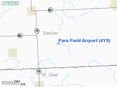
Location & QuickFacts
| FAA Information Effective: | 2008-09-25 |
| Airport Identifier: | 4Y8 |
| Airport Status: | Operational |
| Longitude/Latitude: | 082-45-14.0000W/43-12-08.0800N
-82.753889/43.202244 (Estimated) |
| Elevation: | 800 ft / 243.84 m (Estimated) |
| Land: | 20 acres |
| From nearest city: | 5 nautical miles NE of Yale, MI |
| Location: | Sanilac County, MI |
| Magnetic Variation: | 06W (1985) |
Owner & Manager
| Ownership: | Privately owned |
| Owner: | Ralph P. Kohlitz |
| Address: | 20918 Beaufait
Harper Woods, MI 48225 |
| Manager: | Jeffery P. Kohlitz |
| Address: | 20918 Beaufait
Harper Woods, MI 48225 |
| Phone number: | 586-753-1042 |
Airport Operations and Facilities
| Airport Use: | Open to public |
| Wind indicator: | Yes |
| Segmented Circle: | No |
| Control Tower: | No |
| Landing fee charge: | No |
| Sectional chart: | Detroit |
| Region: | AGL - Great Lakes |
| Boundary ARTCC: | ZOB - Cleveland |
| Tie-in FSS: | LAN - Lansing |
| FSS on Airport: | No |
| FSS Toll Free: | 1-800-WX-BRIEF |
| NOTAMs Facility: | (NOTAM-d service avaliable) |
Airport Communications
Runway Information
Runway 06/24
| Dimension: | 2500 x 65 ft / 762.0 x 19.8 m |
| Surface: | TURF, Fair Condition |
| |
Runway 06 |
Runway 24 |
| Longitude: | 082-45-28.5600W | 082-44-59.3600W |
| Latitude: | 43-12-01.8800N | 43-12-14.2800N |
| Traffic Pattern: | Left | Left |
| Displaced threshold: | 476.00 ft | 200.00 ft |
| Obstruction: | 37 ft trees, 274.0 ft from runway, 50 ft left of centerline, 7:1 slope to clear
APCH RATIO 20:1 AT DSPLCD THLD. 37 FT TREE 50 FT L 750 FT DSTC. | 6 ft brush, 50.0 ft from runway, 8:1 slope to clear
APCH RATIO 13:1 AT DSPLCD THLD, +20 FT TREES 260 FT DSTC, 60 FT L & R. |
|
Radio Navigation Aids
| ID |
Type |
Name |
Ch |
Freq |
Var |
Dist |
| ZR | NDB | Sarnia | | 404.00 | 06W | 27.7 nm |
| MTC | TACAN | Selfridge | 064X | | 06W | 35.6 nm |
| BAX | VOR/DME | Bad Axe | 019X | 108.20 | 05W | 36.4 nm |
| ECK | VORTAC | Peck | 087X | 114.00 | 07W | 3.6 nm |
| PSI | VORTAC | Pontiac | 047X | 111.00 | 03W | 45.6 nm |
| FNT | VORTAC | Flint | 116X | 116.90 | 06W | 45.8 nm |
| DET | VOT | Detroit City | | 111.60 | | 49.3 nm |
Remarks
- ROLLING TERRAIN; RY SLOPES DOWNWARD AT BOTH ENDS. OPOSITE RY END NOT VSBL FM THLDS.
- MAN-MADE OR NATURAL OBJECTS EXIST WITHIN THE AIRSPACE NEEDED TO INSURE SAFETY IN TAKEOFF & LANDING OF ACFT.
Images and information placed above are from
http://www.airport-data.com/airport/4Y8/
We thank them for the data!
| General Info
|
| Country |
United States
|
| State |
MICHIGAN
|
| FAA ID |
4Y8
|
| Latitude |
43-12-08.089N
|
| Longitude |
082-45-14.747W
|
| Elevation |
800 feet
|
| Near City |
YALE
|
We don't guarantee the information is fresh and accurate. The data may
be wrong or outdated.
For more up-to-date information please refer to other sources.
|
|


