 |
|
Padgham Field
Allegan City Airport |
| IATA: 35D – ICAO: K35D – FAA LID: 35D |
| Summary |
| Airport type |
Public |
| Operator |
City of Allegan |
| Location |
Allegan, Michigan |
| Elevation AMSL |
891 ft / 272 m |
| Coordinates |
42°31′51.5″N 85°49′30.5″W / 42.530972°N 85.825139°W / 42.530972; -85.825139Coordinates: 42°31′51.5″N 85°49′30.5″W / 42.530972°N 85.825139°W / 42.530972; -85.825139 |
| Runways |
| Direction |
Length |
Surface |
| ft |
m |
| 11/29 |
4,300'x75' |
1,311x23 |
Asphalt |
| 15/33 |
1,598'x150' |
487x46 |
Turf |
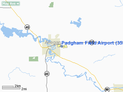
Allegan City Airport (Padgham Field) (IATA: 35D, ICAO: K35D, FAA LID: 35D) is a general aviation airport located 1 mile (2 km) east of Allegan in Allegan County, Michigan, USA.
The address of the airport is: 740 Grand St., Allegan, MI, 49010
The airport offers flight training, aircraft rental, a full maintenance facility (including major overhauls), skydiving, public telephone, weather briefings, and 24 hour 100LL fuel servicing. Facilities
The airport is staffed daily from 8AM until dusk.
Runways
- Runway 11/29: 3,500 x 75 ft. (1,067 x 23 m), Surface: Asphalt
- Runway 15/33: 2,000 x 150 ft. (609 x 46 m), Surface: Turf
Airport Communications
- CTAF/UNICOM:122.8
- GRAND RAPIDS APPROACH:128.4
- GRAND RAPIDS DEPARTURE:128.4
- WX ASOS at BIV (18 nm NW):119.025 (616-394-0190)
Location
- The airport is accessible by road from M-222, (exit #55 off of US-131), and is located near M-40 and M-89.
Skydiving
- Padgham Field has skydiving operations at the East side of the field. There is a small skydiving club operating there and Skydive Inc. operates it's Skydive Allegan operation there as well.
Skydiving
Padgham Field has active skydiving operations at the field. There is a small skydiving club operating on Saturdays and a commercial operation, Skydive Inc. that operates as Skydive Allegan and jumps on Saturdays, Sundays, Wednesday evenings, and throughout the week on occasion. These operations typically put skydivers over the North center of the field and land in the field area between the T-hangars.
Experienced skydivers normally exit the aircraft from an altitude of 10,000' AGL and will freefall to approximately 2,500' AGL before deploying their canopies. Skydive Inc.'s Skydive Allegan Tandem Skydivers will normally exit the aircraft from an altitude of 10,000' AGL and will free fall to approximately 4,500' AGL before deploying their canopies. During skydiving operations, Padgham Field will potentially have skydiving canopy traffic in a small pattern from 4,500' AGL to the ground.
Skydive aircraft are in constant communication with Grand Rapids Approach and will give notices via local frequencies as to skydiver jump status.
The above content comes from Wikipedia and is published under free licenses – click here to read more.
Location & QuickFacts
| FAA Information Effective: | 2008-09-25 |
| Airport Identifier: | 35D |
| Airport Status: | Operational |
| Longitude/Latitude: | 085-49-30.1000W/42-31-51.3000N
-85.825028/42.530917 (Estimated) |
| Elevation: | 707 ft / 215.49 m (Surveyed) |
| Land: | 110 acres |
| From nearest city: | 1 nautical miles E of Allegan, MI |
| Location: | Allegan County, MI |
| Magnetic Variation: | 01W (1980) |
Owner & Manager
| Ownership: | Publicly owned |
| Owner: | City Of Allegan |
| Address: | 112 Locust Street
Allegan, MI 49010 |
| Phone number: | 269-673-5511 |
| Manager: | Jason Blair |
| Address: | 740 Grand St
Allegan, MI 49010 |
| Phone number: | 269-673-4157
AMGR CELL PH 269-275-7959. |
Airport Operations and Facilities
| Airport Use: | Open to public |
| Wind indicator: | Yes |
| Segmented Circle: | Yes |
| Control Tower: | No |
| Lighting Schedule: | DUSK-DAWN
ACTVT MIRL RY 10/28; VASI RYS 10 & 28; REIL RY 28 - CTAF. |
| Beacon Color: | Clear-Green (lighted land airport) |
| Landing fee charge: | No |
| Sectional chart: | Chicago |
| Region: | AGL - Great Lakes |
| Boundary ARTCC: | ZAU - Chicago |
| Tie-in FSS: | LAN - Lansing |
| FSS on Airport: | No |
| FSS Toll Free: | 1-800-WX-BRIEF |
| NOTAMs Facility: | LAN (NOTAM-d service avaliable) |
| Federal Agreements: | NGY |
Airport Communications
| CTAF: | 122.800 |
| Unicom: | 122.800 |
Airport Services
| Fuel available: | 100LL |
| Airframe Repair: | MAJOR |
| Power Plant Repair: | MAJOR |
| Bottled Oxygen: | NONE |
| Bulk Oxygen: | NONE |
Runway Information
Runway 10/28
| Dimension: | 3498 x 75 ft / 1066.2 x 22.9 m |
| Surface: | ASPH, Good Condition
SURFACE ROUGH. |
| Weight Limit: | Single wheel: 18000 lbs. |
| Edge Lights: | Medium |
| |
Runway 10 |
Runway 28 |
| Longitude: | 085-49-49.9141W | 085-49-03.3370W |
| Latitude: | 42-31-51.4228N | 42-31-48.7434N |
| Elevation: | 703.00 ft | 704.00 ft |
| Alignment: | 94 | 127 |
| Traffic Pattern: | Left | Left |
| Markings: | Non-precision instrument, Good Condition | Non-precision instrument, Good Condition |
| Crossing Height: | 35.00 ft | 30.00 ft |
| VASI: | 2-box on left side
VASI OTS INDEFLY. | 2-box on left side |
| Visual Glide Angle: | 3.50° | 3.50° |
| Runway End Identifier: | No | Yes |
| Centerline Lights: | No | No |
| Touchdown Lights: | No | No |
| Obstruction: | 54 ft trees, 1280.0 ft from runway, 20:1 slope to clear | 15 ft trees, 250.0 ft from runway, 140 ft right of centerline, 3:1 slope to clear |
|
Runway 14/32
| Dimension: | 2003 x 150 ft / 610.5 x 45.7 m |
| Surface: | TURF, Fair Condition
SURFACE ROUGH. |
| |
Runway 14 |
Runway 32 |
| Longitude: | 085-49-44.6303W | 085-49-27.7749W |
| Latitude: | 42-32-01.0412N | 42-31-45.6808N |
| Elevation: | 699.00 ft | 702.00 ft |
| Alignment: | 127 | 127 |
| Traffic Pattern: | Left | Left |
| Markings: | None,
MKD WITH THREE 3 FT YELLOW CONES. | None, |
| Displaced threshold: | 602.00 ft | 0.00 ft |
| Runway End Identifier: | No | No |
| Centerline Lights: | No | No |
| Touchdown Lights: | No | No |
| Obstruction: | 58 ft trees, 350.0 ft from runway, 135 ft right of centerline, 6:1 slope to clear
APCH RATIO 16:1 TO DSPLCD THLD. | 60 ft trees, 0.0 ft from runway, 138 ft left of centerline
RY 32 APCH RATIO 20:1 BASED ON STRAIGHT OUT. |
|
Radio Navigation Aids
| ID |
Type |
Name |
Ch |
Freq |
Var |
Dist |
| HLM | NDB | Holland | | 233.00 | 03W | 21.7 nm |
| BT | NDB | Batol | | 272.00 | 04W | 30.2 nm |
| HAI | NDB | Three Rivers | | 407.00 | 02W | 35.9 nm |
| IRS | NDB | Sturgis | | 382.00 | 04W | 46.5 nm |
| PMM | VOR/DME | Pullman | 058X | 112.10 | 00E | 13.0 nm |
| GRR | VOR/DME | Grand Rapids | 106Y | 115.95 | 04W | 21.1 nm |
| AZO | VOR/DME | Kalamazoo | 027X | 109.00 | 01W | 21.4 nm |
| ELX | VOR/DME | Keeler | 113X | 116.60 | 00E | 26.7 nm |
| BTL | VORTAC | Battle Creek | 031X | 109.40 | 02W | 28.7 nm |
| MKG | VORTAC | Muskegon | 099X | 115.20 | 01W | 39.5 nm |
Remarks
- RY 10/28 PARALLEL TWY MARKED WITH REFLECTORS.
Images and information placed above are from
http://www.airport-data.com/airport/35D/
We thank them for the data!
| General Info
|
| Country |
United States
|
| State |
MICHIGAN
|
| FAA ID |
35D
|
| Latitude |
42-31-51.538N
|
| Longitude |
085-49-30.488W
|
| Elevation |
708 feet
|
| Near City |
ALLEGAN
|
We don't guarantee the information is fresh and accurate. The data may
be wrong or outdated.
For more up-to-date information please refer to other sources.
|
|


