 |
|
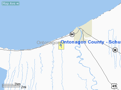
Ontonagon County - Schuster Field Airport |
Location & QuickFacts
| FAA Information Effective: | 2008-09-25 |
| Airport Identifier: | OGM |
| Airport Status: | Operational |
| Longitude/Latitude: | 089-22-01.5170W/46-50-43.6930N
-89.367088/46.845470 (Estimated) |
| Elevation: | 669 ft / 203.91 m (Surveyed) |
| Land: | 360 acres |
| From nearest city: | 3 nautical miles W of Ontonagon, MI |
| Location: | Ontonagon County, MI |
| Magnetic Variation: | 00E (1980) |
Owner & Manager
| Ownership: | Publicly owned |
| Owner: | County Of Ontonagon |
| Address: | Courthouse, Ontonagon Co Arpt,, 725 Greenland Ave
Ontonagon, MI 49953 |
| Phone number: | 906-884-4255 |
| Manager: | Carol Huntoon |
| Address: | 725 Greenland Rd, Courthouse
Ontonagon, MI 49953-6412 |
| Phone number: | 906-884-6214
PAGER 906-777-1186, MGR RES 906-884-2345. |
Airport Operations and Facilities
| Airport Use: | Open to public |
| Wind indicator: | Yes |
| Segmented Circle: | Yes |
| Control Tower: | No |
| Lighting Schedule: | DUSK-DAWN
MIRL RY 17/35 & PAPI RY 17/35 DUSK-2300; AFTER 2300 ACTVT - CTAF. |
| Beacon Color: | Clear-Green (lighted land airport) |
| Landing fee charge: | No |
| Sectional chart: | Green Bay |
| Region: | AGL - Great Lakes |
| Boundary ARTCC: | ZMP - Minneapolis |
| Tie-in FSS: | GRB - Green Bay |
| FSS on Airport: | No |
| FSS Toll Free: | 1-800-WX-BRIEF |
| NOTAMs Facility: | GRB (NOTAM-d service avaliable) |
| Federal Agreements: | NGY |
Airport Communications
Airport Services
| Fuel available: | 100LL
24 HR SELF-SERVE FUEL W VISA OR MASTER CHARGE. |
| Airframe Repair: | NONE |
| Power Plant Repair: | NONE |
| Bottled Oxygen: | NONE |
| Bulk Oxygen: | NONE |
Runway Information
Runway 17/35
| Dimension: | 3500 x 75 ft / 1066.8 x 22.9 m |
| Surface: | ASPH, Fair Condition |
| Weight Limit: | Single wheel: 12000 lbs. |
| Edge Lights: | Medium |
| |
Runway 17 |
Runway 35 |
| Longitude: | 089-22-08.7590W | 089-21-54.2700W |
| Latitude: | 46-51-00.2130N | 46-50-27.1730N |
| Elevation: | 639.00 ft | 665.00 ft |
| Alignment: | 127 | 127 |
| Traffic Pattern: | Left | Left |
| Markings: | Non-precision instrument, Good Condition | Non-precision instrument, Good Condition |
| Crossing Height: | 25.00 ft | 25.00 ft |
| VASI: | 2-light PAPI on left side | 2-light PAPI on left side |
| Visual Glide Angle: | 3.45° | 3.45° |
| Runway End Identifier: | Yes | Yes |
| Obstruction: | 64 ft trees, 1800.0 ft from runway, 25:1 slope to clear | 63 ft trees, 1460.0 ft from runway, 20:1 slope to clear |
|
Radio Navigation Aids
| ID |
Type |
Name |
Ch |
Freq |
Var |
Dist |
| OGM | NDB | Ontonagon | | 375.00 | 00W | 0.3 nm |
| RXW | NDB | Watersmeet | | 407.00 | 01E | 33.7 nm |
| LNL | NDB | Land O Lakes | | 396.00 | 02W | 42.3 nm |
| CM | NDB | Galey | | 275.00 | 02W | 42.8 nm |
| BDJ | NDB | Boulder Junction | | 206.00 | 02E | 44.4 nm |
| MHA | NDB | Manitowish | | 364.00 | 01W | 48.4 nm |
| CMX | VOR/DME | Houghton | 075X | 112.80 | 02W | 41.1 nm |
| IWD | VORTAC | Ironwood | 025X | 108.80 | 01E | 36.5 nm |
Remarks
Images and information placed above are from
http://www.airport-data.com/airport/OGM/
We thank them for the data!
| General Info
|
| Country |
United States
|
| State |
MICHIGAN
|
| FAA ID |
OGM
|
| Latitude |
46-50-43.693N
|
| Longitude |
089-22-01.517W
|
| Elevation |
669 feet
|
| Near City |
ONTONAGON
|
We don't guarantee the information is fresh and accurate. The data may
be wrong or outdated.
For more up-to-date information please refer to other sources.
|
|


