 |
|
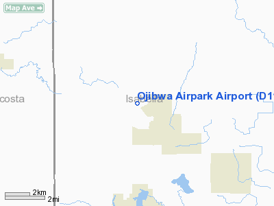
Location & QuickFacts
| FAA Information Effective: | 2008-09-25 |
| Airport Identifier: | D11 |
| Airport Status: | Operational |
| Longitude/Latitude: | 085-00-10.0960W/43-43-12.0970N
-85.002804/43.720027 (Estimated) |
| Elevation: | 950 ft / 289.56 m (Estimated) |
| Land: | 25 acres |
| From nearest city: | 3 nautical miles NW of Weidman, MI |
| Location: | Isabella County, MI |
| Magnetic Variation: | 05W (1985) |
Owner & Manager
| Ownership: | Privately owned |
| Owner: | Ojibwa Property Owners Assn |
| Address: | P.o. Box 82
Weidman, MI 48893
ARPT LOCATED AT 7723 WINDOGA LK. DRIVE; WEIDMAN MI 48893. |
| Phone number: | 989-644-8692 |
| Manager: | Raymond Battleshaw |
| Address: | P.o. Box 249
Weidman, MI 48893 |
| Phone number: | 989-644-3677
ALSO CALL ROBERT NUMERICK ASST AMGR 989- 644-8084. |
Airport Operations and Facilities
| Airport Use: | Open to public |
| Wind indicator: | Yes |
| Control Tower: | No |
| Lighting Schedule: | DUSK-DAWN |
| Landing fee charge: | No |
| Sectional chart: | Chicago |
| Region: | AGL - Great Lakes |
| Boundary ARTCC: | ZMP - Minneapolis |
| Tie-in FSS: | LAN - Lansing |
| FSS on Airport: | No |
| FSS Toll Free: | 1-800-WX-BRIEF |
| NOTAMs Facility: | LAN (NOTAM-d service avaliable) |
Airport Communications
Airport Services
| Airframe Repair: | NONE |
| Power Plant Repair: | NONE |
| Bottled Oxygen: | NONE |
| Bulk Oxygen: | NONE |
Runway Information
Runway 05/23
| Dimension: | 3600 x 125 ft / 1097.3 x 38.1 m |
| Surface: | TURF, Good Condition |
| Edge Lights: | Low |
| |
Runway 05 |
Runway 23 |
| Traffic Pattern: | Left | Left |
| Displaced threshold: | 700.00 ft | 400.00 ft
APCH RATIO 25:1 AT DSPLCD THR OVR +52 FT TREES, 1300 FT DSTC, 0 FT B. |
| Runway End Identifier: | No | No |
| Centerline Lights: | No | No |
| Touchdown Lights: | No | No |
| Obstruction: | 15 ft road, 125 ft left of centerline
RWY 05 APCH RATIO 20:1 TO DSPLCD THLD OVER 75 FT TREE, 1500 FT DSTC, 63 FT LEFT. | 21 ft trees, 63.0 ft from runway, 75 ft right of centerline, 3:1 slope to clear |
|
Radio Navigation Aids
| ID |
Type |
Name |
Ch |
Freq |
Var |
Dist |
| AMN | NDB | Alma | | 329.00 | 05W | 25.7 nm |
| GDW | NDB | Wiggins | | 209.00 | 04W | 27.4 nm |
| CAD | NDB | Cadillac | | 269.00 | 04W | 37.8 nm |
| MOP | VOR/DME | Mount Pleasant | 043X | 110.60 | 05W | 12.9 nm |
| HIC | VOR/DME | White Cloud | 123X | 117.60 | 01W | 32.2 nm |
| HTL | VOR/DME | Houghton Lake | 053X | 111.60 | 05W | 41.1 nm |
| MBS | VOR/DME | Saginaw | 076X | 112.90 | 03W | 41.8 nm |
| BXZ | VOR/DME | West Branch | 079X | 113.20 | 06W | 47.4 nm |
Remarks
- ARPT CLSD WHEN SNOW COVERED EXCEPT FOR SKI EQUIPPED ACFT; APRXLY NOV THRU APR.
- TREES & BLDGS BOTH SIDES OF RY.
- RY 05 HAS 14 FT ROAD & 3 FT FENCE AT THLD, AND TALL TREES ALL QUADS.
- RY 23 EAST 400 FT IS SOFT WHEN WET.
- PROVIDED ANY OBST IN RWY APCH SLOPE SFC REMOVED/LOWERED RO RWY THR DSPLCD AND MKD TO PROVIDE MINIMUM 10:1 APCH CLNC OVER OBST.
Images and information placed above are from
http://www.airport-data.com/airport/D11/
We thank them for the data!
| General Info
|
| Country |
United States
|
| State |
MICHIGAN
|
| FAA ID |
D11
|
| Latitude |
43-43-12.097N
|
| Longitude |
085-00-10.096W
|
| Elevation |
950 feet
|
| Near City |
WEIDMAN
|
We don't guarantee the information is fresh and accurate. The data may
be wrong or outdated.
For more up-to-date information please refer to other sources.
|
|


