 |
|
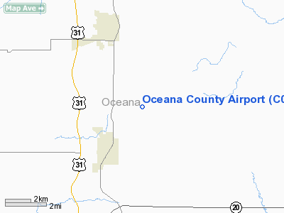
Location & QuickFacts
| FAA Information Effective: | 2008-09-25 |
| Airport Identifier: | C04 |
| Airport Status: | Operational |
| Longitude/Latitude: | 086-19-46.8000W/43-38-30.3000N
-86.329667/43.641750 (Estimated) |
| Elevation: | 910 ft / 277.37 m (Estimated) |
| Land: | 90 acres |
| From nearest city: | 4 nautical miles SE of Hart/shelby, MI |
| Location: | Oceana County, MI |
| Magnetic Variation: | 03W (1985) |
Owner & Manager
| Ownership: | Publicly owned |
| Owner: | Oceana County |
| Address: | Court House, 100 S. State St., P. O. Box 14
Hart, MI 49420 |
| Phone number: | 231-873-4835 |
| Manager: | Peter W Kelly |
| Address: | 2752 W Buchanan
Shelby, MI 49455 |
| Phone number: | 231-861-9910
AMGR PAGER 231-712-1130; CELL PH 231-742-0210 |
Airport Operations and Facilities
| Airport Use: | Open to public |
| Wind indicator: | Yes |
| Segmented Circle: | Yes |
| Control Tower: | No |
| Lighting Schedule: | RDO-CTL
ACTVT MIRL RY 08/26 & PAPI RYS 08 & 26 - CTAF. |
| Landing fee charge: | No |
| Sectional chart: | Chicago |
| Region: | AGL - Great Lakes |
| Traffic Pattern Alt: | 800 ft |
| Boundary ARTCC: | ZMP - Minneapolis |
| Tie-in FSS: | LAN - Lansing |
| FSS on Airport: | No |
| FSS Toll Free: | 1-800-WX-BRIEF |
| NOTAMs Facility: | LAN (NOTAM-d service avaliable) |
| Federal Agreements: | 1 |
Airport Communications
| CTAF: | 122.700 |
| Unicom: | 122.700 |
Airport Services
| Fuel available: | 100LL
FUEL 24 HR SELF SERVE. |
| Airframe Repair: | MAJOR |
| Power Plant Repair: | MAJOR |
| Bottled Oxygen: | NONE |
| Bulk Oxygen: | NONE |
Runway Information
Runway 08/26
| Dimension: | 3500 x 75 ft / 1066.8 x 22.9 m |
| Surface: | ASPH, Good Condition
RWY 14/32 ROUGH & SOFT WHEN WET. |
| Edge Lights: | Medium |
| |
Runway 08 |
Runway 26 |
| Longitude: | 086-20-10.9200W | 086-19-23.7100W |
| Latitude: | 43-38-27.6100N | 43-38-32.0700N |
| Traffic Pattern: | Left | Left |
| Markings: | Basic, Fair Condition | Basic, Fair Condition |
| Crossing Height: | 25.00 ft | 25.00 ft |
| VASI: | 2-light PAPI on left side | 2-light PAPI on left side |
| Visual Glide Angle: | 4.00° | 4.00° |
| Runway End Identifier: | No | No |
| Centerline Lights: | No | No |
| Touchdown Lights: | No | No |
| Obstruction: | 17 ft road, 459.0 ft from runway, 15:1 slope to clear | 25 ft trees, 625.0 ft from runway, 17:1 slope to clear
RWY 26 APCH RATIO 25:1 TO RWY END. |
|
Runway 14/32
| Dimension: | 2240 x 100 ft / 682.8 x 30.5 m |
| Surface: | TURF, Good Condition
RWY 14/32 ROUGH & SOFT WHEN WET. |
| |
Runway 14 |
Runway 32 |
| Longitude: | 086-19-55.5300W | 086-19-36.2500W |
| Latitude: | 43-38-39.4900N | 43-38-22.3500N |
| Elevation: | 910.00 ft | 910.00 ft |
| Traffic Pattern: | Left | Left |
| Displaced threshold: | 375.00 ft | 564.00 ft |
| Runway End Identifier: | No | No |
| Centerline Lights: | No | No |
| Touchdown Lights: | No | No |
| Obstruction: | 17 ft road
RWY 14 RY 14 HAS 70 FT TREES L & R 1480 FT FM DSPLCD THLD APCH RATIO 21:1. | 51 ft trees, 1275.0 ft from runway, 25:1 slope to clear
RWY 32 APCH RATIO 20:1 AT DSPLCD THLD, 95 FT TREES, 0B, 2924 FT FM DSPLCD THLD. |
|
Radio Navigation Aids
| ID |
Type |
Name |
Ch |
Freq |
Var |
Dist |
| LDM | NDB | Ludington | | 341.00 | 03W | 19.6 nm |
| HIC | VOR/DME | White Cloud | 123X | 117.60 | 01W | 27.0 nm |
| MBL | VOR/DME | Manistee | 051X | 111.40 | 05W | 37.9 nm |
| MKG | VORTAC | Muskegon | 099X | 115.20 | 01W | 31.1 nm |
Remarks
- RADIO CONTROLLED MODEL ACFT OPNS ON FLD DLY.
- ESTABD PRIOR TO 1959.
Images and information placed above are from
http://www.airport-data.com/airport/C04/
We thank them for the data!
| General Info
|
| Country |
United States
|
| State |
MICHIGAN
|
| FAA ID |
C04
|
| Latitude |
43-38-30.030N
|
| Longitude |
086-19-45.266W
|
| Elevation |
910 feet
|
| Near City |
HART/SHELBY
|
We don't guarantee the information is fresh and accurate. The data may
be wrong or outdated.
For more up-to-date information please refer to other sources.
|
|


