 |
|
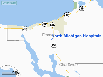
North Michigan Hospitals Inc Heliport |
Location & QuickFacts
| FAA Information Effective: | 2008-09-25 |
| Airport Identifier: | MI56 |
| Airport Status: | Operational |
| Longitude/Latitude: | 084-58-22.1880W/45-20-21.0330N
-84.972830/45.339176 (Estimated) |
| Elevation: | 636 ft / 193.85 m (Estimated) |
| Land: | 0 acres |
| From nearest city: | 0 nautical miles N of Petoskey, MI |
| Location: | Emmet County, MI |
| Magnetic Variation: | 05W (1990) |
Owner & Manager
| Ownership: | Privately owned |
| Owner: | Northern Michigan Hospital |
| Address: | 416 Conable St
Petoskey, MI 49770 |
| Phone number: | 616-348-4000 |
| Manager: | Paul Horn / Donald Kalchik |
| Address: | 416 Conable St
Petoskey, MI 49770 |
| Phone number: | 616-348-4000
E.R. 616-348-4520. |
Airport Operations and Facilities
| Airport Use: | Private
MEDICAL USE. |
| Segmented Circle: | No |
| Control Tower: | No |
| Lighting Schedule: | PHONE REQ
FOR PERIMETER LGTS CALL 616-348-4000. |
| Sectional chart: | Lake Huron |
| Region: | AGL - Great Lakes |
| Boundary ARTCC: | ZMP - Minneapolis |
| Tie-in FSS: | LAN - Lansing |
| FSS on Airport: | No |
| FSS Toll Free: | 1-800-WX-BRIEF |
Runway Information
Helipad H1
| Dimension: | 100 x 74 ft / 30.5 x 22.6 m |
| Surface: | ASPH, |
| |
Runway H1 |
Runway |
| Traffic Pattern: | Left | Left |
|
Radio Navigation Aids
| ID |
Type |
Name |
Ch |
Freq |
Var |
Dist |
| BFA | NDB | Boyne Falls | | 263.00 | 06W | 10.6 nm |
| CVX | NDB | Charlevoix | | 392.00 | 05W | 12.8 nm |
| CXK | NDB | Clam Lake | | 251.00 | 05W | 28.8 nm |
| SJX | NDB | St James | | 382.00 | 05W | 32.6 nm |
| GYG | NDB | Grayling | | 359.00 | 06W | 35.9 nm |
| TV | NDB | Gwenn | | 365.00 | 05W | 41.2 nm |
| PZQ | NDB | Rogers City | | 215.00 | 07W | 48.8 nm |
| CGG | VOR | Grayling | | 109.80 | 06W | 40.9 nm |
| GLR | VOR/DME | Gaylord | 029X | 109.20 | 06W | 22.7 nm |
| PLN | VORTAC | Pellston | 055X | 111.80 | 06W | 21.8 nm |
| TVC | VORTAC | Traverse City | 093X | 114.60 | 02W | 47.2 nm |
Remarks
- PRVDD APCH/DEP RTE OPERS FROM 270-330 DEGS & FROM 360-030 DEGS; TKOF/LNDG AREA MARKED; WIND INDICATOR MAINTAINED & LAMP POST 100 FT N IS REMOVED.
Images and information placed above are from
http://www.airport-data.com/airport/MI56/
We thank them for the data!
| General Info
|
| Country |
United States
|
| State |
MICHIGAN
|
| FAA ID |
MI56
|
| Latitude |
45-20-21.033N
|
| Longitude |
084-58-22.188W
|
| Elevation |
636 feet
|
| Near City |
PETOSKEY
|
We don't guarantee the information is fresh and accurate. The data may
be wrong or outdated.
For more up-to-date information please refer to other sources.
|
|


