|
|
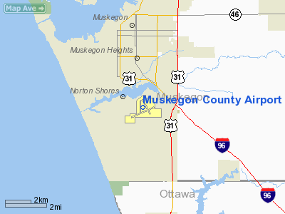
| Muskegon County Airport |
 |
| IATA: MKG – ICAO: KMKG – FAA LID: MKG |
| Summary |
| Airport type |
Public |
| Owner |
Muskegon County |
| Operator |
Muskegon County |
| Serves |
Muskegon, Michigan
USA |
| Location |
Norton Shores, Michigan |
| Elevation AMSL |
628 ft / 191.4 m |
| Coordinates |
43°10′10.15″N 86°14′17.6″W / 43.1694861°N 86.238222°W / 43.1694861; -86.238222Coordinates: 43°10′10.15″N 86°14′17.6″W / 43.1694861°N 86.238222°W / 43.1694861; -86.238222 |
| Website |
http://www.muskegonairport.com |
| Runways |
| Direction |
Length |
Surface |
| ft |
m |
| 6/24 |
6,501 |
1,982 |
Asphalt |
| 14/32 |
6,100 |
1,859 |
Asphalt |
| Statistics (2009) |
| Total passengers |
32,009 ▼ 43% |
| Total enplanements |
16,194 ▼ 46% |
| Aircraft operations |
61,580 |
| Based aircraft |
77 |
| Sources: Federal Aviation Administration |
Muskegon County Airport (IATA: MKG, ICAO: KMKG, FAA LID: MKG) is a public airport located four miles (6 km) south of the city of Muskegon in Norton Shores, Michigan, USA. The airport has two runways. It is mostly used for general aviation but is also served by United Express flying CRJ-200 regional jets to its Chicago-O'Hare hub. The airport and the county of Muskegon restored service to Chicago through the Essential Air Service program. History
In 1927, the Greater Muskegon Chamber of Commerce began a campaign to establish the Muskegon County Airport. The Muskegon County Board of Commissioners approved the construction of the airport's first terminal in 1931. The Works Progress Administration (WPA) project cost the county $12,000.
United Airlines ended flights to Chicago (ORD) in October 1979. Muskegon County Airport was the recipient of both the 2007-2008 and 2008-2009 Balchen/Post Awards for outstanding achievement in snow and ice control in the small commercial service airport category. Midwest Connect discontinued service to Milwaukee (MKE), effective September 2008. Also in September, the Airport was awarded a $650,000 federal Small Community Air Service grant to restore non-stop flights to Chicago-O'Hare International Airport. On July 15, 2009, Mesaba Airlines petitioned the DOT for Essential Air Service subsidies to continue operating into Muskegon and seven other communities. Per DOT procedure, these cities were opened for for bids by all interested carriers. For Muskegon, SkyWest Airlines submitted a bid to provide service to Chicago which required less than half the annual subsidy Mesaba wanted to continue service to Detroit. SkyWest was selected in November, 2009, and began service on February 12, 2010, replacing Mesaba. SkyWest is under a two-year contract for the service.
The airport hosted an airshow called the Muskegon Air Fair until 2006. Due to budget deficits, the air fair was placed on hiatus for the summer of 2007, but has been reinstated during Muskegon's Summer Celebration.
Airlines and destinations
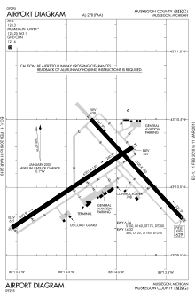 | |
FAA Airport Diagram |
| Airlines |
Destinations |
| United Express operated by SkyWest Airlines |
Chicago-O'Hare |
Ground Transportation
- Car rental agencies are available at the airport.
- The Muskegon Area Transit System (MATS) route Harvey provides bus service to the airport.
FBOs
The airport is served by a fixed base operator, Executive Air Transport. The FBO provides fuel and other pilot services.
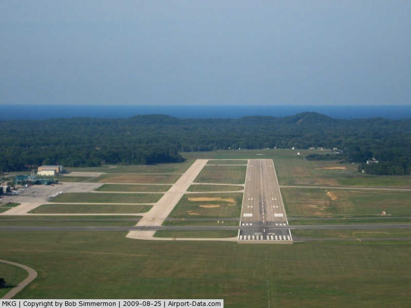
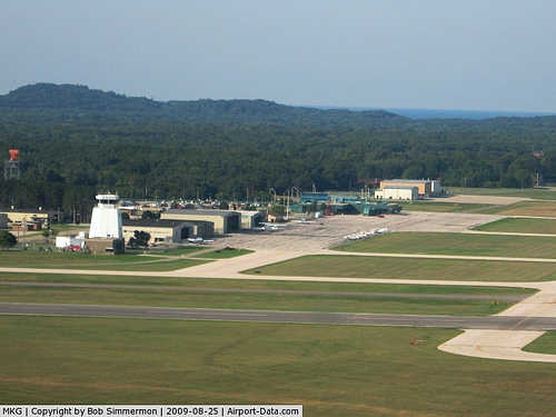
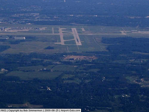
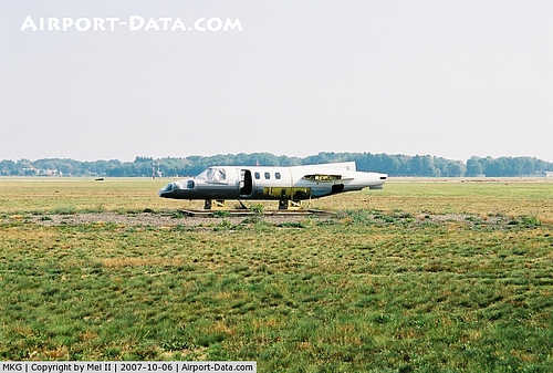
Photo gallery
The above content comes from Wikipedia and is published under free licenses – click here to read more.
|
 |
(Click on the photo to enlarge) |
|
 |
(Click on the photo to enlarge) |
|
 |
(Click on the photo to enlarge) |
|
 |
(Click on the photo to enlarge) |
Location & QuickFacts
| FAA Information Effective: | 2008-09-25 |
| Airport Identifier: | MKG |
| Airport Status: | Operational |
| Longitude/Latitude: | 086-14-17.6030W/43-10-10.1570N
-86.238223/43.169488 (Estimated) |
| Elevation: | 629 ft / 191.72 m (Surveyed) |
| Land: | 1200 acres |
| From nearest city: | 4 nautical miles S of Muskegon, MI |
| Location: | Muskegon County, MI |
| Magnetic Variation: | 04W (1995) |
Owner & Manager
| Ownership: | Publicly owned |
| Owner: | Muskegon Co. |
| Address: | 99 Sinclair Drive
Muskegon, MI 49441 |
| Phone number: | 231-798-4596 |
| Manager: | Marty Piette, A.a.e. |
| Address: | 99 Sinclair Drive
Muskegon, MI 49441 |
| Phone number: | 231-798-4596 |
Airport Operations and Facilities
| Airport Use: | Open to public |
| Wind indicator: | Yes |
| Segmented Circle: | No |
| Control Tower: | Yes |
| Lighting Schedule: | DUSK-DAWN
WHEN ATCT CLSD ACTVT HIRL RYS 06/24 & 14/32; MIRL RY 18/36; REIL RYS 06 & 14; MALSR RYS 24 & 32 - CTAF. |
| Beacon Color: | Clear-Green (lighted land airport) |
| Landing fee charge: | Yes |
| Sectional chart: | Chicago |
| Region: | AGL - Great Lakes |
| Boundary ARTCC: | ZAU - Chicago |
| Tie-in FSS: | LAN - Lansing |
| FSS on Airport: | No |
| FSS Toll Free: | 1-800-WX-BRIEF |
| NOTAMs Facility: | MKG (NOTAM-d service avaliable) |
| Certification type/date: | I A S 05/1973 |
| Federal Agreements: | NGRY |
Airport Communications
| CTAF: | 126.250 |
| Unicom: | 122.950 |
Airport Services
| Fuel available: | 100LLA |
| Airframe Repair: | MAJOR |
| Power Plant Repair: | MAJOR |
| Bottled Oxygen: | NONE |
| Bulk Oxygen: | LOW |
Runway Information
Runway 06/24
| Dimension: | 6501 x 150 ft / 1981.5 x 45.7 m |
| Surface: | ASPH, Fair Condition |
| Surface Treatment: | Porous Friction Course |
| Weight Limit: | Single wheel: 100000 lbs.
Dual wheel: 160000 lbs.
Dual tandem wheel: 300000 lbs. |
| Edge Lights: | High |
| |
Runway 06 |
Runway 24 |
| Longitude: | 086-15-03.2200W | 086-13-50.1780W |
| Latitude: | 43-09-41.8700N | 43-10-17.4170N |
| Elevation: | 622.00 ft | 627.00 ft |
| Alignment: | 56 | 127 |
| ILS Type: | | ILS/DME
|
| Traffic Pattern: | Left | Left |
| Markings: | Precision instrument, Fair Condition | Precision instrument, Fair Condition |
| Crossing Height: | 45.00 ft | 51.00 ft |
| VASI: | 4-box on left side | 4-box on left side |
| Visual Glide Angle: | 3.00° | 3.00° |
| Approach lights: | | MALSR |
| Runway End Identifier: | Yes | |
| Obstruction: | 85 ft trees, 2681.0 ft from runway, 192 ft right of centerline, 29:1 slope to clear | 90 ft tree, 3312.0 ft from runway, 890 ft left of centerline, 34:1 slope to clear |
|
Runway 14/32
| Dimension: | 5001 x 150 ft / 1524.3 x 45.7 m |
| Surface: | ASPH, Fair Condition |
| Surface Treatment: | Porous Friction Course |
| Weight Limit: | Single wheel: 80000 lbs.
Dual wheel: 120000 lbs.
Dual tandem wheel: 210000 lbs. |
| Edge Lights: | High |
| |
Runway 14 |
Runway 32 |
| Longitude: | 086-14-23.5710W | 086-13-37.8810W |
| Latitude: | 43-10-36.7740N | 43-10-00.4240N |
| Elevation: | 628.00 ft | 625.00 ft |
| Alignment: | 127 | 127 |
| ILS Type: | | ILS
|
| Traffic Pattern: | Left | Left |
| Markings: | Precision instrument, Fair Condition | Precision instrument, Fair Condition |
| Crossing Height: | 40.00 ft | 0.00 ft |
| Displaced threshold: | 290.00 ft | 0.00 ft |
| VASI: | 4-box on left side | |
| Visual Glide Angle: | 3.00° | 0.00° |
| RVR Equipment: | | touchdown |
| Approach lights: | | MALSR |
| Runway End Identifier: | Yes | |
| Obstruction: | , 50:1 slope to clear | 91 ft tree, 2974.0 ft from runway, 886 ft right of centerline, 30:1 slope to clear |
|
Radio Navigation Aids
| ID |
Type |
Name |
Ch |
Freq |
Var |
Dist |
| HLM | NDB | Holland | | 233.00 | 03W | 22.7 nm |
| LDM | NDB | Ludington | | 341.00 | 03W | 48.3 nm |
| HIC | VOR/DME | White Cloud | 123X | 117.60 | 01W | 33.4 nm |
| GRR | VOR/DME | Grand Rapids | 106Y | 115.95 | 04W | 39.9 nm |
| PMM | VOR/DME | Pullman | 058X | 112.10 | 00E | 42.7 nm |
| MKG | VORTAC | Muskegon | 099X | 115.20 | 01W | 8.7 nm |
Remarks
- DEER & BIRDS ON & INVOF ARPT.
- 24 HR PPR FOR UNSKED ACR OPNS WITH MORE THAN 30 PSGR SEATS BTN 2300-0600, CALL AMGR 231-798-4596. AFTER HOURS 231-798-1329
Images and information placed above are from
http://www.airport-data.com/airport/MKG/
We thank them for the data!
| General Info
|
| Country |
United States
|
| State |
MICHIGAN
|
| FAA ID |
MKG
|
| Latitude |
43-10-10.157N
|
| Longitude |
086-14-17.603W
|
| Elevation |
628 feet
|
| Near City |
MUSKEGON
|
We don't guarantee the information is fresh and accurate. The data may
be wrong or outdated.
For more up-to-date information please refer to other sources.
|
|