 |
|
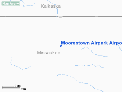
Moorestown Airpark Airport |
Location & QuickFacts
| FAA Information Effective: | 2008-09-25 |
| Airport Identifier: | 6Y0 |
| Airport Status: | Operational |
| Longitude/Latitude: | 084-59-45.1480W/44-27-45.0430N
-84.995874/44.462512 (Estimated) |
| Elevation: | 1213 ft / 369.72 m (Estimated) |
| Land: | 130 acres |
| From nearest city: | 1 nautical miles SE of Moorestown, MI |
| Location: | Missaukee County, MI |
| Magnetic Variation: | 05W (1985) |
Owner & Manager
| Ownership: | Privately owned |
| Owner: | Lois Whipple |
| Address: | P.o. Box 51497
Moorestown, MI 49651-1497
ARPT PHYSICAL ADDRESS 4840 E. MOORESTOWN RD. MOORESTOWN, MI. |
| Phone number: | 231-229-4232 |
| Manager: | Lois Whipple |
| Address: | P.o. Box 51497
Moorestown, MI 49651-1497 |
| Phone number: | 231-229-4232
EVENING PHONE NUMBER 231-224-4443 |
Airport Operations and Facilities
| Airport Use: | Open to public |
| Wind indicator: | Yes |
| Segmented Circle: | Yes |
| Control Tower: | No |
| Landing fee charge: | No |
| Sectional chart: | Lake Huron |
| Region: | AGL - Great Lakes |
| Boundary ARTCC: | ZMP - Minneapolis |
| Tie-in FSS: | LAN - Lansing |
| FSS on Airport: | No |
| FSS Toll Free: | 1-800-WX-BRIEF |
| NOTAMs Facility: | LAN (NOTAM-d service avaliable) |
Airport Communications
| CTAF: | 122.800 |
| Unicom: | 122.800 |
Airport Services
| Airframe Repair: | NONE |
| Power Plant Repair: | NONE |
| Bottled Oxygen: | NONE |
| Bulk Oxygen: | NONE |
Runway Information
Runway 03/21
| Dimension: | 2797 x 100 ft / 852.5 x 30.5 m |
| Surface: | TURF, Fair Condition |
| |
Runway 03 |
Runway 21 |
| Longitude: | 084-59-48.4800W | 084-59-31.5500W |
| Latitude: | 44-27-29.9200N | 44-27-54.7700N |
| Elevation: | 1213.00 ft | 1213.00 ft |
| Traffic Pattern: | Left | Left |
| Displaced threshold: | 799.00 ft | 998.00 ft |
| Runway End Identifier: | No | No |
| Centerline Lights: | No | No |
| Touchdown Lights: | No | No |
| Obstruction: | 51 ft tree, 231.0 ft from runway, 106 ft right of centerline, 4:1 slope to clear
RWY 03 APCH RATIO 20:1 AT DSPLCD THLD. | 60 ft trees, 150.0 ft from runway, 2:1 slope to clear
RWY 21 APCH RATIO 20:1 AT DSPLCD THLD OVER +60 FT TREES 1200 FT DSTC, L/R |
|
Runway 09/27
| Dimension: | 2599 x 100 ft / 792.2 x 30.5 m |
| Surface: | TURF, Fair Condition |
| |
Runway 09 |
Runway 27 |
| Longitude: | 085-00-07.3800W | 084-59-31.5300W |
| Latitude: | 44-27-47.9900N | 44-27-47.9900N |
| Elevation: | 1213.00 ft | 1213.00 ft |
| Traffic Pattern: | Left | Left |
| Displaced threshold: | 399.00 ft | 429.00 ft |
| Runway End Identifier: | No | No |
| Centerline Lights: | No | No |
| Touchdown Lights: | No | No |
| Obstruction: | 40 ft trees, 56.0 ft from runway, 85L/ ft right of centerline, 1:1 slope to clear
APCH RATIO 1:1 AT DSPLCD THLD; 27 FT TREES, 47 FT DSTC FM DSPLCD THLD, 98 FT L. 20:1 STRAIGHT OUT | 15 ft road, 34.0 ft from runway, 2:1 slope to clear
RWY 27 APCH RATIO 30:1 AT DSPLCD THLD OVER 15 FT RD, 463 DSTC, 0B. |
|
Radio Navigation Aids
| ID |
Type |
Name |
Ch |
Freq |
Var |
Dist |
| GYG | NDB | Grayling | | 359.00 | 06W | 18.7 nm |
| CAD | NDB | Cadillac | | 269.00 | 04W | 21.2 nm |
| TV | NDB | Gwenn | | 365.00 | 05W | 24.7 nm |
| CXK | NDB | Clam Lake | | 251.00 | 05W | 28.3 nm |
| GDW | NDB | Wiggins | | 209.00 | 04W | 37.1 nm |
| BHW | NDB | Hardwood | | 236.00 | 06W | 41.2 nm |
| BFA | NDB | Boyne Falls | | 263.00 | 06W | 42.4 nm |
| CGG | VOR | Grayling | | 109.80 | 06W | 17.4 nm |
| HTL | VOR/DME | Houghton Lake | 053X | 111.60 | 05W | 15.5 nm |
| GLR | VOR/DME | Gaylord | 029X | 109.20 | 06W | 35.3 nm |
| BXZ | VOR/DME | West Branch | 079X | 113.20 | 06W | 37.3 nm |
| TVC | VORTAC | Traverse City | 093X | 114.60 | 02W | 26.7 nm |
Remarks
- NO SNOW REMOVAL, WINTER OPNS FOR SKI-EQUIPPED ACFT ONLY.
Images and information placed above are from
http://www.airport-data.com/airport/6Y0/
We thank them for the data!
| General Info
|
| Country |
United States
|
| State |
MICHIGAN
|
| FAA ID |
6Y0
|
| Latitude |
44-27-45.043N
|
| Longitude |
084-59-45.148W
|
| Elevation |
1213 feet
|
| Near City |
MOORESTOWN
|
We don't guarantee the information is fresh and accurate. The data may
be wrong or outdated.
For more up-to-date information please refer to other sources.
|
|


