 |
|
| Midway Airport |
| IATA: none – ICAO: none – FAA LID: 42MI |
| Summary |
| Airport type |
Private |
| Operator |
G. Johnson & P. Weitzel |
| Location |
Babcock, Michigan |
| Elevation AMSL |
963 ft / 293.5 m |
| Coordinates |
42°12′55.15″N 84°48′24.9″W / 42.2153194°N 84.806917°W / 42.2153194; -84.806917 |
| Runways |
| Direction |
Length |
Surface |
| ft |
m |
| 9/27 |
2,260 |
689 |
Turf |
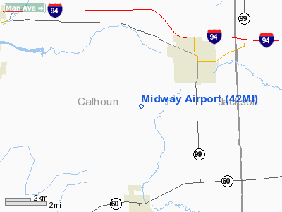
Midway Airport (FAA LID: 42MI) is a small, privately owned airfield in Babcock in the U.S. state of Michigan, located approximately two miles (3 km) southwest of the city of Albion in Calhoun County.
Facilities
Midway Airport covers 9 acres (36,000 m) and has one runway:
- Runway 9/27: 2,260 x 100 ft (689 x 30 m), Surface: Turf
The above content comes from Wikipedia and is published under free licenses – click here to read more.
Location & QuickFacts
| FAA Information Effective: | 2008-09-25 |
| Airport Identifier: | 42MI |
| Airport Status: | Operational |
| Longitude/Latitude: | 084-48-24.9080W/42-12-55.1520N
-84.806919/42.215320 (Estimated) |
| Elevation: | 963 ft / 293.52 m (Estimated) |
| Land: | 9 acres |
| From nearest city: | 3 nautical miles SW of Albion, MI |
| Location: | Calhoun County, MI |
| Magnetic Variation: | 04W (1985) |
Owner & Manager
| Ownership: | Privately owned |
| Owner: | G. Johnson & P. Weitzel |
| Address: | 9644 25 1/2 Mile Rd.
Homer, MI 49245 |
| Phone number: | 517-629-6944 |
| Manager: | Gust G. Johnson |
| Address: | 9644 25 1/2 Mile Rd
Homer, MI 49245 |
| Phone number: | 517-629-6944 |
Airport Operations and Facilities
| Airport Use: | Private |
| Wind indicator: | Yes |
| Segmented Circle: | Yes |
| Control Tower: | No |
| Landing fee charge: | No |
| Sectional chart: | Detroit |
| Region: | AGL - Great Lakes |
| Boundary ARTCC: | ZOB - Cleveland |
| Tie-in FSS: | LAN - Lansing |
| FSS on Airport: | No |
| FSS Toll Free: | 1-800-WX-BRIEF |
Airport Services
| Airframe Repair: | NONE |
| Power Plant Repair: | NONE |
Runway Information
Runway 09/27
| Dimension: | 2260 x 100 ft / 688.8 x 30.5 m |
| Surface: | TURF, Good Condition |
| |
Runway 09 |
Runway 27 |
| Traffic Pattern: | Left | Left |
| Displaced threshold: | 187.00 ft | 440.00 ft |
| Runway End Identifier: | No | No |
| Touchdown Lights: | No | No |
| Obstruction: | 12 ft hill, 200.0 ft from runway, 16:1 slope to clear
APCH RATIO 18:1 AT DSPLCD THLD; +90 FT TREES 1687 FT 120 FT R; +60 FT TREES 837 FT 165 FT L; APCH RATIO 13:1 AT DSPLCD THLD. | 15 ft road, 0.0 ft from runway
APCH RATIO 11:1 AT DSPLCD THR; 96 FT TREE 1100 FT 65 FT RIGHT. |
|
Radio Navigation Aids
| ID |
Type |
Name |
Ch |
Freq |
Var |
Dist |
| BT | NDB | Batol | | 272.00 | 04W | 19.0 nm |
| ANQ | NDB | Angola | | 347.00 | 05W | 36.8 nm |
| IRS | NDB | Sturgis | | 382.00 | 04W | 37.0 nm |
| HAI | NDB | Three Rivers | | 407.00 | 02W | 38.3 nm |
| ADG | NDB | Adrian | | 278.00 | 06W | 38.6 nm |
| TCU | NDB | Tecumseh | | 239.00 | 04W | 42.7 nm |
| OZW | NDB | Howell | | 243.00 | 05W | 44.2 nm |
| BYN | NDB | Bryan | | 260.00 | 04W | 46.8 nm |
| USE | NDB | Fulton | | 375.00 | 05W | 47.3 nm |
| LFD | VOR/DME | Litchfield | 049X | 111.20 | 05W | 9.4 nm |
| JXN | VOR/DME | Jackson | 033X | 109.60 | 05W | 15.7 nm |
| AZO | VOR/DME | Kalamazoo | 027X | 109.00 | 01W | 33.2 nm |
| GRR | VOR/DME | Grand Rapids | 106Y | 115.95 | 04W | 46.0 nm |
| BTL | VORTAC | Battle Creek | 031X | 109.40 | 02W | 20.6 nm |
| LAN | VORTAC | Lansing | 045X | 110.80 | 05W | 30.6 nm |
Remarks
- CROPS IN PRIM SFC; BOTH SIDES.
Images and information placed above are from
http://www.airport-data.com/airport/42MI/
We thank them for the data!
| General Info
|
| Country |
United States
|
| State |
MICHIGAN
|
| FAA ID |
42MI
|
| Latitude |
42-12-55.152N
|
| Longitude |
084-48-24.908W
|
| Elevation |
963 feet
|
| Near City |
ALBION
|
We don't guarantee the information is fresh and accurate. The data may
be wrong or outdated.
For more up-to-date information please refer to other sources.
|
|


