 |
|
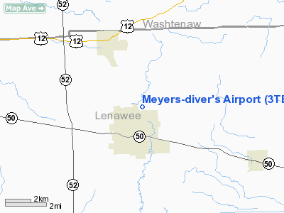
Location & QuickFacts
| FAA Information Effective: | 2008-09-25 |
| Airport Identifier: | 3TE |
| Airport Status: | Operational |
| Longitude/Latitude: | 083-56-20.9910W/42-01-30.2570N
-83.939164/42.025071 (Estimated) |
| Elevation: | 815 ft / 248.41 m (Estimated) |
| Land: | 75 acres |
| From nearest city: | 2 nautical miles N of Tecumseh, MI |
| Location: | Lenawee County, MI |
| Magnetic Variation: | 05W (1985) |
Owner & Manager
| Ownership: | Privately owned |
| Owner: | Al Meyers Airport Inc |
| Address: | 4330 Macon Rd
Tecumseh, MI 49286 |
| Phone number: | 517-423-7629 |
| Manager: | Keith Diver |
| Address: | 4330 Macon Road, 4330 Macon Rd
Tecumseh, MI 49286 |
| Phone number: | 517-423-7629 |
Airport Operations and Facilities
| Airport Use: | Open to public |
| Wind indicator: | Yes |
| Segmented Circle: | Yes |
| Control Tower: | No |
| Lighting Schedule: | RDO-CTL
ACTVT LIRL RY 18/36 - CTAF. |
| Landing fee charge: | No |
| Sectional chart: | Detroit |
| Region: | AGL - Great Lakes |
| Boundary ARTCC: | ZOB - Cleveland |
| Tie-in FSS: | LAN - Lansing |
| FSS on Airport: | No |
| FSS Toll Free: | 1-800-WX-BRIEF |
| NOTAMs Facility: | LAN (NOTAM-d service avaliable) |
Airport Communications
Airport Services
| Fuel available: | 100LL
FUEL AVBL 0800-1730 MON-SAT. |
| Airframe Repair: | MAJOR |
| Power Plant Repair: | MINOR |
| Bottled Oxygen: | NONE |
| Bulk Oxygen: | NONE |
Runway Information
Runway 09/27
| Dimension: | 1820 x 100 ft / 554.7 x 30.5 m |
| Surface: | TURF, Good Condition
RY 18/36 PAVEMENT CRACKING.
RY 18/36 PAVEMENT CRACKING. |
| |
Runway 09 |
Runway 27 |
| Longitude: | 083-56-34.9800W | 083-56-10.8600W |
| Latitude: | 42-01-28.8600N | 42-01-29.7600N |
| Alignment: | 88 | 127 |
| Traffic Pattern: | Left | Left |
| Runway End Identifier: | No | No |
| Centerline Lights: | No | No |
| Touchdown Lights: | No | No |
| Obstruction: | 53 ft trees, 267.0 ft from runway, 5:1 slope to clear | 5 ft post, 100.0 ft from runway, 55 ft right of centerline, 20:1 slope to clear |
|
Runway 18/36
| Dimension: | 2660 x 75 ft / 810.8 x 22.9 m |
| Surface: | ASPH, Poor Condition
RY 18/36 PAVEMENT CRACKING.
RY 18/36 PAVEMENT CRACKING. |
| Weight Limit: | Single wheel: 6000 lbs. |
| Edge Lights: | Low |
| |
Runway 18 |
Runway 36 |
| Longitude: | 083-56-20.7650W | 083-56-20.2350W |
| Latitude: | 42-01-44.1860N | 42-01-18.0150N |
| Elevation: | 812.00 ft | 797.00 ft |
| Alignment: | 127 | 127 |
| Traffic Pattern: | Left | Right |
| Markings: | Basic, Good Condition
RY 18/36 MARKINGS FADED. | Basic, Good Condition |
| Displaced threshold: | 780.00 ft | 500.00 ft |
| Runway End Identifier: | No | No |
| Centerline Lights: | | No |
| Touchdown Lights: | No | No |
| Obstruction: | 14 ft trees, 201.0 ft from runway
RWY 18 APCH RATIO 24:1 TO DSPLCD THLD BASED ON +45 FT TREES; 1100 FT DSTC; 40 FT L & 50 FT R.
RWY 18 SCTD +12 FT TREES 180 FT FM THLD; 0B. | 68 ft trees, 1650.0 ft from runway, 21:1 slope to clear
APCH RATIO 31:1 AT DSPLCD THLD; +17 FT OBS ROAD; 530 FT DIST.
+17' ROAD 30' FM THR. |
|
Radio Navigation Aids
| ID |
Type |
Name |
Ch |
Freq |
Var |
Dist |
| TCU | NDB | Tecumseh | | 239.00 | 04W | 2.7 nm |
| ADG | NDB | Adrian | | 278.00 | 06W | 11.2 nm |
| USE | NDB | Fulton | | 375.00 | 05W | 26.5 nm |
| RYS | NDB | Grosse Ile | | 419.00 | 06W | 35.4 nm |
| OZW | NDB | Howell | | 243.00 | 05W | 36.7 nm |
| BYN | NDB | Bryan | | 260.00 | 04W | 40.4 nm |
| G | NDB | Golf | | 398.00 | 05W | 41.9 nm |
| DFI | NDB | Defiance | | 246.00 | 05W | 46.9 nm |
| VQ | NDB | Cargl | | 230.00 | 05W | 48.2 nm |
| TOL | TACAN | Toledo | 072X | | 05W | 26.7 nm |
| JXN | VOR/DME | Jackson | 033X | 109.60 | 05W | 27.1 nm |
| DXO | VOR/DME | Detroit | 081X | 113.40 | 06W | 27.9 nm |
| LFD | VOR/DME | Litchfield | 049X | 111.20 | 05W | 36.9 nm |
| VWV | VOR/DME | Waterville | 078X | 113.10 | 02W | 37.0 nm |
| CRL | VORTAC | Carleton | 104X | 115.70 | 03W | 21.5 nm |
| SVM | VORTAC | Salem | 090X | 114.30 | 03W | 27.7 nm |
| PSI | VORTAC | Pontiac | 047X | 111.00 | 03W | 44.4 nm |
| YIP | VOT | Willow Run | | 112.00 | | 22.4 nm |
| DTW | VOT | Detroit Met Wayne | | 109.80 | | 28.4 nm |
| DET | VOT | Detroit City | | 111.60 | | 47.0 nm |
Remarks
- RY 09/27 WEST END- ACFT PKG & BLDGS IN PRIMARY SFC 50' N OF CNTRLN.
- RY 18/36 ACFT LND/TKOF ADJ W OF ASPH RWY. AREA IS NOT MKD TO DELINEATE AREA BEING USED.
- MAINT FOR MEYERS ACFT ONLY.
- RY 09/27 NOT PLOWED AFTER WINTER STORMS.
- SKYDIVING ACTIVITY.
- ESTABD PRIOR 1959.
Images and information placed above are from
http://www.airport-data.com/airport/3TE/
We thank them for the data!
| General Info
|
| Country |
United States
|
| State |
MICHIGAN
|
| FAA ID |
3TE
|
| Latitude |
42-01-30.257N
|
| Longitude |
083-56-20.991W
|
| Elevation |
815 feet
|
| Near City |
TECUMSEH
|
We don't guarantee the information is fresh and accurate. The data may
be wrong or outdated.
For more up-to-date information please refer to other sources.
|
|


