 |
|
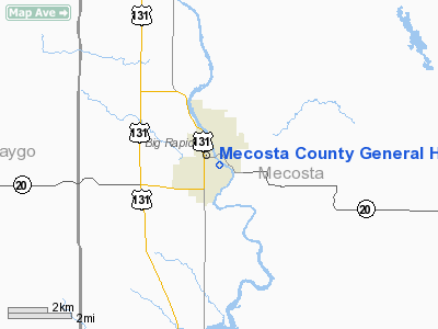
Mecosta County General Hospital Heliport |
Location & QuickFacts
| FAA Information Effective: | 2008-09-25 |
| Airport Identifier: | 19MI |
| Airport Status: | Operational |
| Longitude/Latitude: | 085-28-25.6590W/43-41-41.5820N
-85.473794/43.694884 (Estimated) |
| Elevation: | 911 ft / 277.67 m (Estimated) |
| Land: | 1 acres |
| From nearest city: | 0 nautical miles N of Big Rapids, MI |
| Location: | Mecosta County, MI |
| Magnetic Variation: | 04W (1985) |
Owner & Manager
| Ownership: | Privately owned |
| Owner: | Mecosta Cty General Hospital |
| Address: | 405 Winter Avenue
Big Rapids, MI 49307 |
| Phone number: | 616-796-8691 |
| Address: |
|
Airport Operations and Facilities
| Airport Use: | Private
MEDICAL USE. |
| Wind indicator: | Yes |
| Segmented Circle: | No |
| Control Tower: | No |
| Sectional chart: | Chicago |
| Region: | AGL - Great Lakes |
| Boundary ARTCC: | ZMP - Minneapolis |
| Tie-in FSS: | LAN - Lansing |
| FSS on Airport: | No |
| FSS Toll Free: | 1-800-WX-BRIEF |
Runway Information
Helipad H1
| Dimension: | 60 x 60 ft / 18.3 x 18.3 m |
| Surface: | CONC, |
| |
Runway H1 |
Runway |
| Traffic Pattern: | Left | Left |
|
Radio Navigation Aids
| ID |
Type |
Name |
Ch |
Freq |
Var |
Dist |
| CAD | NDB | Cadillac | | 269.00 | 04W | 35.0 nm |
| AMN | NDB | Alma | | 329.00 | 05W | 37.4 nm |
| LDM | NDB | Ludington | | 341.00 | 03W | 43.7 nm |
| GDW | NDB | Wiggins | | 209.00 | 04W | 46.4 nm |
| HIC | VOR/DME | White Cloud | 123X | 117.60 | 01W | 12.8 nm |
| MOP | VOR/DME | Mount Pleasant | 043X | 110.60 | 05W | 32.3 nm |
| MBL | VOR/DME | Manistee | 051X | 111.40 | 05W | 48.3 nm |
| MKG | VORTAC | Muskegon | 099X | 115.20 | 01W | 40.1 nm |
Remarks
- APP/DEP OPNS ARE FROM 30 DEGS TO 80 DEGS; AREA IS MARKED; WIND INDICATOR IS MAINTAINED; WIND SOCK BE LGTD, FLOODLIGHTS DIRECTED SO AS NOT TO INTERFERE WITH PILOT'S VISION.
Images and information placed above are from
http://www.airport-data.com/airport/19MI/
We thank them for the data!
| General Info
|
| Country |
United States
|
| State |
MICHIGAN
|
| FAA ID |
19MI
|
| Latitude |
43-41-41.582N
|
| Longitude |
085-28-25.659W
|
| Elevation |
911 feet
|
| Near City |
BIG RAPIDS
|
We don't guarantee the information is fresh and accurate. The data may
be wrong or outdated.
For more up-to-date information please refer to other sources.
|
|


