 |
|
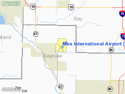
Mbs International Airport |
| MBS International Airport |
| IATA: MBS – ICAO: KMBS – FAA LID: MBS |
| Summary |
| Airport type |
Public |
| Owner |
MBS International |
| Serves |
Saginaw, Michigan
Midland, Michigan
Bay City, Michigan |
| Location |
Tittabawassee Township, Saginaw County, Michigan |
| Elevation AMSL |
668 ft / 204 m |
| Coordinates |
43°31′58″N 084°04′47″W / 43.53278°N 84.07972°W / 43.53278; -84.07972 |
| Runways |
| Direction |
Length |
Surface |
| ft |
m |
| 5/23 |
8,002 |
2,439 |
Asphalt |
| 14/32 |
6,400 |
1,951 |
Asphalt |
| Statistics (2006) |
| Aircraft operations |
50,254 |
| Based aircraft |
27 |
| Source: Federal Aviation Administration |
MBS International Airport (IATA: MBS, ICAO: KMBS, FAA LID: MBS) is located in Freeland, Michigan, serving the nearby cities of Midland, Bay City, and Saginaw. It was formerly named Tri City Airport or Freeland Tri-City Airport. The airport was renamed to MBS International Airport in 1994 (representative of its IATA airport code) to prevent confusion with other airports named "Tri City Airport" across the United States.
The commercial airport is a special municipal body owned by Bay County and the cities of Midland and Saginaw. The airports's name is an initialism formed from the names of the three owning communities. It is governed by a nine-member commission made up of three members from each of the owning communities. Facilities
MBS International Airport covers 3,200 acres (13 km²) and has two runways:
- Runway 5/23: 8,002 x 150 ft (2,439 x 46 m), Surface: Asphalt
- Runway 14/32: 6,400 x 150 ft (1,951 x 46 m), Surface: Asphalt
History
During World War II, it was used to hold prisoners of war. Civilian control of the airport resumed in the mid 1940s.
The 1980s and 1990s saw a lot of growth at MBS. During this time, airline service expanded and many airlines began serving MBS.
- During the 1980s, Air Canada operated the Jetstream 31, linking MBS with Toronto, Canada.
- American Eagle Airlines operated Shorts 360 turboprop aircraft between MBS and Chicago, Illinois, as well as Lansing, Grand Rapids, Kalamazoo, and Traverse City. American left MBS in the late 1980s.
- Chicago Express Airlines, the now-defunct ATA Airlines carrier, served MBS in the early 1990s with daily service to Chicago Midway Airport using the Jetstream 31 turboprop aircraft.
- Comair (Delta Connection) briefly linked MBS with Cincinnati, Ohio, using Embraer EMB 120 Brasilia, a 32-seat turboprop. Comair left MBS and started service in Flint, where they terminated service years later.
- Continental Airlines provided mainline service in the 1980s to Cleveland, Ohio. The airline used McDonnell Douglas DC-9 and Boeing 737 aircraft on this route. Mainline service was downgraded to Continental Express service in the late 1980s. Continental Express used Beechcraft 1900 turboprop aircraft. Service to Flint and Chicago Midway also existed in 1992. The airline left MBS in the mid-1990s and returned in 2002. Service was dropped to Cleveland again in 2003.
- Republic Airlines served MBS in the 1960s, 1970s, and 1980s. The airline linked MBS with Detroit using the DC-9 aircraft. During this time, Republic Express provided turboprop service to Flint, Grand Rapids, and Traverse City. Republic stopped MBS service when they merged with Northwest Airlines in the 1980s, and in 2010, Northwest merged with Delta Air Lines. Delta still serves MBS today.
- Skyway Airlines (The Midwest Express Connection) served MBS in the 1990s with service to Milwaukee, Wisconsin, using the Beechcraft 1900 turboprop aircraft. Skyway also tried service to Toronto, Flint, and Grand Rapids in the late 1990s. The airline pulled out in the late 1990s.
- United Airlines provided MBS with mainline service since commercial service was started. In the 1980s and 1990s, United linked MBS with Chicago using Boeing 737 and 727 aircraft. Service to Denver, Colorado, also existed in the 1980s. Mainline United left MBS in the late 1990s, and was replaced with United Express, which still serves MBS with service to Chicago's O'Hare International Airport using the 50 seat Bombardier Canadair Regional Jet (CRJ) aircraft.
- US Airways began service to MBS in 1996, operating Fokker 100 and Boeing 737 aircraft to Pittsburgh, Pennsylvania. Mainline service ended soon after, and US Airways Express assumed the Pittsburgh flights using the Beech 1900 and Saab 340 aircraft. US Airways suspended service to MBS just two days after entering Chapter 11 bankruptcy protection in late 2002. At the time it was the only city for US Airways to drop. Since then, US Airways has also left Flint, Lansing, Kalamazoo, and Grand Rapids, leaving Detroit as the only Michigan destination served by US Airways.
- Air Force One landed at the airport two times during the 2004 United States Election for nearby rallies in support of George W. Bush (Air Force One also visited the airport in 1974 when then President Richard M. Nixon made a speech at the airport and arrived to give endorsement toJames Sparling, a Congressional candidate).
Current operations
Once the third busiest airport in Michigan, MBS has fallen in air service and passenger numbers. One major reason for this is the low-cost competition at nearby Bishop International Airport in Flint, which offers more flights to more destinations and often cheaper fares.
2006 enplanements were 200,150 boardings, a 6.33% drop from the previous year.
Air Wisconsin runs ground services for United Express.
Delta Air Lines merged with Northwest Airlines.
Until October 1, 2009 Mesaba Airlines ran ground services for Delta Connection.
Compass Airlines, Comair, and Mesaba Airlines ground handling merged into one service called Regional Elite Airline Services. Regional Elite is 100% owned by Delta Air Lines.
Regional Elite runs ground services for Delta and Delta Connection at MBS.
New Terminal
In early 2007, it was announced that the Airport Commission has approved plans for the construction of a new state-of-the-art passenger terminal. This new $48-million, 75,000 sq ft (7,000 m) project would begin sometime in 2007 and will take 18 months. The new terminal will be built just north of the current terminal. Airport officials hope this will bring more airlines and more competition to MBS.
Airlines
| Airlines |
Destinations |
| Delta Connection operated by Pinnacle Airlines |
Detroit, Minneapolis/St. Paul |
| United Express operated by SkyWest Airlines |
Chicago-O'Hare |
| United Express operated by Mesa Airlines |
Chicago-O'Hare |
Accidents and incidents
- On 6 April 1958, Vickers Viscount N7437, operating Capital Airlines Flight 67, stalled and crashed on approach. All 47 on board were killed. The cause was attributed to ice accretion on the horizontal stabiliser.
- On August 16, 1987 a Northwest Airlines MD-80, Northwest Airlines Flight 255, originated at MBS. After departing MBS, the flight dropped off and picked up passengers at Detroit Metropolitan Wayne County Airport before crashing on takeoff en route to Phoenix, Arizona, killing 148 passengers and 6 crew members.
The above content comes from Wikipedia and is published under free licenses – click here to read more.
Location & QuickFacts
| FAA Information Effective: | 2008-09-25 |
| Airport Identifier: | MBS |
| Airport Status: | Operational |
| Longitude/Latitude: | 084-04-46.7300W/43-31-58.4930N
-84.079647/43.532915 (Estimated) |
| Elevation: | 668 ft / 203.61 m (Surveyed) |
| Land: | 3200 acres |
| From nearest city: | 9 nautical miles NW of Saginaw, MI |
| Location: | Saginaw County, MI |
| Magnetic Variation: | 04W (1980) |
Owner & Manager
| Ownership: | Publicly owned |
| Owner: | Mbs International |
| Address: | 8500 Garfield Rd Ste 101
Freeland, MI 48623 |
| Phone number: | 989-695-5555 |
| Manager: | Jeff Nagel |
| Address: | 8500 Garfield Rd Ste 101
Freeland, MI 48623 |
| Phone number: | 989-695-5555
OR AFT BUSINESS HRS 989-695-5558. |
Airport Operations and Facilities
| Airport Use: | Open to public |
| Wind indicator: | Yes |
| Segmented Circle: | Yes |
| Control Tower: | Yes |
| Lighting Schedule: | DUSK-DAWN
WHEN ATCT IS CLSD HIRL RYS 05/23 & 14/32 ARE PRESET ON MED INTST. ACTVT MALSR RYS 05 & 23 - CTAF. |
| Beacon Color: | Clear-Green (lighted land airport) |
| Landing fee charge: | Yes
LNDG FEE WAIVED WHEN FUEL PURCHASED. |
| Sectional chart: | Detroit |
| Region: | AGL - Great Lakes |
| Boundary ARTCC: | ZOB - Cleveland |
| Tie-in FSS: | LAN - Lansing |
| FSS on Airport: | No |
| FSS Toll Free: | 1-800-WX-BRIEF |
| NOTAMs Facility: | MBS (NOTAM-d service avaliable) |
| Certification type/date: | I B S 05/1973
INDEX C ARFF SERVICE AVAILABLE UPON REQUEST. |
| Federal Agreements: | NGPY3 |
Airport Communications
| CTAF: | 120.100 |
| Unicom: | 122.950 |
Airport Services
| Fuel available: | 100LLA |
| Airframe Repair: | MAJOR |
| Power Plant Repair: | MAJOR |
| Bottled Oxygen: | HIGH |
Runway Information
Runway 05/23
| Dimension: | 8002 x 150 ft / 2439.0 x 45.7 m |
| Surface: | ASPH, Fair Condition |
| Surface Treatment: | Saw-cut or plastic Grooved |
| Weight Limit: | Single wheel: 135000 lbs.
Dual wheel: 160000 lbs.
Dual tandem wheel: 265000 lbs. |
| Edge Lights: | High |
| |
Runway 05 |
Runway 23 |
| Longitude: | 084-05-21.3090W | 084-04-03.6810W |
| Latitude: | 43-31-36.5370N | 43-32-31.8090N |
| Elevation: | 666.00 ft | 650.00 ft |
| Alignment: | 46 | 127 |
| ILS Type: | ILS
| ILS
|
| Traffic Pattern: | Left | Left |
| Markings: | Precision instrument, Good Condition | Precision instrument, Good Condition |
| Crossing Height: | 0.00 ft | 54.00 ft |
| VASI: | | 4-light PAPI on left side |
| Visual Glide Angle: | 0.00° | 3.00° |
| RVR Equipment: | touchdown | |
| Approach lights: | MALSR | MALSR |
| Runway End Identifier: | No | No |
| Centerline Lights: | No | No |
| Touchdown Lights: | No | No |
|
Runway 14/32
| Dimension: | 6400 x 150 ft / 1950.7 x 45.7 m |
| Surface: | ASPH, Fair Condition |
| Surface Treatment: | Saw-cut or plastic Grooved |
| Weight Limit: | Single wheel: 135000 lbs.
Dual wheel: 160000 lbs.
Dual tandem wheel: 265000 lbs. |
| Edge Lights: | High |
| |
Runway 14 |
Runway 32 |
| Longitude: | 084-05-22.3850W | 084-04-21.6180W |
| Latitude: | 43-32-14.0320N | 43-31-28.8620N |
| Elevation: | 668.00 ft | 660.00 ft |
| Alignment: | 127 | 127 |
| Traffic Pattern: | Left | Left |
| Markings: | Non-precision instrument, Good Condition | Non-precision instrument, Good Condition |
| Crossing Height: | 46.00 ft | 50.00 ft |
| VASI: | 4-box on left side | 4-light PAPI on left side |
| Visual Glide Angle: | 3.00° | 3.00° |
| Runway End Identifier: | Yes | Yes |
| Centerline Lights: | No | No |
| Touchdown Lights: | No | No |
| Obstruction: | 55 ft trees, 2300.0 ft from runway, 100 ft right of centerline, 38:1 slope to clear | 56 ft trees, 2500.0 ft from runway, 120 ft left of centerline, 41:1 slope to clear |
|
Radio Navigation Aids
| ID |
Type |
Name |
Ch |
Freq |
Var |
Dist |
| HYX | NDB | Browne | | 385.00 | 06W | 11.4 nm |
| GDW | NDB | Wiggins | | 209.00 | 04W | 31.4 nm |
| AMN | NDB | Alma | | 329.00 | 05W | 33.3 nm |
| BHW | NDB | Hardwood | | 236.00 | 06W | 43.0 nm |
| MBS | VOR/DME | Saginaw | 076X | 112.90 | 03W | 0.1 nm |
| MOP | VOR/DME | Mount Pleasant | 043X | 110.60 | 05W | 29.1 nm |
| BXZ | VOR/DME | West Branch | 079X | 113.20 | 06W | 42.9 nm |
| FNT | VORTAC | Flint | 116X | 116.90 | 06W | 37.0 nm |
Remarks
Images and information placed above are from
http://www.airport-data.com/airport/MBS/
We thank them for the data!
| General Info
|
| Country |
United States
|
| State |
MICHIGAN
|
| FAA ID |
MBS
|
| Latitude |
43-31-58.493N
|
| Longitude |
084-04-46.730W
|
| Elevation |
668 feet
|
| Near City |
SAGINAW
|
We don't guarantee the information is fresh and accurate. The data may
be wrong or outdated.
For more up-to-date information please refer to other sources.
|
|


