 |
|
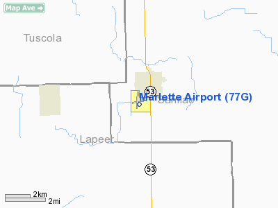
Location & QuickFacts
| FAA Information Effective: | 2008-09-25 |
| Airport Identifier: | 77G |
| Airport Status: | Operational |
| Longitude/Latitude: | 083-05-27.2920W/43-18-42.5880N
-83.090914/43.311830 (Estimated) |
| Elevation: | 895 ft / 272.80 m (Estimated) |
| Land: | 480 acres |
| From nearest city: | 1 nautical miles SW of Marlette, MI |
| Location: | Sanilac County, MI |
| Magnetic Variation: | 05W (1980) |
Owner & Manager
| Ownership: | Publicly owned |
| Owner: | Marlette Township |
| Address: | 6725 Airport Rd
Marlette, MI 48453 |
| Manager: | Ted Huntoon |
| Address: | 6010 E. Marlette
Marlette, MI 48453 |
| Phone number: | 989-635-7548
OTHER PHONES 989-635-3431 (NGT RES). |
Airport Operations and Facilities
| Airport Use: | Open to public |
| Wind indicator: | Yes |
| Segmented Circle: | Yes |
| Control Tower: | No |
| Lighting Schedule: | DUSK-DAWN
ACTVT MIRL RYS 01/19 & 09/27; PAPI & REIL RY 27 - CTAF. |
| Beacon Color: | Clear-Green (lighted land airport) |
| Landing fee charge: | No |
| Sectional chart: | Detroit |
| Region: | AGL - Great Lakes |
| Boundary ARTCC: | ZOB - Cleveland |
| Tie-in FSS: | LAN - Lansing |
| FSS on Airport: | No |
| FSS Toll Free: | 1-800-WX-BRIEF |
| NOTAMs Facility: | LAN (NOTAM-d service avaliable) |
| Federal Agreements: | NGY |
Airport Communications
| CTAF: | 122.800 |
| Unicom: | 122.800 |
Airport Services
| Fuel available: | 100LL |
| Airframe Repair: | MAJOR |
| Power Plant Repair: | MAJOR |
Runway Information
Runway 01/19
| Dimension: | 3500 x 75 ft / 1066.8 x 22.9 m |
| Surface: | ASPH, Fair Condition |
| Edge Lights: | Medium
RWY 9/27 NSTD MIRL; LGTS LAST 2000 FT NOT SPLIT AMBER/WHITE LENS. |
| |
Runway 01 |
Runway 19 |
| Longitude: | 083-05-31.3880W | 083-05-28.2460W |
| Latitude: | 43-18-31.3060N | 43-19-05.7940N |
| Elevation: | 867.00 ft | 891.00 ft |
| Alignment: | 4 | 127 |
| Traffic Pattern: | Left | Left |
| Markings: | Non-precision instrument, Fair Condition | Non-precision instrument, Fair Condition |
| Crossing Height: | 20.00 ft | 20.00 ft |
| VASI: | 4-light PAPI on left side | 4-light PAPI on left side |
| Visual Glide Angle: | 3.00° | 3.00° |
| Runway End Identifier: | No | No |
| Obstruction: | , 50:1 slope to clear | 24 ft trees, 820.0 ft from runway, 160 ft left of centerline, 25:1 slope to clear |
|
Runway 09/27
| Dimension: | 3800 x 75 ft / 1158.2 x 22.9 m |
| Surface: | ASPH, Fair Condition |
| Edge Lights: | Non-standard lighting system
RWY 9/27 NSTD MIRL; LGTS LAST 2000 FT NOT SPLIT AMBER/WHITE LENS. |
| |
Runway 09 |
Runway 27 |
| Longitude: | 083-05-50.7110W | 083-04-59.3790W |
| Latitude: | 43-18-36.9370N | 43-18-37.2730N |
| Elevation: | 868.00 ft | 876.00 ft |
| Alignment: | 89 | 127 |
| Traffic Pattern: | Left | Left |
| Markings: | Non-precision instrument, Fair Condition | Non-precision instrument, Fair Condition |
| Crossing Height: | 20.00 ft | 20.00 ft |
| VASI: | 4-light PAPI on right side | 4-light PAPI on right side |
| Visual Glide Angle: | 3.00° | 3.00° |
| Runway End Identifier: | | Yes |
| Obstruction: | 45 ft trees, 1290.0 ft from runway, 24:1 slope to clear | 24 ft trees, 800.0 ft from runway, 200 ft right of centerline, 25:1 slope to clear |
|
Radio Navigation Aids
| ID |
Type |
Name |
Ch |
Freq |
Var |
Dist |
| HYX | NDB | Browne | | 385.00 | 06W | 34.3 nm |
| ZR | NDB | Sarnia | | 404.00 | 06W | 43.7 nm |
| MTC | TACAN | Selfridge | 064X | | 06W | 43.5 nm |
| BAX | VOR/DME | Bad Axe | 019X | 108.20 | 05W | 28.7 nm |
| MBS | VOR/DME | Saginaw | 076X | 112.90 | 03W | 45.0 nm |
| ECK | VORTAC | Peck | 087X | 114.00 | 07W | 16.7 nm |
| FNT | VORTAC | Flint | 116X | 116.90 | 06W | 35.5 nm |
| PSI | VORTAC | Pontiac | 047X | 111.00 | 03W | 41.5 nm |
Remarks
- GLIDER OPNS ON & INVOF ARPT.
Images and information placed above are from
http://www.airport-data.com/airport/77G/
We thank them for the data!
| General Info
|
| Country |
United States
|
| State |
MICHIGAN
|
| FAA ID |
77G
|
| Latitude |
43-18-42.588N
|
| Longitude |
083-05-27.292W
|
| Elevation |
895 feet
|
| Near City |
MARLETTE
|
We don't guarantee the information is fresh and accurate. The data may
be wrong or outdated.
For more up-to-date information please refer to other sources.
|
|


