 |
|
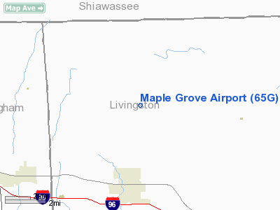
Maple Grove Airport (65G) |
Location & QuickFacts
| FAA Information Effective: | 2008-09-25 |
| Airport Identifier: | 65G |
| Airport Status: | Operational |
| Longitude/Latitude: | 084-03-44.8550W/42-43-02.1200N
-84.062460/42.717256 (Estimated) |
| Elevation: | 908 ft / 276.76 m (Surveyed) |
| Land: | 25 acres |
| From nearest city: | 3 nautical miles N of Fowlerville, MI |
| Location: | Livingston County, MI |
| Magnetic Variation: | 05W (1985) |
Owner & Manager
| Ownership: | Privately owned |
| Owner: | Jack Sherwood |
| Address: | 7080 Sherwood Rd
Fowlerville, MI 48836 |
| Phone number: | 517-223-9956 |
| Manager: | Dennis L Bowdoin |
| Address: | 7278 Sherwood Road
Fowlerville, MI 48836 |
| Phone number: | 517-223-7809 |
Airport Operations and Facilities
| Airport Use: | Open to public |
| Wind indicator: | Yes |
| Segmented Circle: | Yes |
| Control Tower: | No |
| Lighting Schedule: | RDO-CTL
ACTVT LIRL RY 09/27 - CTAF. |
| Landing fee charge: | No |
| Sectional chart: | Detroit |
| Region: | AGL - Great Lakes |
| Boundary ARTCC: | ZOB - Cleveland |
| Tie-in FSS: | LAN - Lansing |
| FSS on Airport: | No |
| FSS Toll Free: | 1-800-WX-BRIEF |
| NOTAMs Facility: | LAN (NOTAM-d service avaliable) |
Airport Communications
| CTAF: | 122.800 |
| Unicom: | 122.800 |
Airport Services
| Fuel available: | 100LL |
| Airframe Repair: | MAJOR |
| Power Plant Repair: | MAJOR |
Runway Information
Runway 09/27
| Dimension: | 3050 x 110 ft / 929.6 x 33.5 m |
| Surface: | TURF, Good Condition |
| Edge Lights: | Low |
| |
Runway 09 |
Runway 27 |
| Longitude: | 084-04-04.3800W | 084-03-23.5200W |
| Latitude: | 42-43-07.2600N | 42-43-07.0800N |
| Elevation: | 908.00 ft | 908.00 ft |
| Traffic Pattern: | Left | Left |
| Displaced threshold: | 200.00 ft | 300.00 ft |
| Obstruction: | 15 ft gnd, 100.0 ft from runway, 6:1 slope to clear
APCH RATIO 20:1 TO DSPLCD THLD. | 15 ft road, 40.0 ft from runway, 2:1 slope to clear
RWY 27 APCH RATIO 20:1 AT DSPLCD THLD, +55 FT TREES 852 FT DSTC. |
|
Runway 18/36
| Dimension: | 2000 x 113 ft / 609.6 x 34.4 m |
| Surface: | TURF, Good Condition |
| |
Runway 18 |
Runway 36 |
| Traffic Pattern: | Left | Left |
| Displaced threshold: | 550.00 ft | 275.00 ft |
| Obstruction: | 55 ft pline, 560.0 ft from runway, 10:1 slope to clear
APCH RATIO 20:1 TO DSPLCD THLD. | 15 ft road, 25.0 ft from runway, 1:1 slope to clear
APCH RATIO 20:1 AT DSPLCD THLD. |
|
Radio Navigation Aids
| ID |
Type |
Name |
Ch |
Freq |
Var |
Dist |
| OZW | NDB | Howell | | 243.00 | 05W | 6.0 nm |
| TCU | NDB | Tecumseh | | 239.00 | 04W | 41.7 nm |
| HYX | NDB | Browne | | 385.00 | 06W | 43.9 nm |
| AMN | NDB | Alma | | 329.00 | 05W | 48.3 nm |
| JXN | VOR/DME | Jackson | 033X | 109.60 | 05W | 32.7 nm |
| DXO | VOR/DME | Detroit | 081X | 113.40 | 06W | 43.2 nm |
| MBS | VOR/DME | Saginaw | 076X | 112.90 | 03W | 49.0 nm |
| FNT | VORTAC | Flint | 116X | 116.90 | 06W | 20.5 nm |
| PSI | VORTAC | Pontiac | 047X | 111.00 | 03W | 23.4 nm |
| SVM | VORTAC | Salem | 090X | 114.30 | 03W | 27.8 nm |
| LAN | VORTAC | Lansing | 045X | 110.80 | 05W | 28.1 nm |
| CRL | VORTAC | Carleton | 104X | 115.70 | 03W | 48.4 nm |
| YIP | VOT | Willow Run | | 112.00 | | 37.6 nm |
| DTW | VOT | Detroit Met Wayne | | 109.80 | | 42.7 nm |
| DET | VOT | Detroit City | | 111.60 | | 50.0 nm |
Remarks
- MAPLE GROVE ARPT IS COLOCATED WITH MAPLE GROVE HELIPORT, BE ALERT FOR ROTARY WING ACFT.
- EXTENSIVE ACFT TRAINING, TWO-WAY RADIO COMMUNICATIONS REQUIRED.
Images and information placed above are from
http://www.airport-data.com/airport/65G/
We thank them for the data!
We don't guarantee the information is fresh and accurate. The data may
be wrong or outdated.
For more up-to-date information please refer to other sources.
|
|


