 |
|
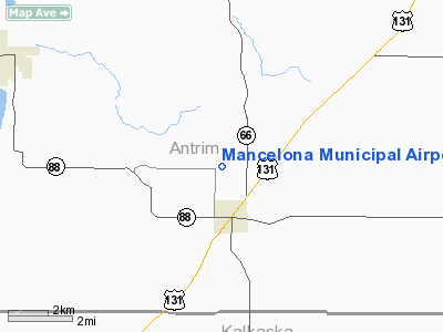
Mancelona Municipal Airport |
Location & QuickFacts
| FAA Information Effective: | 2008-09-25 |
| Airport Identifier: | D90 |
| Airport Status: | Operational |
| Longitude/Latitude: | 085-04-00.1880W/44-55-30.0230N
-85.066719/44.925006 (Estimated) |
| Elevation: | 1133 ft / 345.34 m (Surveyed) |
| Land: | 200 acres |
| From nearest city: | 2 nautical miles N of Mancelona, MI |
| Location: | Antrim County, MI |
| Magnetic Variation: | 05W (1985) |
Owner & Manager
| Ownership: | Publicly owned |
| Owner: | Mancelona Township |
| Address: | P.o. Box 332
Mancelona, MI 49659 |
| Phone number: | 231-587-5171 |
| Manager: | Roger C Anger |
| Address: | Po Box 332
Mancelona, MI 49659 |
| Phone number: | 231-587-5171
AMGR CELL PH 231-633-0837. |
Airport Operations and Facilities
| Airport Use: | Open to public |
| Wind indicator: | Yes |
| Segmented Circle: | Yes |
| Control Tower: | No |
| Landing fee charge: | No |
| Sectional chart: | Green Bay |
| Region: | AGL - Great Lakes |
| Boundary ARTCC: | ZMP - Minneapolis |
| Tie-in FSS: | LAN - Lansing |
| FSS on Airport: | No |
| FSS Toll Free: | 1-800-WX-BRIEF |
| NOTAMs Facility: | LAN (NOTAM-d service avaliable) |
Airport Communications
Runway Information
Runway 10/28
| Dimension: | 2050 x 120 ft / 624.8 x 36.6 m |
| Surface: | TURF, Fair Condition |
| |
Runway 10 |
Runway 28 |
| Longitude: | 085-04-07.7300W | 085-03-39.8600W |
| Latitude: | 44-55-27.5100N | 44-55-23.3000N |
| Elevation: | 1133.00 ft | 1133.00 ft |
| Traffic Pattern: | Left | Left |
| Displaced threshold: | 830.00 ft | 200.00 ft |
| Runway End Identifier: | No | No |
| Centerline Lights: | No | No |
| Touchdown Lights: | No | No |
| Obstruction: | 50 ft trees, 200.0 ft from runway, 105 ft right of centerline, 4:1 slope to clear
APCH RATIO 20:1 AT DSPLCD THLD. | 50 ft tree, 250.0 ft from runway, 130 ft left of centerline, 5:1 slope to clear
APCH RATIO 9:1 AT DSPLCD THR; BASED ON CTLG OBSTN; APCH RATIO 20:1 BASED ON STRAIGHT OUT. |
|
Runway 18/36
| Dimension: | 3400 x 140 ft / 1036.3 x 42.7 m |
| Surface: | TURF, Fair Condition |
| |
Runway 18 |
Runway 36 |
| Longitude: | 085-04-06.9300W | 085-04-06.9300W |
| Latitude: | 44-55-50.8000N | 44-55-19.2000N |
| Elevation: | 1133.00 ft | 1133.00 ft |
| Traffic Pattern: | Left | Left |
| Runway End Identifier: | No | No |
| Centerline Lights: | No | No |
| Touchdown Lights: | No | No |
| Obstruction: | 45 ft trees, 900.0 ft from runway, 60 ft left of centerline, 20:1 slope to clear | 25 ft tree, 100.0 ft from runway, 135 ft left of centerline, 4:1 slope to clear |
|
Radio Navigation Aids
| ID |
Type |
Name |
Ch |
Freq |
Var |
Dist |
| CXK | NDB | Clam Lake | | 251.00 | 05W | 7.5 nm |
| GYG | NDB | Grayling | | 359.00 | 06W | 14.6 nm |
| BFA | NDB | Boyne Falls | | 263.00 | 06W | 15.8 nm |
| TV | NDB | Gwenn | | 365.00 | 05W | 19.2 nm |
| CVX | NDB | Charlevoix | | 392.00 | 05W | 24.2 nm |
| CAD | NDB | Cadillac | | 269.00 | 04W | 41.8 nm |
| CGG | VOR | Grayling | | 109.80 | 06W | 20.5 nm |
| GLR | VOR/DME | Gaylord | 029X | 109.20 | 06W | 16.3 nm |
| HTL | VOR/DME | Houghton Lake | 053X | 111.60 | 05W | 38.1 nm |
| TVC | VORTAC | Traverse City | 093X | 114.60 | 02W | 25.8 nm |
| PLN | VORTAC | Pellston | 055X | 111.80 | 06W | 45.7 nm |
Remarks
- ARPT CLSD WHEN SNOW COVERED & NOV THRU APR 15; RYS NOT PLOWED.
- TREES/BRUSH TRANS ZONE BOTH SIDES.
- PRIOR TO 1959.
Images and information placed above are from
http://www.airport-data.com/airport/D90/
We thank them for the data!
| General Info
|
| Country |
United States
|
| State |
MICHIGAN
|
| FAA ID |
D90
|
| Latitude |
44-55-30.023N
|
| Longitude |
085-04-00.188W
|
| Elevation |
1133 feet
|
| Near City |
MANCELONA
|
We don't guarantee the information is fresh and accurate. The data may
be wrong or outdated.
For more up-to-date information please refer to other sources.
|
|


