 |
|
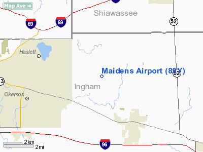
Location & QuickFacts
| FAA Information Effective: | 2008-09-25 |
| Airport Identifier: | 89Y |
| Airport Status: | Operational |
| Longitude/Latitude: | 084-19-24.8950W/42-44-00.1230N
-84.323582/42.733367 (Estimated) |
| Elevation: | 920 ft / 280.42 m (Estimated) |
| Land: | 50 acres |
| From nearest city: | 3 nautical miles NW of Williamston, MI |
| Location: | Ingham County, MI |
| Magnetic Variation: | 05W (1985) |
Owner & Manager
| Ownership: | Privately owned |
| Owner: | John C. Maidens
OWNER LIVES ON PREMISES. |
| Address: | 5155 N Zimmer Rd
Williamston, MI 48895 |
| Phone number: | 517-655-2453 |
| Manager: | John C. Maidens |
| Address: | 5155 N Zimmer Rd
Williamston, MI 48895 |
| Phone number: | 517-655-2453 |
Airport Operations and Facilities
| Airport Use: | Open to public |
| Wind indicator: | Yes |
| Segmented Circle: | No |
| Control Tower: | No |
| Landing fee charge: | No |
| Sectional chart: | Detroit |
| Region: | AGL - Great Lakes |
| Boundary ARTCC: | ZOB - Cleveland |
| Tie-in FSS: | LAN - Lansing |
| FSS on Airport: | No |
| FSS Toll Free: | 1-800-WX-BRIEF |
| NOTAMs Facility: | LAN (NOTAM-d service avaliable) |
Airport Communications
Runway Information
Runway 09/27
| Dimension: | 2300 x 70 ft / 701.0 x 21.3 m
RY 09/27 SLOPES DOWN TO THE W. |
| Surface: | TURF, Poor Condition
RWY 09/27 RWY SFC ROUGH WITH RUTS AND ROCKS DUE TO ONGOING CONSTRUCTION PROJECT. |
| |
Runway 09 |
Runway 27 |
| Traffic Pattern: | Right | Left |
| Displaced threshold: | 214.00 ft | 1070.00 ft |
| Obstruction: | 80 ft tree, 24.0 ft from runway, 110 ft right of centerline
RWY 09, APCH RATIO AT DSPLCD THLD 20:1 OVER 38 FT TREES, 760 FT DSTC, 0B. | 35 ft pline, 0.0 ft from runway
RWY 27 APCH RATIO 20:1 AT DSPLCD THLD; +63 FT TREES, 1260 FT DSTC, OB. |
|
Radio Navigation Aids
| ID |
Type |
Name |
Ch |
Freq |
Var |
Dist |
| OZW | NDB | Howell | | 243.00 | 05W | 16.0 nm |
| AMN | NDB | Alma | | 329.00 | 05W | 40.9 nm |
| BT | NDB | Batol | | 272.00 | 04W | 44.2 nm |
| TCU | NDB | Tecumseh | | 239.00 | 04W | 46.3 nm |
| HYX | NDB | Browne | | 385.00 | 06W | 46.7 nm |
| JXN | VOR/DME | Jackson | 033X | 109.60 | 05W | 29.1 nm |
| LFD | VOR/DME | Litchfield | 049X | 111.20 | 05W | 44.8 nm |
| MBS | VOR/DME | Saginaw | 076X | 112.90 | 03W | 49.2 nm |
| LAN | VORTAC | Lansing | 045X | 110.80 | 05W | 16.5 nm |
| FNT | VORTAC | Flint | 116X | 116.90 | 06W | 29.0 nm |
| PSI | VORTAC | Pontiac | 047X | 111.00 | 03W | 35.0 nm |
| SVM | VORTAC | Salem | 090X | 114.30 | 03W | 37.7 nm |
| BTL | VORTAC | Battle Creek | 031X | 109.40 | 02W | 48.4 nm |
| YIP | VOT | Willow Run | | 112.00 | | 46.5 nm |
Remarks
- RY 09/27 TREES, BRUSH AND CROPS INSIDE PRIMARY SFC, S SIDE OF RY.
- RY 09/27 RY CONSTRUCTION IN PROGRESS, WITH HEAVY EQUIPMENT IN PRIMARY SFC, N SIDE OF RY.
- RY 09/27 RY USABLE WIDTH IS 50 FT DURING CONSTRUCTION.
- PRVDD THE AREA 125 FT EITHER SIDE OF RY CNTRLN & 200 FT OFF EACH IS CLEAR; AND ANY OBSTN IN APCH BE REMOVED OR LOWERED OR THE THLD DSPLCD TO PRVD A CLEAR 20:1 APCH.
Images and information placed above are from
http://www.airport-data.com/airport/89Y/
We thank them for the data!
| General Info
|
| Country |
United States
|
| State |
MICHIGAN
|
| FAA ID |
89Y
|
| Latitude |
42-44-00.123N
|
| Longitude |
084-19-24.895W
|
| Elevation |
920 feet
|
| Near City |
WILLIAMSTON
|
We don't guarantee the information is fresh and accurate. The data may
be wrong or outdated.
For more up-to-date information please refer to other sources.
|
|


